
Ridgeway in Fort Erie in Niagara Region, Ontario — Central Canada (North America)
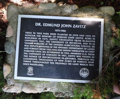
Dr. Edmund John Zavitz 1895-1968
Photographed by Kevin Westell, June 23, 2026
1. Dr. Edmund John Zavitz 1895-1968 - Marker
Erected by Bertie Township and the Department of Lands and Forests Ontario.
Topics. This historical marker is listed in this topic list: Horticulture & Forestry. A significant historical year for this entry is 1970.
Location. 42° 54.242′ N, 79° 2.467′ W. Marker is in Fort Erie, Ontario, in Niagara Region. It is in Ridgeway. It is on Garrison Road, on the right when traveling west. Marker is within Battle of Ridgeway Heritage Park, beside the south side of a tree,
this page online

Regionally, this marker is on Ontario’s Golden Horseshoe and in Niagara Canada. It is also in Central Canada. Globally, it is in North America, on the Great Lakes, in the Western Hemisphere, in the Western World, and in the Anglosphere. Historically, it finds itself in what was once a British colony, the Viceroyalty of New France, the Haudenosaunee (Iroquois) Confederacy, and Rupert’s Land.
Other nearby markers. At least 8 other markers are within walking distance of this marker: The Battle Of Ridgeway (within shouting distance of this marker); Ridgeway Battlefield / Le Champ de bataille de Ridgeway (within shouting distance of this marker); Battle of Ridgeway Memorial (within shouting distance of this marker); A Catalyst to Confederation (within shouting distance of this marker); In the Line of Fire (within shouting distance of this marker); A Day to Remember - June 2, 1866 (within shouting distance of this marker);
Photographed by Kevin Westell, June 23, 2026
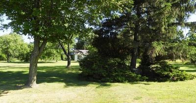
2. Dr. Edmund John Zavitz 1895-1968 - Marker in context
Photo faces north from near Garrison Rd. Marker is on low stone cairn (centre right) under conifer tree and framed by conifer bushes. Straight north is the (light) historic farmhouse (recently moved to this park); and further behind on the left is the (dark) picnic shelter.
Also see . . . Edmund Zavitz (by Wikipedia). (Submitted on June 24, 2026, by Kevin Westell of St. Catharines, Ontario.)
Credits. This page was last revised on June 24, 2026. It was originally submitted on June 24, 2026, by Kevin Westell of St. Catharines, Ontario. This page has been viewed 13 times since then. Photos: 1, 2. submitted on June 24, 2026, by Kevin Westell of St. Catharines, Ontario.
