
Stevensville in Fort Erie in Niagara Region, Ontario — Central Canada (North America)
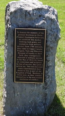
To honour the memory of the pioneer Brethren in Christ (Tunker) Anabaptist believers
Photographed by Kevin Westell, June 23, 2026
1. To honour the memory of the pioneer Brethren in Christ (Tunker) Anabaptist believers - Marker
Topics. This historical marker is listed in this topic list: Religion & Religious Structures. A significant historical year for this entry is 1788.
Location. 42° 56.456′ N, 79° 6.049′ W. Marker is in Fort Erie, Ontario, in Niagara Region. It is in Stevensville. It is on Church Road, on the right when traveling east. Touch for map. Marker is at or near this postal address: 4943 Church Rd, Fort Erie ON L0S 1S0, Canada. Touch for directions.

Regionally, this marker is on Ontario’s Golden Horseshoe and in Niagara Canada. It is also in Central Canada. Globally, it is in North America, on the Great Lakes, in the Western Hemisphere, in the Western World, and in the Anglosphere. Historically, it finds itself in what was once a British colony, the Viceroyalty of New France, the Haudenosaunee (Iroquois) Confederacy, and Rupert’s Land.
Other nearby markers. At least 8 other markers are within 6 kilometers of this marker, measured as the crow flies: In Memory of Bishop John Winger (here, next to this marker); Traditional Site of the first Brethren in Christ Sunday School (here, next to this marker); Stevensville Conservation Area (approx. 2.2 kilometers away); Well's Mill Millstone
this page online
Photographed by Kevin Westell, June 23, 2026
2. To honour the memory of the pioneer Brethren in Christ (Tunker) Anabaptist believers
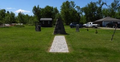
This marker is on the left, in a group of 3 markers on the south side of Church Road. They are across from the church and cemetery.
Credits. This page was last revised on June 25, 2026. It was originally submitted on June 25, 2026, by Kevin Westell of St. Catharines, Ontario. This page has been viewed 6 times since then. Photos: 1, 2. submitted on June 25, 2026, by Kevin Westell of St. Catharines, Ontario.
