Buffalo in Harding County, South Dakota — The American Midwest (Upper Plains)
Energy Production in Harding County
Photographed by Cosmos Mariner, August 24, 2023
1. Energy Production in Harding County Marker
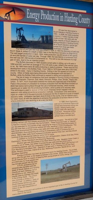
Oil was first discovered in South Dakota in Harding County in 1953. In 2008, the state produced a record 1.7 million barrels of total crude oil from 162 wells with the large majority of South Dakota's oil being produced in Harding County. All of South Dakota's natural gas comes from three gas fields southwest of Buffalo.
The first oil and gas test hole was drilled in 1928. In 1954 the discovery oil well was the #1 State A, drilled to a depth of 8681 feet in the Red River formation by Shell Oil Co. The well began production in April, 1954. Initial production was 80 barrels of API gravity oil and 200 barrels of water per day. Through 1999, the total lifetime oil production from the well was 341,169 barrels of incremental oil. The well is now idle because of a high gas oil ratio, due to the air injection project.
The Buffalo discovery in 1954 caused a small spike in drilling, up to 45 wells in 1956 and 1957 and then an average of 15 or 20 wells a year, drilled in the next ten years or so. By 1965 there were 30 wells producing or ready to produce. These were the first development wells in the Buffalo Field. From 1965 to 1975 there were about 200 holes drilled in the state — many in Harding County. Drilling in the 70's spread out over the county. Other oil fields were being discovered and developed north and east of Buffalo, while the Buffalo Field continued to expand in drilling and production of oil.
The list of major oil companies that have operated in Harding County is impressive, including Champlin, Chevron, Gulf, Mobil, Pennzoil, Phillips, Shell, Sinclair, Texaco and Union. In 1977, Koch Exploration entered the scene and organized part of the Buffalo Field in the process of unitization to increase production from the Red River formation at 8500 feet below land surface through the use of enhanced recovery,
this page online
In 1995, Koch Exploration sold out to Continental Resources. At that time horizontal drilling was started, utilizing mainly older vertical wells with declining oil production. Horizontal drilling involves either drilling a new vertical hole or re-entering an existing vertical well that already penetrates the producing formation. The drill bit is then turned so it moves horizontally into the formation. These horizontal holes, or "laterals", can be extended for thousands of feet, exposing far more of the producing formation to the drill
Photographed by Cosmos Mariner, August 24, 2023
2. Energy Production in Harding County Marker
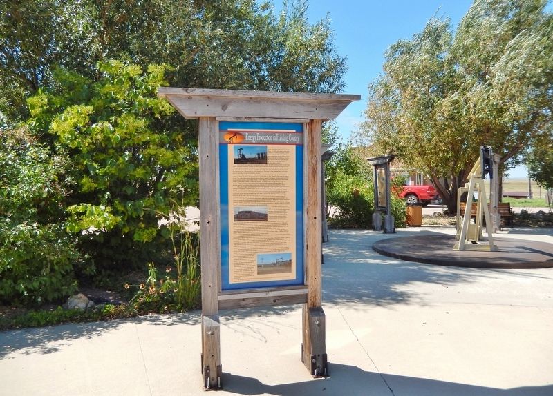
The marker is on the heritage walkway in Centennial Park.
In addition to Continental Resources are Luff Exploration, Citation Oil & Gas, Prima Exploration, Murex Petroleum and Wyoming Resources.
Shallow gas was discovered in the West Short Pine Hills. Spyglass Cedar Creek, a company out of Texas, has drilled 15 producing gas wells and has constructed a connecting pipeline, with two compressor stations, to the Williston Basin gas line that runs from Montana to the Black Hills. Operators of gas wells in Harding County are Clark Blake, Bowers Oil & Gas, Inland Oil & Gas, Nearburg Production, Sands Oil Co., and Spyglass Operating.
Energy production has been an economic boom for Harding County. The oil field, along with the gas field, is the largest employer in the county. While many small towns in South Dakota have no means of keeping their young people at home, energy has provided jobs for local people and has brought people into the area.
A 4.5% severance tax on minerals also benefits both the State of South Dakota and Harding County as each receives half of the severance tax, which the county uses to maintain the roads in the energy fields. The school also receives a share of the county's half. In addition, wells on South Dakota School and Public Lands send approximately $4 million to the SD Department of Education.
Energy production will continue to be an important part of life in Harding County for many years in the future.
Erected by Buffalo & Harding County, South Dakota.
Topics. This historical marker is listed in these topic lists: Industry & Commerce • Natural Resources. A significant historical month for this entry is April 1954.
Location. 45° 34.857′ N, 103° 32.775′ W. Marker is in Buffalo, South Dakota, in Harding County. It can be reached from Theodore Roosevelt Expressway (CanAm Highway) (U.S. 85) just south of Connel Street (State Highway 20), on the left when traveling north. The marker is in Centennial Park. Touch for map. Marker is at or near this postal address: 91 US Highway 85, Buffalo SD 57720, United States of America. Touch for directions.

Regionally, this marker is in West River. It is also in the American Lewis & Clark Corridor, on the prairies, and on the Northern Plains. Globally, it is in North America, the Western Hemisphere, the Western World, and the Anglosphere. Historically, it finds itself in what was once Rupert’s Land and also the Louisiana Purchase.
Other nearby markers. At least 8 other markers are within walking distance of this marker: The Establishment of Harding County (here, next to this marker); Centennial Park (here, next to this marker); Cattle Ranching in Harding County (here, next to this marker); The Buffalo "Paints Himself Red" (here, next to this marker); The Homesteaders (here, next to this marker); Tipperary (here, next to this marker); Three-Toes, The Wolf (here, next to this marker); Medora - Deadwood Stage Line (here, next to this marker). Touch for a list and map of all markers in Buffalo.
Credits. This page was last revised on June 27, 2026. It was originally submitted on June 25, 2026, by Cosmos Mariner of Cape Canaveral, Florida. This page has been viewed 14 times since then. Photos: 1, 2. submitted on June 25, 2026, by Cosmos Mariner of Cape Canaveral, Florida.
