Dundas in Richland County, Illinois — The American Midwest (Great Lakes)
1950 Census Population Center
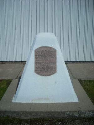
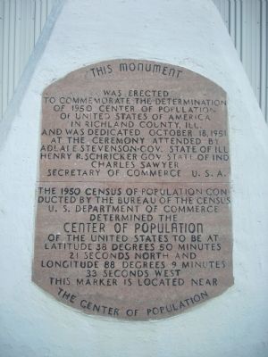
The 1950 census of population conducted by the Bureau of the Census, U.S. Department of Commerce determined the center of population of the United States to be at latitude 38 degrees 50 minutes 21 seconds north and longitude 88 degrees 9 minutes 33 seconds west. This marker is located near the center of population.
Erected 1951.
Topics. This historical marker is listed in this topic list: Industry & Commerce. A significant historical date for this entry is October 18, 1708.
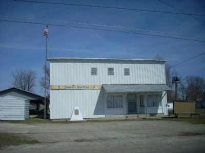
Location. 38° 50.063′ N, 88° 5.074′ W. Marker is in Dundas, Illinois, in Richland County. Marker is at the intersection of County Route 1800 N and North Easy Avenue, on the left when traveling east on County Route 1800 N. Marker is located in front of the Dundas Ruritan Club building. Touch for map. Marker is at or near this postal address: 4616 East Dundas Lane, Dundas IL 62425, United States of America. Touch for directions.
Other nearby markers. At least 8 other markers are within 9 miles of this marker, measured as the crow flies. Solar Power in Olney, Illinois (approx. 6.8 miles away); History of the Olney Albino Gray Squirrel (approx. 6.9 miles away); Lincoln and Douglas in Olney (approx. 7.2 miles away); War Memorial (approx. 7.2 miles away); Bower Park / Bird Haven (approx. 7.2 miles away); Historic McsBurg School / The One-Room Rural Schools of Richland County (approx. 7.3 miles away); Neighborhood Marker (approx. 7.3 miles away); Robert Ridgway and "Bird Haven" (approx. 8.2 miles away).
Also see . . . U.S. Census Bureau History: 1950 Overview. This link identifies some of the new manners in which the census was taken in 1950, the first decennial census after WWII. Citizens outside the U.S. (especially military) were counted for the first time; UNIVAC1, one of the earliest non-military computers was used to tabulate census data; and for the first time, select populations were recounted. (Submitted on May 6, 2010, by John Desaulniers, Jr. of Mingo, Iowa.)
Additional commentary.
1. The 1950 Census
The 1950 census reported the United States continental population as 150,897,361 up nearly 19 million from 1940. The aggregate number changed
only 3.6 million, however the 1930 and 1940 census data also included the population of the Philippines, because those islands had been ceded to the United States in 1898. On July 4, 1946, the Philippines were granted independence and became the Republic of the Philippines. Even with the loss of over 400,000 US lives in WWII (see http://www.infoplease.com/ipa/A0004615.html), continental population grew substantially - the beginning of the "baby boom."
— Submitted May 6, 2010, by John Desaulniers, Jr. of Mingo, Iowa.
2. Stevenson and Schricker
Present at the ceremony for this marker in October, 1951 were Adlai Stevenson, governor of Illinois, and Henry Schricker, governor of Indiana, even though Dundas is 35 miles (as the crow flies) from the Indiana border. In July, 1952, Henry Schricker would introduce Adlai Stevenson at the Democratic National Convention in Chicago, where Stevenson would win the nomination of the party.
— Submitted May 6, 2010, by John Desaulniers, Jr. of Mingo, Iowa.
Additional keywords. Census
Credits. This page was last revised on January 4, 2020. It was originally submitted on May 6, 2010, by John Desaulniers, Jr. of Mingo, Iowa. This page has been viewed 2,172 times since then and 68 times this year. Photos: 1, 2, 3. submitted on May 6, 2010, by John Desaulniers, Jr. of Mingo, Iowa. • Bill Pfingsten was the editor who published this page.


