Buffalo in Harding County, South Dakota — The American Midwest (Upper Plains)
The Establishment of Harding County
Photographed by Cosmos Mariner, August 24, 2023
1. The Establishment of Harding County Marker
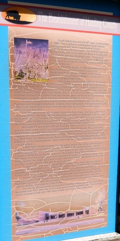
South Dakota became the 40th state on November 2, 1889. The counties in northwestern South Dakota changed twice with what is now Harding County originally divided into three parts. The northern part was Ewing County, the central part was Burdick County and the southern part was Harding County. The general election of 1898 changed the boundaries of Butte County to the south to include all of Harding County and Perkins County to the east.
A vote of the people in 1908 separated Harding and Perkins Counties from Butte County, thus establishing the present boundaries of the county. However, it could not be designated a county until a county seat was established.
Thus began a controversial battle for the county seat. Camp Crook, which was a thriving community along the Little Missouri River near the Montana state line, presented several strong arguments. It was the largest town in Harding County; the community around Camp Crook was thickly settled; it was one of the oldest towns and settlements in the county; and, in as much as no other town consisted of more than a store or two, Camp Crook was the only place which had the facilities for a county seat, a matter of great importance from the standpoint of economics.
However, Camp Crook's beautiful location along the banks of the Little Missouri River was also its biggest drawback. Citizens in the northeastern and southeastern parts of the county would have to travel more than 60 miles by horseback or by buggy to transact county business.
The concept of a centrally-located county seat took shape. During a gathering of interested citizens, two diagonal lines were drawn on a map of Harding County to locate the center of the county where they would locate a new town which would be named “Buffalo.” Later, the decision was made to move the location about four miles west
this page online
Ray Gilbert, Frank Gilbert, William Fried and Frank Van Horn — all being settlers near the center of the county — purchased 40 acres of land at the site. Ray and Frank Gilbert formed a partnership known as Gilbert Brothers, erected a building on the site, and organized the “Grand River Mercantile” in 1908. Other buildings soon erected were the Van Horn Hotel, the Harding County Bank and the Harding County Herald Building. Soon Buffalo was a thriving young town, determined to be seriously considered in the selection of a county seat.
A bitter fight followed between the two towns, and so the county commissioners ordered an election to be held on January 26, 1909, to decide the question. As the election approached, both towns did all in their power to get votes. The Gilbert Brothers & Company offered the county five rooms for office space above the Grand River Mercantile, rent free for two years, and offered the 40 acres of town site for $414. The following week, the citizens of Camp Crook, not to be outdone, advertised that they would give the county a gift
Photographed by Cosmos Mariner, August 24, 2023
2. The Establishment of Harding County Marker
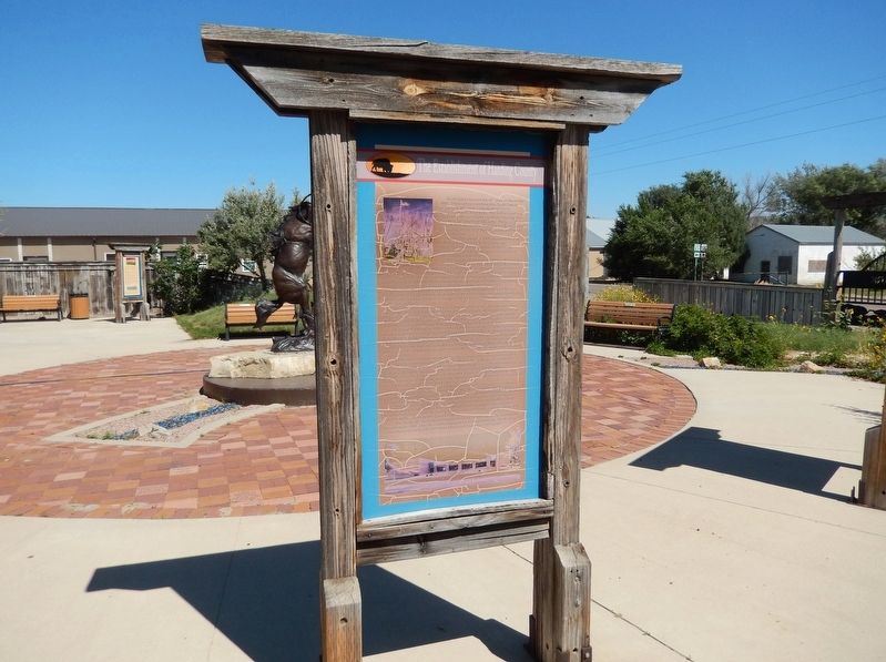
The marker is on the heritage walkway in Centennial Park.
To gain votes, both towns offered free entertainments, chiefly dances and ball games, to attract people from all parts of the county. At these gatherings; speakers presented the advantages of the town in which the celebration was taking place. As liquor flowed rather freely, fights between the supporters of each town were not infrequent.
The election resulted in a victory for Buffalo with 432 voting for Buffalo and 187 voting for Camp Crook. Buffalo, therefore, became the temporary county seat. At a November election in 1910, the question of the permanent county seat was settled. 814 voted for Buffalo; 159 voted for Camp Crook.
The county officials conducted business from their offices above the Grand River Mercantile until 1911 when the court house was built on the present site. The building served Harding County until 1997 when a new court house was constructed.
Erected by Buffalo & Harding County, South Dakota.
Topics. This historical marker is listed in this topic list: Political Subdivisions. A significant historical date for this entry is November 3, 1908.
Location. 45° 34.857′ N, 103° 32.775′ W. Marker is in Buffalo, South Dakota, in Harding County. It can be reached from Theodore Roosevelt Expressway (CanAm Highway) (U.S. 85) just south of Connel Street (State Highway 20), on the left when traveling north. The marker is in Centennial Park. Touch for map. Marker is at or near this postal address: 91 US Highway 85, Buffalo SD 57720, United States of America. Touch for directions.

Regionally, this marker is in West River. It is also in the American Lewis & Clark Corridor, on the prairies, and on the Northern Plains. Globally, it is in North America, the Western Hemisphere, the Western World, and the Anglosphere. Historically, it finds itself in what was once Rupert’s Land and also the Louisiana Purchase.
Other nearby markers. At least 8 other markers are within walking distance of this marker: Energy Production in Harding County (here, next to this marker); Centennial Park (here, next to this marker); Cattle Ranching in Harding County (here, next to this marker); The Buffalo "Paints Himself Red" (here, next to this marker); The Homesteaders (here, next to this marker); Medora - Deadwood Stage Line (here, next to this marker); Three-Toes, The Wolf (here, next to this marker); Tipperary (here, next to this marker). Touch for a list and map of all markers in Buffalo.
Also see . . . Harding County (Wikipedia).
Excerpt: Harding County was established as a county in the Dakota Territory on March 5, 1881, but was not organized at that time. Its name recognized J. A. Harding, who had been Speaker of the House of Dakota Territory. Its boundaries were altered in 1883, in 1889, and in 1894. On November 8, 1898, Harding County was dissolved and its territory assigned to Butte County. However, on November 3, 1908, it was again created (with altered boundaries) from Butte County's area, and on February 17, 1909, its governing organization was completed.(Submitted on June 25, 2026, by Cosmos Mariner of Cape Canaveral, Florida.)
Credits. This page was last revised on June 27, 2026. It was originally submitted on June 25, 2026, by Cosmos Mariner of Cape Canaveral, Florida. This page has been viewed 16 times since then. Photos: 1, 2. submitted on June 25, 2026, by Cosmos Mariner of Cape Canaveral, Florida.
