Guildford in Surrey, England, United Kingdom — Northwestern Europe (the British Isles)
Tunsgate Arch
Photographed by Ray Gurganus, April 13, 2026
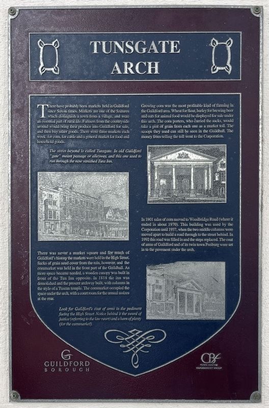
1. Tunsgate Arch Marker
The street beyond is called Tunsgate. In old Guildford "gate" meant passage or alleyway, and this one used to run through the now vanished Tins Inn.
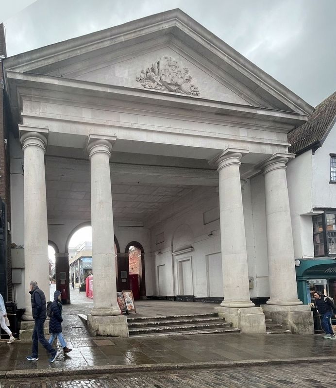
There was never a market square and for much of Guildford's history the markets were held in the High Street. Sacks of grain need cover from the rain, however, and the cornmarket was held in the front part of the Guildhall. As more space became needed, a wooden canopy was built in front of the Tun Inn opposite. In 1818 the inn was demolished and the present archway built, with columns in the style of a Tuscan temple. The cornmarket occupied the space under the arch, with a court room for the annual assizes at the rear.
Growing corn was the most profitable kind of farming in the Guildford area. Wheat for flour, barley for brewing beer and cuts for animal food would be displayed for sale under this arch. The corn porters, who carried the sacks, would take a pint of grain from each one as a market toll. The scoops they used can still be seen in the Guildhall. The money from selling the toll went to the Corporation.
In 1901 sales of corn moved to Woodbridge Road (where it ended in about 1970). This building was used by the Corporation until 1937, when the two middle columns were moved apart to build a road through to the street behind. In 1992 this road was filled in and the steps replaced. The coat of arms of Guildford and of its twin town Freiburg were
this page online
Erected by Guildford Borough.
Topics. This historical marker is listed in these topic lists: Architecture • Industry & Commerce.
Location. 51° 14.143′ N, 0° 34.326′ W. Marker is in Guildford, England, in Surrey. It is at the intersection of High Street and Tunsgate, on the right when traveling east on High Street. Touch for map. Marker is at or near this postal address: 128 High Street, Guildford, England GU1 3HQ, United Kingdom. Touch for directions.

Regionally, this marker is in the Greater South East. Globally, it is on the Atlantic Ocean, in the North Atlantic Region, in Europe, in Atlantic Europe, on one of the British Isles, in the Western World, and in the Anglosphere. Historically, it finds itself in what was once the Roman Empire.
Other nearby markers. At least 8 other markers are within walking distance of this marker: Guildhall (a few steps from this marker); Holy Trinity Church (within shouting distance of this marker); Holy Trinity Church: a thousand years of Christian history (about 90 meters away, measured
Photographed by Ray Gurganus, April 13, 2026
2. Tunsgate Arch
Credits. This page was last revised on June 27, 2026. It was originally submitted on June 26, 2026, by Ray Gurganus of Washington, District of Columbia. This page has been viewed 10 times since then. Photos: 1, 2. submitted on June 26, 2026, by Ray Gurganus of Washington, District of Columbia. • Andrew Ruppenstein was the editor who published this page.
