Saint Marys in Perth County, Ontario — Central Canada (North America)
Water Street Bridge
Historic St. Marys

Photographed by Tim Boyd, June 21, 2026
1. Water Street Bridge Marker
History of the Water Street Bridge
Because of its location at the confluence of the Thames River and Trout Creek, St. Marys has always been dependent on its bridges. The spectacular railway viaducts across the two river valleys enabled the Grand Trunk Railway to proceed westward to Sarnia and southward to London. The triple-arched bridge across the Thames River was constructed in 1865, and the double-arched Church Street Bridge across Trout Creek was built in 1885. Limestone was the primary building material in all of these bridges.
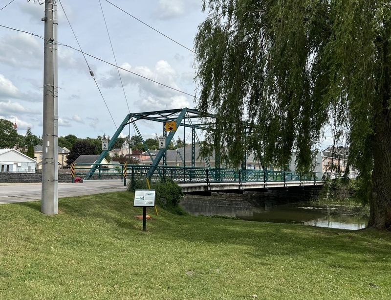
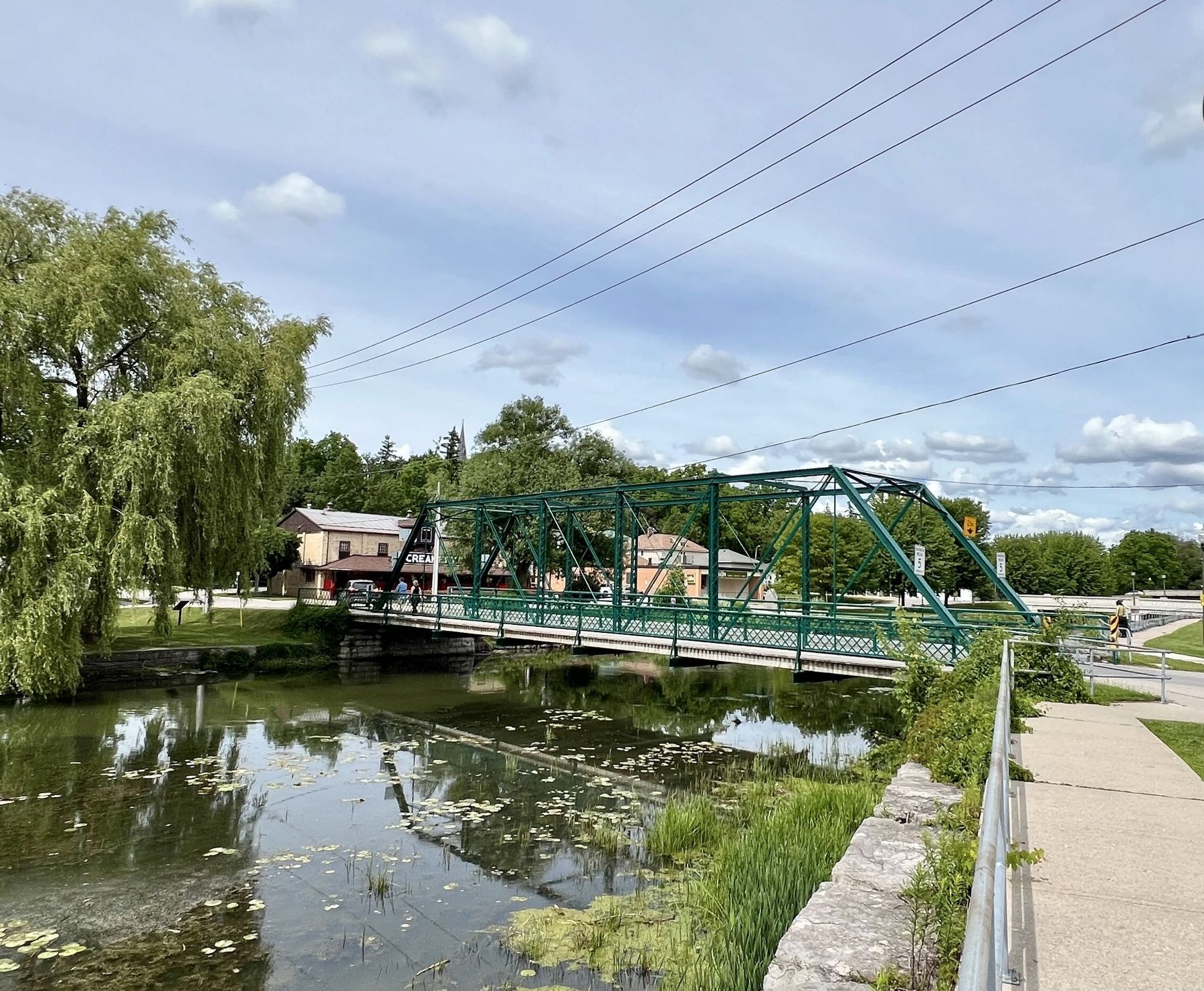
In 1898, the Water Street Bridge opened for vehicular traffic across Trout Creek, replacing a wooden truss bridge. Unlike the town's other heritage bridges, this one was constructed of steel. The footings and abutments were designed by local architect Joseph Humphris. The steelwork was engineered and fabricated by the Stratford Bridge Company. The limestone components were built by local stonemason John Elliott, one of the builders of the Church Street Bridge and in 1891, the new St. Marys Town Hall. The bridge cost $2,000, financed by a debenture over a ten-year period.
Local Fears Allayed
In
this page online
To allay public concern over the load-bearing capacity of the Water Street Bridge, William Weir, one of St. Marys' great characters, drove twenty of his fattened steers onto the bridge. They had a combined weight of more than ten tons, far in excess of wagon loads of that era. Thus William Weir's experiment was a dramatic demonstration of the strength of the bridge. Local concerns were allayed and opposition to the new bridge design was silenced.
The Water Street Bridge is a steel, seven panel, pin-connected Pratt through-truss bridge. This design was originally patented by Thomas and Caleb Pratt in 1844 and was used primarily by railroads. In its earliest form, the Pratt truss was a combination of timber and iron. Eventually the Pratt truss design was constructed exclusively of steel and was very popular in the late 19th and early 20th centuries, not only for railway bridges but
Photographed by Tim Boyd, June 21, 2026
2. Water Street Bridge Marker
In the Pratt truss design, the top and bottom chords and vertical members act in compression, and the diagonal members act in tension. The ends of the diagonal members were fitted with eyes that were secured by heavy bolts at each end. These bolts, known as pin connections, held the bridge together. This design was remarkably simple in appearance but readily supported the traffic loads of the day. The Stratford Bridge Company manufactured all the components at its factory and assembled them at the bridge site.
Erected 2010 by Heritage St. Marys.
Topics. This historical marker is listed in this topic list: Bridges & Viaducts. A significant historical year for this entry is 1898.
Location. 43° 15.637′ N, 81° 8.63′ W. Marker is in Saint Marys, Ontario, in Perth County. It is at the intersection of Parkview Drive and Water Street North, on the right when traveling west on Parkview Drive. Touch for map. Marker is at or near this postal address: 120 Parkview Drive, Saint Marys ON N4X 1B8, Canada. Touch for directions.

Regionally, this marker is in the Huron-Perth-Waterloo-Wellington Area and in Southwestern
Photographed by Tim Boyd, June 21, 2026
3. The Water Street Bridge in 2026
Other nearby markers. At least 8 other markers are within walking distance of this marker: The Historic Banks of Trout Creek (within shouting distance of this marker); The Hutton-MacPherson Block (about 150 meters away, measured in a direct line); Mill Race (about 150 meters away); John McDonald Block (about 150 meters away); Mill Wheel (about 180 meters away); Andrews Jeweller (about 210 meters away); St. Marys Opera House (about 210 meters away); The A. Workman Building (about 210 meters away). Touch for a list and map of all markers in Saint Marys.
Credits. This page was last revised on June 27, 2026. It was originally submitted on June 27, 2026, by Tim Boyd of Hamilton, Ontario. This page has been viewed 13 times since then. Photos: 1, 2, 3. submitted on June 27, 2026, by Tim Boyd of Hamilton, Ontario. • Andrew Ruppenstein was the editor who published this page.
