Lawrence Township in Mercer County, New Jersey — The American Northeast (Mid-Atlantic)
The “Pole Farm” Map

Photographed by Richard Peterson, June 14, 2026
1. The "Pole Farm" Map Marker
Between 1943 and 1948, AT&T produced a map (right) of the Pole Farm. Now faded and in the AT&T Archive, the map documents the locations of the diamond-shape antennas, known as rhombic antennas, covering the 820-acre property. By the time this map was produced in 1943, the original London and Buenos Aires Tower Arrays had been removed but the service roads that paralleled them are still visible on the map, in their distinctive reversed L-shaped plan.
( captions )
— World map showing the AT&T network of cities that received international phone call transmissions from the Pole Farm.
— To commemorate the Pole Farm and its contribution to telecommunications history, this historic map has been recreated here in concrete and stone.
Topics. This historical marker is listed in this topic list: Communications. A significant historical year for this entry is 1943.
Location. 40° 18.871′ N, 74° 44.339′ W. Marker is in Lawrence Township, New Jersey, in Mercer County. It is on Cold Soil Road north of Keefe Road, on the left when traveling west. Located on the Lawrence Hopewell Trail, at Mercer Meadows Pole Farm. Touch for map. Marker
this page online

Regionally, this marker is in Central Jersey and in Greater Princeton. It is also in the American Northeast and in the Mid-Atlantic. Globally, it is in North America, the Western Hemisphere, the Western World, and the Anglosphere. Historically, it finds itself in what was once New Netherland and also one of the original Thirteen Colonies.
Other nearby markers. At least 8 other markers are within walking distance of this marker: London Towers (a few steps from this marker); "Hello London" (a few steps from this marker); “Keep Mum - The World Has Ears” (a few steps from this marker); Going Silent (a few steps from this marker); The "Pole Farm" (within shouting distance of this marker); Pole Farm District (about 700 feet away, measured in a direct line); A Timeline of AT&T's Pole Farm (about 700 feet away); Arctic Parkway (approx. 0.9 miles away). Touch for a list and map of all markers in Lawrence Township.
Also see . . .
1. “Pole Farm” History – 1929 – 1975 - Hopewell Valley History Project.
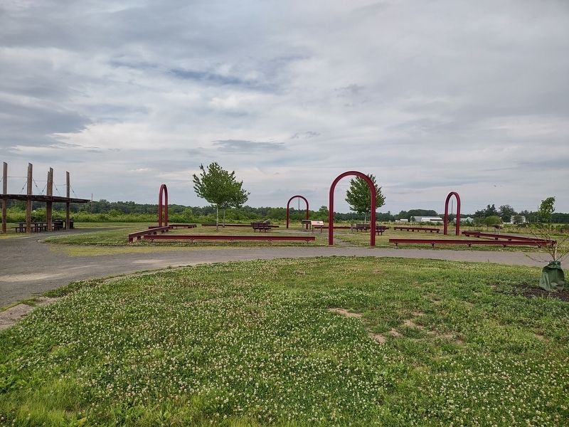
Thanks to several(Submitted on June 27, 2026, by Richard Peterson of East Windsor, New Jersey.)contributors, the History Project site now has several pamphlets on the history and operation of the Lawrenceville Transmitting Center, and associated historical photos of the site and operation.Photographed by Richard Peterson, June 14, 20262. The "Pole Farm" Map MarkerThe steel beams form the footprint of Building Two. Five Historical Markers are located within.
2. Mercer County Park Commission: Mercer Meadows. (Submitted on July 5, 2026, by Michael Herrick of Southbury, Connecticut.)

Photographed by Richard Peterson, June 14, 2026
3. The 1943 “Pole Farm” Map
Credits. This page was last revised on July 5, 2026. It was originally submitted on June 27, 2026, by Richard Peterson of East Windsor, New Jersey. This page has been viewed 21 times since then. Photos: 1, 2, 3. submitted on June 27, 2026, by Richard Peterson of East Windsor, New Jersey. • Michael Herrick was the editor who published this page.
