Collingwood in Simcoe County, Ontario — Central Canada (North America)
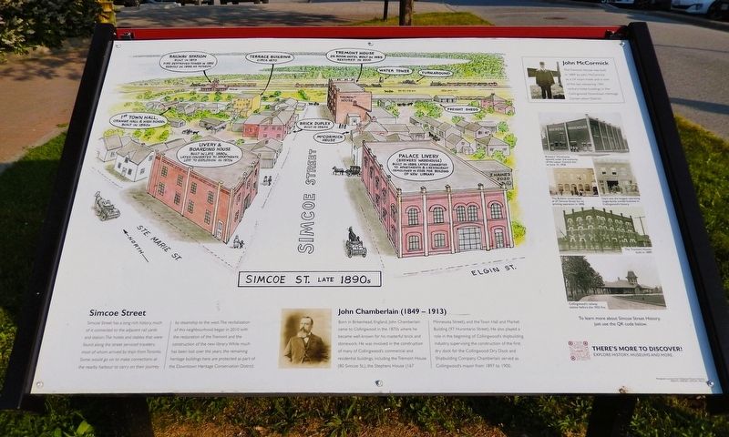
Simcoe Street - Late 1890's
Photographed by Cosmos Mariner, June 4, 2024
1. Simcoe Street - Late 1890's Marker
Simcoe Street
Simcoe Street has a long rich history, much of it connected to the adjacent rail yards and station. The hotels and stables that were found along the street serviced travelers, most of whom arrived by train from Toronto. Some would go on to make connections at the nearby harbour to carry on their journey by steamship to the west. The revitalization of this neighbourhood began in 2010 with the restoration of the Tremont and the construction of the new library. While much has been lost over the years, the remaining heritage buildings here are protected as part of the Downtown Heritage Conservation District.
John Chamberlain (1849-1913)
Born in Birkenhead, England, John Chamberlain came to Collingwood in the 1870s where he became well-known for his masterful brick and stonework. He was involved in the construction of many of Collingwood's commercial and residential buildings, including the Tremont House (80 Simcoe St.), the Stephens House (167 Minnesota Street), and the Town Hall and Market Building (97 Hurontario Street). He also played a role in the beginning of Collingwood's shipbuilding industry, supervising
this page online
John McCormick
The Tremont House was built in 1889 by John McCormick as a 24 room hotel and is one of the last remaining 19th century hotel buildings in the Collingwood Downtown Heritage Conservation District.
[illustration captions]
• Railway Station — Built in 1873; fire destroyed tower in 1932; rebuilt in 1998 as museum
• Terrace Building — Circa 1870
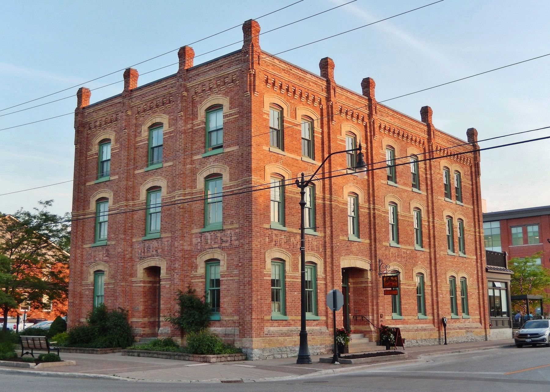
• Tremont House — 24 room hotel built in 1889; restored in 2010
• Water Tower
• Turnaround
• Freight Sheds
• 1st Town Hall — Grange Hall & High School; built in 1850s
• Brick Duplex — Built in 1860s
• McCormick House
• Livery & Boarding House — Built in late 1880s; later converted to apartments; lost to explosion in 1970s
• Palace Livery (Brewers’ Warehouse) — Built in 1889; later converted to apartments and a restaurant; demolished in 2005 for building of new library
Topics. This historical marker is listed in these topic lists: Architecture • Industry & Commerce • Railroads & Streetcars • Settlements & Settlers.
Location. 44° 30.074′ N,

2. Marker detail: Brewers’ Warehouse
Brewers’ Warehouse opened under the authority of the Liquor Control Act on June 15, 1938.

Regionally, this marker is in Central Ontario Cottage Country and specifically in Georgian Bay Country. It is also in Central Canada. Globally, it is in North America, on the Great Lakes, in the Western Hemisphere, in the Western World, and in the Anglosphere. Historically, it finds itself in what was once a British colony, the Viceroyalty of New France, the Haudenosaunee (Iroquois) Confederacy, and Rupert’s Land.
Other nearby markers. At least 8 other markers are within walking distance of this marker: Pride Flag (within shouting distance of this marker); All Saints' Anglican Church (about 120 meters away, measured in a direct line); Collingwood World War I Cenotaph (about 150 meters away); St. Mary's Collingwood, 1858 (about 180 meters away); St. Charles Garnier, SJ (about 180 meters away);

3. Marker detail: The Bulletin & Dey’s
(left) The Bulletin constructed at 27 Simcoe Street for its printing operation in 1898.
(right) Dey’s was the longest operating single-family owned business in Collingwood’s history.
(right) Dey’s was the longest operating single-family owned business in Collingwood’s history.

4. Marker detail: Collingwood’s railway station before the 1932 fire

Photographed by Cosmos Mariner, June 4, 2024
5. Simcoe Street - Late 1890's Marker
Looking south from Simcoe Street.
Photographed by Cosmos Mariner, June 4, 2024
6. The Tremont House — built in 1889
It is just east of this historical marker, at the intersection of Simcoe Street and Saint Paul Street.
Credits. This page was last revised on June 29, 2026. It was originally submitted on June 28, 2026, by Cosmos Mariner of Cape Canaveral, Florida. This page has been viewed 15 times since then. Photos: 1, 2, 3, 4, 5, 6. submitted on June 29, 2026, by Cosmos Mariner of Cape Canaveral, Florida.
