Marker Logo
THE HISTORICAL
MARKER DATABASE
“Bite-Size Bits of Local, National, and Global History”
Near Mt. Sidney in Augusta County, Virginia — The American South (Mid-Atlantic)
 

Salem Evangelical Lutheran Church
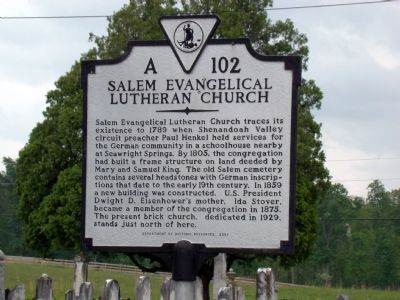
 
 
Salem Evangelical Lutheran Church Marker image. Click for full size.
Photographed by J. J. Prats, May 2, 2010
1. Salem Evangelical Lutheran Church Marker
Inscription. Salem Evangelical Lutheran Church traces its existence to 1789 when Shenandoah Valley circuit preacher Paul Henkel held services for the German community in a schoolhouse nearby at Seawright Springs. By 1805, the congregation had built a frame structure on land deeded by Mary and Samuel King. The old Salem cemetery contains several headstones with German inscriptions that date to the early 19th century. In 1859 a new building was constructed. U.S. President Dwight D. Eisenhower’s mother, Ida Stover, became a member of the congregation in 1875. The present brick church, dedicated in 1929, just north of here.
 
Erected 2001 by Department of Historic Resources. (Marker Number A-102.)
 
Topics and series. This historical marker is listed in this topic list: Religion & Religious Structures. In addition, it is included in the Virginia Department of Historic Resources (DHR) series list. A significant historical year for this entry is 1789.
 
Location. 38° 16.674′ N,
Paid Advertisement
Click or scan to see
this page online
78° 59.034′ W. Marker is near Mt. Sidney, Virginia, in Augusta County. It is at the intersection of Salem Church Road (County Route 804) and Burke’s Mill Road, on the right when traveling north on Salem Church Road. Touch for map. Marker is at or near this postal address: 417 Salem Church Rd, Mount Sidney VA 24467, United States of America. Touch for directions.

Regionally, this marker is in Virginia’s Shenandoah Valley. It is also in the American South and specifically in the Upper South. Globally, it is in North America, the Western Hemisphere, the Western World, and the Anglosphere. Historically, it finds itself in what was once the territory of the Mississippian Culture, one of the original Thirteen Colonies, one of the Confederate States of America, and the Antebellum South.

Other nearby markers. At least 8 other markers are within 3 miles of this marker, measured as the crow flies: Augusta Stone Church
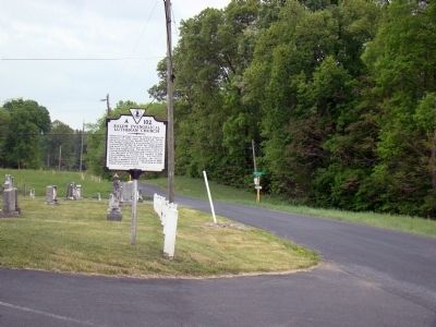
Salem Evangelical Lutheran Church Marker image. Click for full size.
Photographed by J. J. Prats, May 2, 2010
2. Salem Evangelical Lutheran Church Marker
(approx. 2.8 miles away); a different marker also named Augusta Stone Church (approx. 2.8 miles away); The Rev. John Craig (approx. 2.8 miles away); Augusta Military Academy (approx. 2.8 miles away); Dwight D. Eisenhower Visits Augusta Military Academy (approx. 2.8 miles away); Augusta Military Academy Museum (approx. 2.8 miles away); This 1886 Bell (approx. 2.8 miles away); Quarles Walk (approx. 2.8 miles away).
 
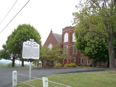
Salem Evangelical Lutheran Church and Marker image. Click for full size.
Photographed by J. J. Prats, May 2, 2010
3. Salem Evangelical Lutheran Church and Marker
 
 
Credits. This page was last revised on June 16, 2016. It was originally submitted on May 7, 2010, by J. J. Prats of Powell, Ohio. This page has been viewed 1,622 times since then and 67 times this year. Photos:   1, 2, 3. submitted on May 7, 2010, by J. J. Prats of Powell, Ohio.

m=30445

CeraNet Cloud Computing sponsors the Historical Marker Database.
This website earns income from purchases you make after using our links to Amazon.com. We appreciate your support.
Paid Advertisement
Sep. 3, 2026
