Beaumont in Jefferson County, Texas — The American South (West South Central)
Southeast Texas Regional Airport

Photographed by Cajun Scrambler, April 5, 2021
1. Soitheast Texas Regional Airport Marker
Originally named Jefferson County Airport, this facility has served area residents since the World War II era. Jefferson County commissioners purchased land to build the airport in 1841, and its development, which included three runways, a taxiway system and apron facilities. began the following year, with initial construction completed in early 1944. Eastern Airlines conducted the first scheduled flight in March of that year. During the war. the airport also served U.S. Marine Air Corps Dive Bomber Squadron No. 931 as a base for advanced training. Pilot trainees used floating targets in the Gulf of Mexico off Sabine Pass for gunnery and divebombing practice.
The airport has accommodated developments in air technology through enhancements of its facilities, Improvements in the 1925s and 1960s included additional land, buildings and taxiways, and installation of runway lighting and instrument landing system. In the early 1980s, when Texas International, Southwest Airlines, Air Texana and Metro Airlines all operated out of the airport, additional improvements were made including completion of a new terminal. In 1999,
this page online
As chemical and petrochemical industries, paper and pulp manufacturing and other area businesses grew, the airport became an increasingly important transportation center. In 2005, it was the site of one of the largest civilian airlifts in U.S. history, when the U.S. military evacuated thousands of local residents with special needs during the landfall of Hurricane Rita. Today, the airport continues to play a vital economic role in southeast Texas.
Erected 2007 by Texas Historical Commission. (Marker Number 15372.)
Topics. This historical marker is listed in these topic lists: Air & Space • Industry & Commerce. A significant historical year for this entry is 1841.
Location. 29° 57.29′ N, 94° 1.147′ W. Marker is in Beaumont, Texas, in Jefferson County. It is on Highway 69 0.4 miles south of Jerry Ware Drive. Touch for map. Marker is at or near this postal address: 6000 North Highway 69, Beaumont TX 77705, United States of America. Touch for directions.

Regionally, this marker is
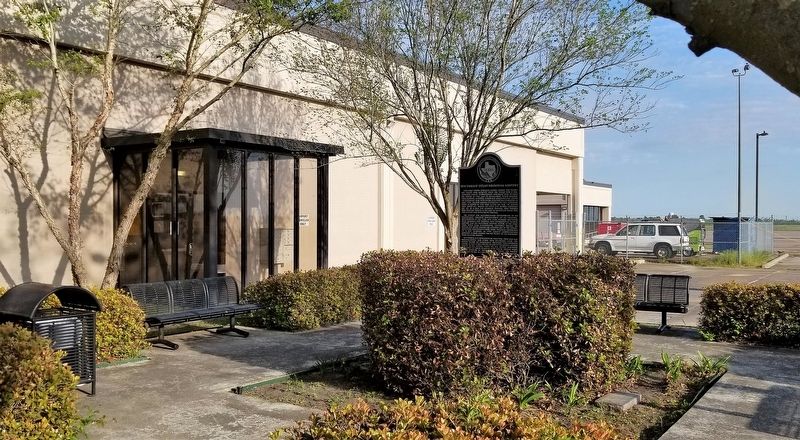
Photographed by Cajun Scrambler, April 5, 2021
2. Southeast Texas Regional Airport Marker
Other nearby markers. At least 8 other markers are within 4 miles of this marker, measured as the crow flies: First Baptist Church of Nederland (approx. 1.8 miles away); Interurban Rail Service (approx. 2 miles away); W.M. "Tex" Ritter (approx. 2 miles away); City of Nederland (approx. 2 miles away); First Mercantile Building (approx. 2.2 miles away); First Baptist Church of Port Neches (approx. 3.6 miles away); First Christian Church (Disciples of Christ) Of Port Arthur (approx. 3.9 miles away); St. Elizabeth Catholic Community (approx. 4 miles away).
More about this marker. The marker stands in a small green space at the airport terminal building.
Credits. This page was last revised on July 1, 2026. It was originally submitted on April 15, 2021, by Cajun Scrambler of Assumption, Louisiana. This page has been viewed 355 times since then and 28 times this year. Last updated on June 30, 2026, by Joe Lotz of Flower Mound, Texas. Photos: 1. submitted on April 15, 2021, by Cajun Scrambler of Assumption, Louisiana. 2. submitted on April 16, 2021, by Cajun Scrambler of Assumption, Louisiana. • Devry Becker Jones was the editor who published this page.
