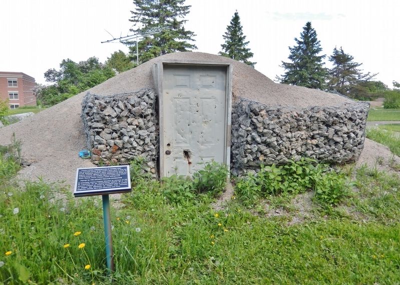
Living Underground at Coober Pedy


Erected by The Ontario Trillium Foundation. (Marker Number CUL #14.)
Topics. This historical marker is listed in this topic list: Industry & Commerce.
Location. 47° 27.139′ N, 79° 38.431′ W. Marker is in Temiskaming Shores, Ontario, in Timiskaming District. It is in Haileybury. It can be reached from Latchford Street just south of Florence Street, on the right when traveling south. The marker is on the trail in RockWalk Park at the Northern College Haileybury Campus. Touch for map. Marker is
this page online

Regionally, this marker is in Northeastern Ontario and specifically in Northern Ontario. It is also in Central Canada. Globally, it is in North America, the Great North Woods, the Western Hemisphere, the Western World, and the Anglosphere. Historically, it finds itself in what was once a British colony, the Viceroyalty of New France, the Haudenosaunee (Iroquois) Confederacy, and Rupert’s Land.
Other nearby markers. At least 8 other markers are within walking distance of this marker: The Inukshuk (a few steps from this marker); Calcite Breccia (within shouting distance of this marker); School of Mines and RockWalk Park / L'École des Mines et le Parc RockWalk (about 90 meters away, measured in a direct line); William H. Wright Building Art Deco Sculpture (about 90 meters away); Millionaires Row / Le Rang des Millionaires (approx. 0.4 kilometers away); Haileybury Jail / Le prison de Haileybury (approx. half a kilometer away); Haileybury Fire Department (approx. half a kilometer away); Court House / Le Palais de Justice
Also see . . . Coober Pedy (Wikipedia).
Excerpt: The town is sometimes referred to as the "opal capital of the world" because of the quantity of precious opals mined there. Coober Pedy is also renowned for its below-ground dwellings, called "dugouts", which are built in this fashion due to the scorching daytime heat.(Submitted on July 4, 2026, by Cosmos Mariner of Cape Canaveral, Florida.)Aboriginal people have a longstanding connection with the area. Western Desert people consider the area to have traditionally been Arabana territory, the area being associated with speakers of a western Arabana dialect called Midlaliri. Other groups had ties to the region, most notably the Kokatha people and also the Yankunytjatjara and Antakirinja. In addition, Western Desert people from much further west used to travel to the Stuart Range to obtain stone from the quarries there (quartz was sought after for axes and small knives). The name of the town (decided in 1920) is thought to derive from the words in the Kokatha language, kupa piti, usually translated as "whitefella" and "hole in the ground", or guba
bidi, "white man's holes", relating to white people's mining activities.In 1858, Scottish-born John McDouall Stuart was the first European explorer to pass near the site of Coober Pedy. On 1 February 1915, Wille Hutchison discovered the first opal in the area, after which the town was established. Opal miners started moving in around 1916. In July 1975, the local Aboriginal people of Coober Pedy adopted the name Umoona, which means "long life" and is also their name for the Acacia aneura, or mulga tree, which is plentiful in the area. The name has since been used for various establishments in the town (Umoona Opal Mine and Museum, Umoona Community Art Centre, Umoona Tjutagku Health Service Aboriginal Corporation).
Credits. This page was last revised on July 4, 2026. It was originally submitted on July 1, 2026, by Cosmos Mariner of Cape Canaveral, Florida. This page has been viewed 15 times since then. Photos: 1, 2. submitted on July 4, 2026, by Cosmos Mariner of Cape Canaveral, Florida.
