National Museum of Transportation near Kirkwood in St. Louis County, Missouri — The American Midwest (Upper Plains)
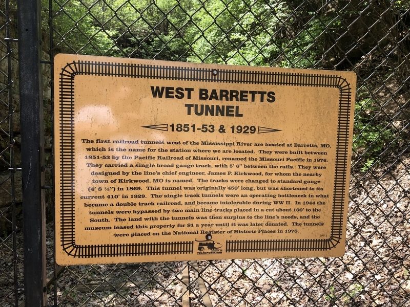
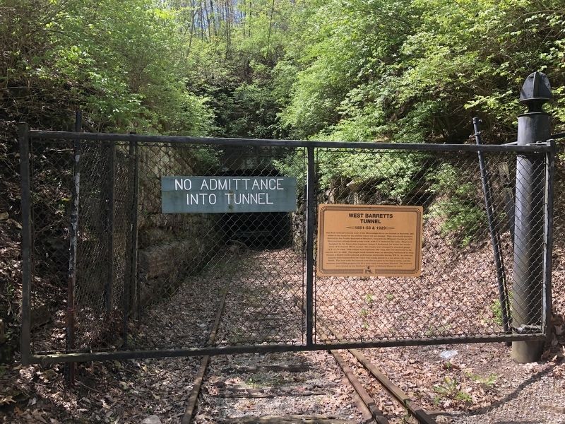
West Barretts Tunnel
1851-53 & 1929
Photographed by Devry Becker Jones (CC0), April 22, 2019
1. West Barretts Tunnel Marker
Inscription.
The first railroad tunnels west of the Mississippi River are located at Barretts, MO, which is the name for the station where we are located. They were built between 1851-53 by the Pacific Railroad of Missouri, renamed the Missouri Pacific in 1876. They carried a single broad gauge track, with 5' 6" between the rails. They were designed by the line's chief engineer, James P. Kirkwood, for whom the nearby town of Kirkwood, MO is named. The tracks were changed to standard gauge (4' 8 ½") in 1869. This tunnel was originally 450' long, but was shortened to its current 410' in 1929. The single track tunnels were an operating bottleneck in what became a double track railroad, and became intolerable during WW II. In 1944 the tunnels were bypassed by two main line tracks placed in a cut about 100' to the South. The land with the tunnels was then surplus to the line's needs, and the museum leased this property for $1 a year until it was later donated. The tunnels were placed on the National Register of Historic Places in 1978.
Erected by National Museum of Transportation.
Topics. This historical marker is listed in this
Click or scan to see this page online
topic list: Railroads & Streetcars. A significant historical year for this entry is 1851.
Location. 38° 34.21′ N, 90° 27.861′ W. Marker is near Kirkwood, Missouri, in St. Louis County. It is in National Museum of Transportation. It can be reached from Barrett Station Road east of Old Dougherty Ferry Road, on the right when traveling east. Touch for map. Marker is at or near this postal address: 3015 Barrett Station Road, Saint Louis MO 63122, United States of America. Touch for directions.
Regionally, this marker is in Greater St. Louis. It is also in the American Midwest, in the Lewis & Clark Corridor, in the Corn Belt, and in the Great River Road Region. Globally, it is in North America, the Western Hemisphere, the Western World, and the Anglosphere. Historically, it finds itself in what was once the Viceroyalty of New France, the territory of the Mississippian Culture, the Louisiana Purchase, and the Antebellum South.
Credits. This page was last revised on July 7, 2026. It was originally submitted on April 28, 2019, by Devry Becker Jones of Washington, District of Columbia. This page has been viewed 1,047 times since then and 145 times this year. Last updated on July 2, 2026, by Garrett Koch of Saint Louis, Missouri. Photos:1, 2. submitted on April 28, 2019, by Devry Becker Jones of Washington, District of Columbia.