Manzanar National Historic Site near Independence in Inyo County, California — The American West (Pacific Coastal)
Community Activities
Manzanar
Photographed by Craig Baker, May 15, 2026
1. Community Activities Marker
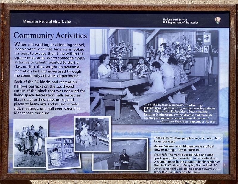
When not working or attending school, incarcerated Japanese Americans looked for ways to occupy their time within the square-mile camp. When someone "with initiative or talent" wanted to start a class or club, they sought an available recreation hall and advertised through the community activities department.
Each of the 36 blocks had recreation halls-a barracks on the southwest corner of the block that was not used for living space. Recreation halls served as libraries, churches, classrooms, and places to learn arts and music or hold club meetings; one hall even served as Manzanar's museum.
"Goh, shogi, drama, musicals, woodcarving, gardening and poem writing are the favorite pastimes for the elderly men. Embroidery, flower making, knitting, leathercraft, sewing, dramas and musicals are the predominant recreations for the women."
Manzanar Free Press, September 10, 1943
These pictures show people using recreation halls in various ways.
Above: Women and children create artificial flowers during a class in Block 14.
From left: The Venice Barbell Club and other sports
this page online
A woman reads in the Japanese books section of the Block 22 Library. Men play Goh in Block 10.
Artist Tamekichi Carl Hibino paints a mural in the Block 8 Visual Education Museum.
Erected by National Park Service.
Topics. This historical marker is listed in these topic lists: Asian Americans • War, World II. A significant historical date for this entry is September 10, 1943.
Location. 36° 43.651′ N, 118° 9.041′ W. Marker is near Independence, California, in Inyo County. It is in Manzanar National Historic Site. It can be reached from Manzanar Reward Road west of U.S. 395. Touch for map. Marker is at or near this postal address: 5001 US-395, Independence CA 93526, United States of America. Touch for directions.

Regionally, this marker is in California’s Sierra Nevada. It is also in the American Mountain West. Globally, it is in North America, on the Ring of Fire, on the Pacific Rim, in the Western Hemisphere, in the Western World, and in the Anglosphere. Historically, it finds itself in what was once New Spain and also Mexico’s Alta California.
Other nearby markers. At least
Photographed by Craig Baker, May 15, 2026
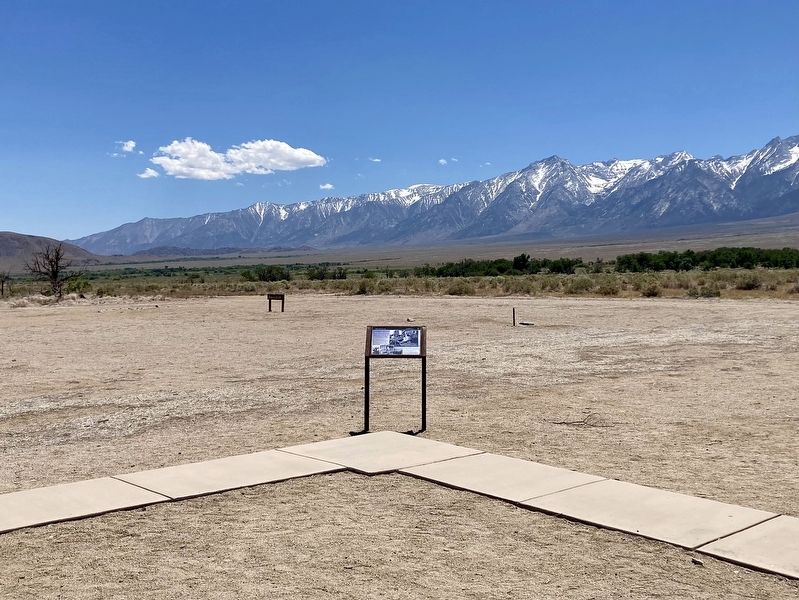
2. Community Activities Marker
Credits. This page was last revised on July 5, 2026. It was originally submitted on July 4, 2026, by Craig Baker of Sylmar, California. This page has been viewed 12 times since then. Photos: 1, 2. submitted on July 4, 2026, by Craig Baker of Sylmar, California.
