Guildford in Surrey, England, United Kingdom — Northwestern Europe (the British Isles)
St. Mary's Church
Photographed by Ray Gurganus, April 13, 2026
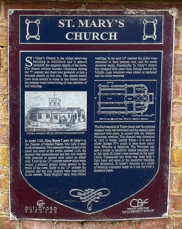
1. St Mary's Church Marker
In about 1120, King Henry I gave St Mary's to the Canons of Merion Priory, who held it until the Reformation. Two transepts were added to the north and south of the tower. Around 1140, the chancel was reconstructed and two side chapels with rounded or apsidal ends added on either side. Later in the 15 century narrow aisles were added, a pillared arcade being opened in the walls of the nave. Early in the 13 century the chancel and the side chapels were remodelled In the current Early English' style, with ribbed vaulting. In the mid 13 century the aisles were extended to their present size, and the north doorway made. Essentially, St. Mary's church has changed little since then, though later in the Middle Ages windows were added or replaced and the roofs
this page online
The Reformation in Tudor times saw the painted internal walls whitewashed and the stained glass replaced with plain, in accord with the simpler Protestant services. The chancel was shortened in 1825 to widen Quarry Street -- it is said to allow George IV's coach to pass more easily from Windsor to Brighton. The Victorian age saw a return in medieval church practices and in this spirit St Mary's was restored in the early 1860s. Fortunately this work was done with a light hand and most of the medieval building was untouched. St Mary's function as a place of worship continues today as it has for over a thousand years.
Erected by Guildford Borough.
Topics. This historical marker is listed in this topic list: Religion & Religious Structures.
Location. 51° 14.09′ N, 0° 34.484′ W. Marker is in Guildford, England, in Surrey. It is on Quarry Street, on the right when traveling south. Touch for map. Marker is at or near this postal address: 4a Quarry Street, Guildford, England GU1 3UP, United Kingdom. Touch for directions.

Regionally, this marker is in the Greater South
Photographed by Ray Gurganus, April 13, 2026
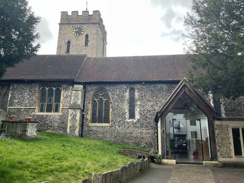
2. St Mary's Church
Other nearby markers. At least 8 other markers are within walking distance of this marker: The Star Inn History (a few steps from this marker); The Stranglers (within shouting distance of this marker); Medieval Synagogue (within shouting distance of this marker); Quarry Street/Rosemary Alley (about 90 meters away, measured in a direct line); The Town Bridge (about 120 meters away); The Castle Keep (about 150 meters away); Friary Square (about 180 meters away); Tunsgate Arch (about 210 meters away). Touch for a list and map of all markers in Guildford.
Photographed by Boots Cash Chemists, circa 1910
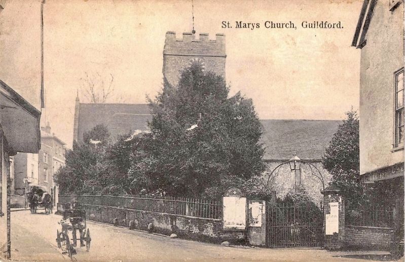
3. St. Mary's Church, Guildford
This postcard image shows the marker location, albeit not the marker itself since the photo was taken a century too early. The marker today is located just to the left of the churchyard gate, which is shown here.
Credits. This page was last revised on July 5, 2026. It was originally submitted on July 4, 2026, by Ray Gurganus of Washington, District of Columbia. This page has been viewed 10 times since then. Photos: 1, 2. submitted on July 4, 2026, by Ray Gurganus of Washington, District of Columbia. 3. submitted on July 5, 2026, by Andrew Ruppenstein of Lamorinda, California. • Andrew Ruppenstein was the editor who published this page.
