Sudbury in Suffolk, England, United Kingdom — Northwestern Europe (the British Isles)
Sudbury Station
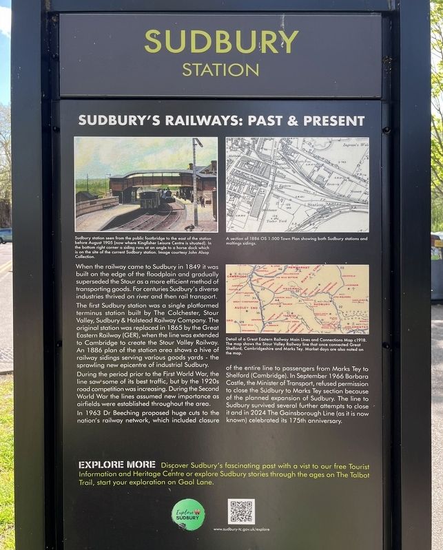
Sudbury's Railways: Past & Present
Photographed by Ray Gurganus, April 18, 2026
1. Sudbury Station Marker
The first Sudbury station was a single platformed terminus station built by The Colchester, Stour Valley, Sudbury & Halstead Railway Company. The original station was replaced in 1865 by the Great Eastern Railway (GER), when the line was extended to Cambridge to create the Stour Valley Railway. An 1886 plan of the station area shows a hive of railway sidings serving various goods yards - the sprawling new epicentre of industrial Sudbury.
During the period prior to the First World War, the line saw some of its best traffic, but by the 1920s road competition was increasing. During the Second World War the lines assumed new importance as airfields were established throughout the area.
In 1963 Dr Beeching proposed huge cuts to the nation's railway network, which included closure of the entire line to passengers from Marks Tey to Shelford (Cambridge). In September 1966
this page online
Topics. This historical marker is listed in this topic list: Railroads & Streetcars. A significant historical year for this entry is 1849.
Location. 52° 2.177′ N, 0° 44.051′ E. Marker is in Sudbury, England, in Suffolk. It is on Cornard Road. Touch for map. Marker is at or near this postal address: 32 Cornard Rd, Sudbury, England CO10 2XA, United Kingdom. Touch for directions.

Regionally, this marker is in England’s East Anglia. Globally, it is on the Atlantic Ocean, in the North Atlantic Region, in Europe, in Atlantic Europe, on one of the British Isles, in the Western World, and in the Anglosphere. Historically, it finds itself in what was once the Roman Empire.
Other nearby markers. At least 8 other markers are within 21 kilometers of this marker, measured as the crow flies: A Short History of Beautiful Sudbury (about 90 meters away, measured in a direct line); Dodie Smith (1896-1990) (approx. 0.3 kilometers away); The Lady Elizabeth (approx. 0.4 kilometers away); Sudbury and the Woollen Cloth Industry (approx. half a kilometer away); Sudbury - the Arrival of Silk Manufacturing (approx. half a kilometer away); Thomas Gainsborough (approx. 7.6 kilometers away); The History of Chappel and Wakes Colne (approx. 12.4 kilometers away); Priory Street Bastion 5 (approx. 20.2 kilometers away). Touch for a list and map of all markers in Sudbury.
Credits. This page was last revised on July 5, 2026. It was originally submitted on July 5, 2026, by Ray Gurganus of Washington, District of Columbia. This page has been viewed 16 times since then. Photo 1. submitted on July 5, 2026, by Ray Gurganus of Washington, District of Columbia. • Andrew Ruppenstein was the editor who published this page.
Editor’s want-list for this marker. photo of the marker within its surroundings • Can you help?
