Saxmundham in Suffolk, England, United Kingdom — Northwestern Europe (the British Isles)
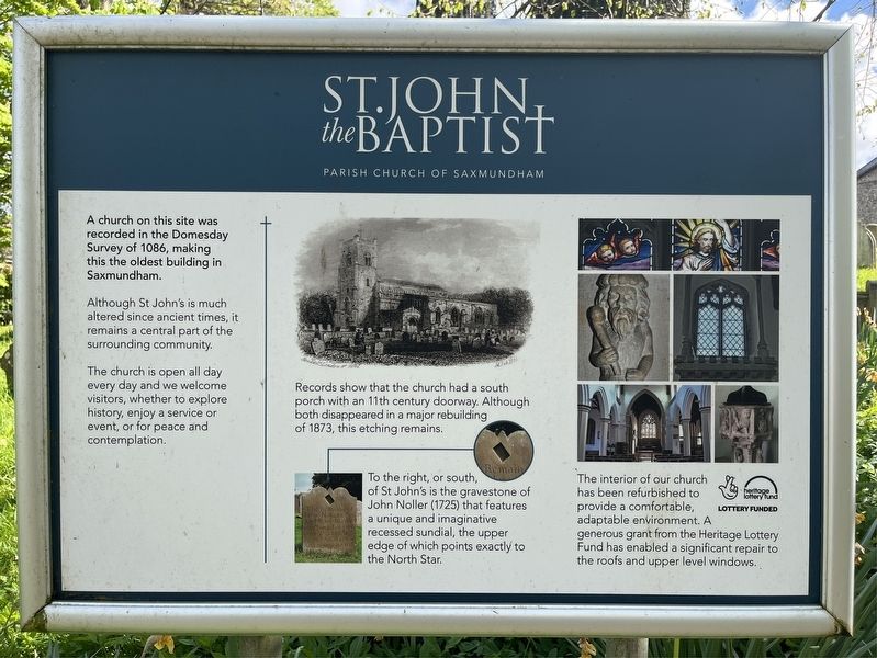
St John the Baptist
Parish Church of Saxmundham
Photographed by Ray Gurganus, April 20, 2026
1. St John the Baptist Marker
Although St John's is much altered since ancient times, it remains a central part of the surrounding community.
The church is open all day every day and we welcome visitors, whether to explore history, enjoy a service or event, or for peace and contemplation.
Records show that the church had a south porch with an 11th century doorway. Although both disappeared in a major rebuilding of 1873, this etching remains.
To the right, or south, of St John's is the gravestone of John Noller (1725) that features a unique and imaginative recessed sundial, the upper edge of which points exactly to the North Star.
The interior of our church has been refurbished to provide a comfortable, adaptable environment. A generous grant from the Heritage Lottery Fund has enabled a significant repair to the roofs and upper level windows.
Topics. This historical marker is listed in this topic list: Religion & Religious Structures. A significant historical year for this entry is 1086 CE.
Location. 52° 12.789′ N, 1° 29.694′ E.
this page online

Regionally, this marker is in East Anglia. Globally, it is on the Atlantic Ocean, in the North Atlantic Region, in Europe, in Atlantic Europe, on one of the British Isles, in the Western World, and in the Anglosphere. Historically, it finds itself in what was once the Roman Empire.
Other nearby markers. At least 7 other markers are within 19 kilometers of this marker, measured as the crow flies: Wickham Market Station (approx. 9.5 kilometers away); Over the Centuries (approx. 14.5 kilometers away); The Old Rectory; Land Girls (approx. 14.7 kilometers away); Woodbridge (approx. 18.1 kilometers away); Isaac Johnson (approx. 18.2 kilometers away); Thomas Seckford (approx. 18.2 kilometers away); The Deben Valley (approx. 18.3 kilometers away).
Photographed by Ray Gurganus, April 20, 2026
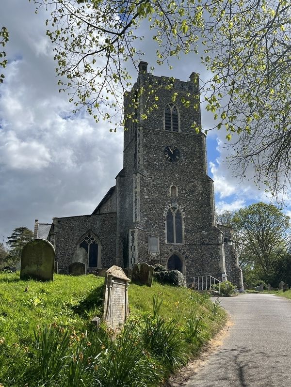
2. St John the Baptist Church
Credits. This page was last revised on July 5, 2026. It was originally submitted on July 5, 2026, by Ray Gurganus of Washington, District of Columbia. This page has been viewed 11 times since then. Photos: 1, 2. submitted on July 5, 2026, by Ray Gurganus of Washington, District of Columbia. • Andrew Ruppenstein was the editor who published this page.
