
Bath Township near Wright-Patterson Air Force Base in Greene County, Ohio — The American Midwest (Great Lakes)
Biplanes to Rocket Science
Dayton Aviation Heritage National Historical Park
Wright Patterson Air Force Base
| — | National Park Service, U.S. Department of the Interior | — |
Photographed by Craig Swain, December 26, 2007
1. Biplanes to Rocket Science Marker
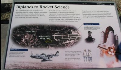
Here, on Wright Brothers Hill, on all sides you are surrounded by the vast research complexes and runways of Wright-Patterson Air Force Base. Problem solving done here since 1917 has taken aviators from Huffman Prairie Flying Field to the moon and back.
In the early 1920s, McCook Field near downtown Dayton proved too small to be safe for further experimental aircraft work. Community leaders formed the Dayton Air Service Committee, buying the lands surrounding this bluff and donating them to the federal government in 1924. Wright Field was then built, keeping the Army Air Corps engineering braintrust in town.
Wright-Patterson Air Force Base remains America's premier center for aeronautical research, development and acquisition, continuing engineering traditions that Orville and Wilbur Wright started when they first learned how to fly over these same fields in 1904.
Erected by National Park Service, U.S. Department of the Interior.
Topics. This historical marker is listed in this topic list: Air & Space. A significant historical year for this entry is 1917.
Location. 39° 47.718′ N, 84° 5.328′ W. Marker is near
this page online

Regionally, this marker is in Ohio’s Dayton Metro and in the Miami Valley. It is also in the American Midwest and in the Corn Belt. Globally, it is in North America, the Western Hemisphere, the Western World, and the Anglosphere. Historically, it finds itself in what was once the Haudenosaunee (Iroquois) Confederacy, the territory of the Mississippian Culture, and the Northwest Territory.
Other nearby markers. At least 8 other markers are within walking distance of this marker: Cow Pasture to Flight School (here, next to this marker); In Case of Floods … (a few steps from this marker); Original Hangar (within shouting distance of this marker); Mound Builders Era (within shouting distance of this marker); Wilbur and Orville Wright (within shouting distance of this marker); Wright Field
Photographed by Craig Swain, December 26, 2007
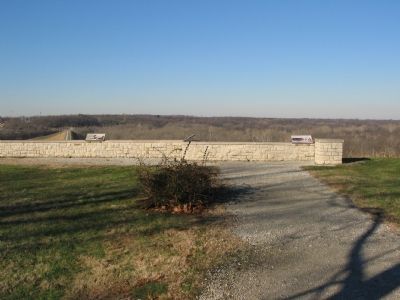
2. Markers at the Overlook
More about this marker. The background of the marker is a satellite photo of Wright-Patterson Air Force Base with portions of the base complex indicated. "Wright Field (1927) - Combat aircraft for World War II were designed at Wright Field. Experimental warplanes were test-flown from both fields in the 1940s." "Patterson Field (1917) - The airfield you see ahead honors Lt. Frank S. Patterson, a test pilot killed in a crash in 1918. At that time, the base was called Wilbur Wright Field."
Photos surrounding this satellite image include a portrait of Lt. Frank Patterson, the space shuttle, a P-51 Fighter from World War II, and a set of space suits. The later carries the caption, "Spacesuits worn by early astronauts, such as Ohioan John Glen, were developed at Wright-Patterson in the 1960s. Early development work on the Space Shuttle was also done here."
Also see . . . Dayton Aviation Heritage National Park. Includes several
Photographed by Craig Swain, December 26, 2007
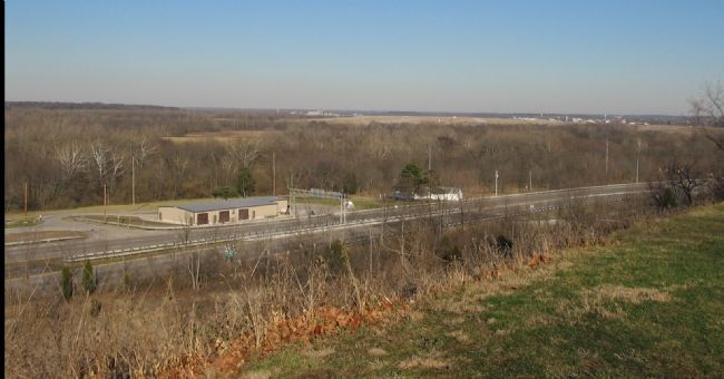
3. View of Patterson Field from the Overlook
Credits. This page was last revised on July 8, 2026. It was originally submitted on January 9, 2008, by Craig Swain of Leesburg, Virginia. This page has been viewed 1,721 times since then and 31 times this year. Last updated on July 5, 2026, by Connor Olson of Menomonee Falls, Wisconsin. Photos: 1, 2, 3. submitted on January 9, 2008, by Craig Swain of Leesburg, Virginia. • Devry Becker Jones was the editor who published this page.
