
Bath Township near Wright-Patterson Air Force Base in Greene County, Ohio — The American Midwest (Great Lakes)
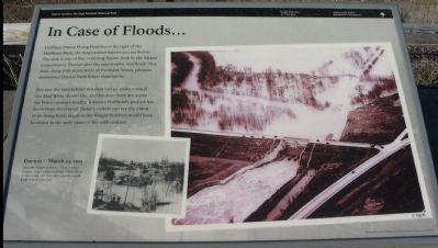
In Case of Floods …
Dayton Aviation Heritage National Historical Park
Wright Patterson Air Force Base
| — | National Park Service, U.S. Department of the Interior | — |
Photographed by Craig Swain, December 26, 2007
1. In Case of Floods ... Marker
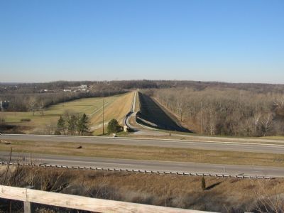
Huffman Prairie Flying Field lies to the right of Huffman Dam, the long earthen barrier you see below. The dam is one of five 'retarding basins' built by the Miami Conservancy District after the catastrophic 1913 flood. This dam, along with many miles of riverbank levees, protects downtown Dayton from future inundation.
Because the land behind this dam can go underwater if the Mad River should rise, and because there are active Air Force runways nearby, Torrence Huffman's pasture has never been developed. Today's visitors can see the oldest of all flying fields much as the Wright brothers would have known it in the early years of the 20th century.
Erected by National Park Service, U.S. Department of the Interior.
Topics. This historical marker is listed in these topic lists: Air & Space • Disasters. A significant historical year for this entry is 1913.
Location. 39° 47.718′ N, 84° 5.335′ W. Marker is near Wright-Patterson Air Force Base, Ohio, in Greene County. It is in Bath Township. It can be reached from Memorial Road. The memorial center is off Kauffman Avenue, off South Broad Street (CR 444). Touch for map.
this page online

Regionally, this marker is in Ohio’s Dayton Metro and in the Miami Valley. It is also in the American Midwest and in the Corn Belt. Globally, it is in North America, the Western Hemisphere, the Western World, and the Anglosphere. Historically, it finds itself in what was once the Haudenosaunee (Iroquois) Confederacy, the territory of the Mississippian Culture, and the Northwest Territory.
Other nearby markers. At least 8 other markers are within walking distance of this marker: Cow Pasture to Flight School (here, next to this marker); Biplanes to Rocket Science (a few steps from this marker); Mound Builders Era (within shouting distance of this marker); Original Hangar (within shouting distance of this marker); Wilbur and Orville Wright (within shouting distance of this marker); Wright Field (about 300 feet away, measured in a direct line); Pioneer Flyers (about 300 feet away); Final Honors (about 400 feet away). Touch for a list and map of all markers in Wright-Patterson Air Force Base.
More about this marker.
Photographed by Craig Swain, December 26, 2007
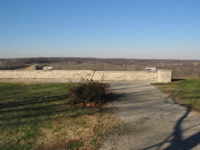
2. Markers at the Overlook
Also see . . . Dayton Aviation Heritage National Park. Includes several locations within the Dayton area associated with the Wright brothers and aviation history. (Submitted on January 9, 2008, by Craig Swain of Leesburg, Virginia.)
Photographed by Craig Swain, December 26, 2007
3. Huffman Dam
Credits. This page was last revised on July 8, 2026. It was originally submitted on January 9, 2008, by Craig Swain of Leesburg, Virginia. This page has been viewed 1,970 times since then and 31 times this year. Last updated on July 5, 2026, by Connor Olson of Menomonee Falls, Wisconsin. Photos: 1, 2, 3. submitted on January 9, 2008, by Craig Swain of Leesburg, Virginia. • Devry Becker Jones was the editor who published this page.
