Harrison Township in Tucson in Ross County, Ohio — The American Midwest (Great Lakes)
Brush Ridge Fire Tower
Tar Hollow State Forest
| — | Ohio Forest Fire Management Through the Years | — |
Photographed by Cajun Scrambler, May 26, 2026
1. Brush Ridge Fire Tower Marker
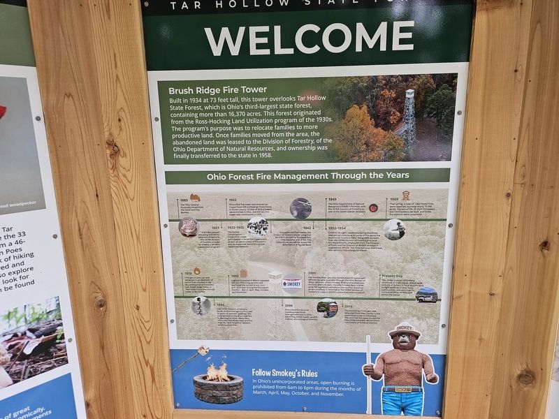
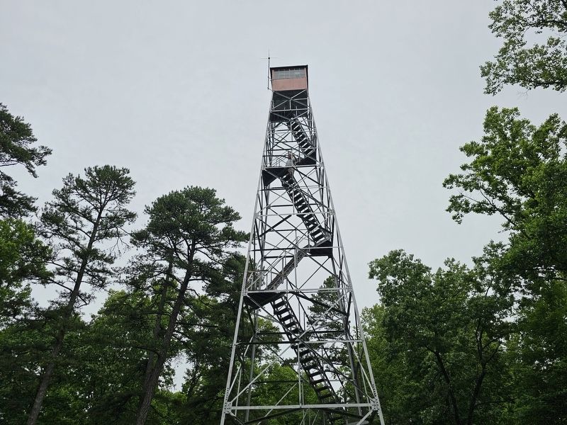
Built in 1934 at 73 feet tall, this tower overlooks Tar Hollow State Forest, which is Ohio's third-largest state forest, containing more than 16,370 acres. This forest originated from the Ross-Hocking Land Utilization program of the 1930s. The program's purpose was to relocate families to more productive land. Once families moved from the area, the abandoned land was leased to the Division of Forestry, of the Ohio Department of Natural Resources, and ownership was finally transferred to the state in 1958.
Ohio Forest Fire Management Through the Years
•1885 - The Ohio General Assembly established the State Forestry Bureau.
•1921 - A bill was passed allocating $10,000 to what would become the ODNR Division of Forestry in order to develop a wildfire suppression program.
•1922 - Ohio's first fire tower was erected on Copperhead Hill in Shawnee State Forest in Scioto County. A total of 39 fire towers were erected in Ohio, and the last fire tower was constructed in 1970.
•1933-1935 - The Civilian Conservation Corps (CCC) crews participated in forest fire suppression, as well as construction of fire
this page online
•1942 - To supplement fire towers, the Division of Forestry began using Civil Air Patrol aircraft for fire detection. Ohio becomes one of the first states to use aircraft for forest fire detection on a regular basis.
• 1949 - The Ohio Department of Natural Resources (ODNR) is formed, with the ODNR Division of Forestry as one of the seven charter divisions.
•1952-1954 - Extreme drought conditions during this three- year period contribute to some of the worst fire seasons on record in Ohio. Along with workers from the ODNR Division of Forestry and local fire departments, employees from the Division of Parks and the Division of Wildlife assisted in suppression efforts. The Ohio National Guard was also called to help extinguish blazes.
• 1969 - That spring, a total of 1,803 forest fires were reported, burning nearly 13,000 acres. The last of the 39 Ohio fire towers was contracted to be built, and three fire stations were completed.
• 1978 - Changes in land use and advances in air detection of forest fires resulted in the discontinuation
Photographed by Cajun Scrambler, May 26, 2026
2. Brush Ridge Fire Tower Marker
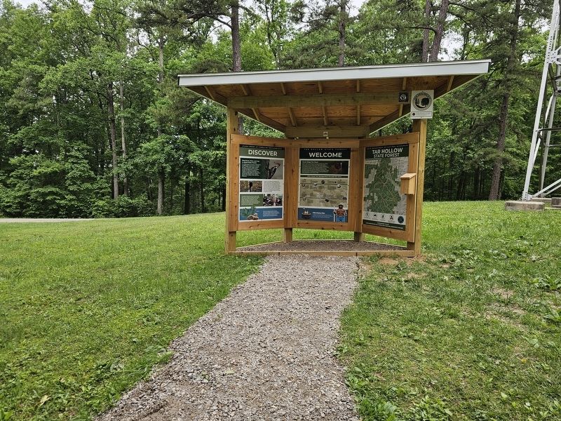
•1986 - The ODNR Division of Forestry sends its first interagency fire crew to assist on western wildfires. The crew worked on the Ace Creek fire in Washington state. Many Ohio resources, including crews and fire engines, have helped on western wildfires since then.
• 1988 - Legislation passed in March repealed the use of burning permits and instituted the current 6 a.m. to 6 p.m. burn ban during the fire season months - March, April, May, October, and November.
•2000 - Prescribed fire became a widespread forest management tool in Ohio, benefiting forest health, wildlife habitat, and ecological diversity.
• 2005 - The Smokey Bear specialty license plate for passenger vehicles became available through the Ohio Bureau of Motor Vehicles. Ohio's Smokey Bear license plate was the first, and is to date, the only Smokey Bear license plate for registered vehicles in the country. A portion of sale proceeds is returned to the ODNR Division of Forestry to support wildfire prevention and education.
•2016 - The Armintrout Firetower
Photographed by Cajun Scrambler, May 26, 2026
3. Brush Ridge Fire Tower
• Present Day - The ODNR Division of Forestry continues to train, equip, and provide millions of dollars to local departments to fight wildfires in their local communities and continues to combat wildfires in Ohio and across the nation.
Erected by Ohio Department of Natural Resources.
Topics. This historical marker is listed in this topic list: Horticulture & Forestry. A significant historical year for this entry is 1934.
Location. 39° 22.496′ N, 82° 45.762′ W. Marker is in Tucson, Ohio, in Ross County. It is in Harrison Township. It is on South Ridge Road. Touch for map. Marker is at or near this postal address: S Ridge Rd, Chillicothe OH 45601, United States of America. Touch for directions.

Regionally, this marker is in the Scioto Valley and in Southern Ohio Hill Country. It is also in the American Midwest, in the Corn Belt, and in Northern Appalachia. Globally, it is in North America, the Western Hemisphere, the Western World, and the Anglosphere. Historically, it finds itself in what was once the Viceroyalty of New France, the Haudenosaunee (Iroquois) Confederacy, the territory of the Mississippian Culture, and the Northwest Territory.
Other nearby markers. At least 8 other markers are within 8 miles of this marker, measured as the crow flies: Laurelville Veterans Memorial (approx. 7.1 miles away); Ernie Pyle 1900-1945 (approx. 7.6 miles away); 1880-1964 (approx. 7.6 miles away); Army Pvt. Everett Jividen (approx. 7.6 miles away); Army Sgt. James William Lundsford, Jr. (approx. 7.6 miles away); Army Sgt. Ralph Wade (approx. 7.6 miles away); Army SP4 Shelby M. Long (approx. 7.6 miles away); Army Pvt. John Speakman (approx. 7.6 miles away).
Another marker is no longer nearby. Salt and Hunting Trails (was approx. 6.9 miles away but has been confirmed missing).
More about this marker. Located in the Tar Hollow State Forest
Credits. This page was last revised on August 2, 2026. It was originally submitted on July 5, 2026, by Cajun Scrambler of Assumption, Louisiana. This page has been viewed 20 times since then. Photos: 1, 2, 3. submitted on July 5, 2026, by Cajun Scrambler of Assumption, Louisiana.
