Marysville in Union County, Ohio — The American Midwest (Great Lakes)
Marysville, Ohio

Photographed by Joel Seewald, October 12, 2019
1. Marysville Ohio Marker
On August 10, 1819, Samuel W. Culbertson (1780-1840), a Zanesville lawyer, established Marysville at the convergence of Mill Creek and the road connecting Delaware to Urbana. Culbertson purchased 450 acres of land on July 10, 1817 and authorized Charles Roberts to survey the village, which originally contained 96 lots. Culbertson named the village in honor of his daughter, Mary Ellen (1810-1853), who later married US Congressman, Joshua Mathiot (1800-1849). The village was originally in Delaware County, located in part of the Virginia Military District. It was land given as bounties to soldiers from Virginia after the Revolutionary War. Union County, which included Marysville, was created in 1820, and Marysville became the county seat in 1822.
Culbertson wrote in 1820, "the legislature of Ohio last Session struck off a new County called Union, including our land, and appointed Commissioners to locate the County Seat. Last fall, I had a Town called Marysville, after my little Daughter, laid out on my land, and two weeks ago, the Commissioners met to fix the County Seat: my Brother attended for me, and procured the
this page online
Erected 2019 by City of Marysville, The Ohio History Connection. (Marker Number 23-80.)
Topics and series. This historical marker is listed in this topic list: Settlements & Settlers. In addition, it is included in the Ohio Historical Society / The Ohio History Connection series list. A significant historical date for this entry is July 10, 1817.
Location. 40° 14.113′ N, 83° 22.031′ W. Marker is in Marysville, Ohio, in Union County. It is at the intersection of South Main Street (Ohio Route 38) and Sixth Street, on the right when traveling south on South Main Street. The marker stands at Marysville City Hall. Touch for map. Marker is at or near this postal address: 209 S Main St, Marysville OH 43040, United States of America. Touch for directions.

Regionally,

Photographed by Joel Seewald, October 12, 2019
2. Marysville Ohio Marker
Other nearby markers. At least 8 other markers are within walking distance of this marker: Marysville Journal-Tribune Clock (a few steps from this marker); Friendship Garden (within shouting distance of this marker); Thomas O. Nuckles (within shouting distance of this marker); Cyprian Lee House / Colonel Noah Orr, “Union County Giant” (within shouting distance of this marker); The Oldest Brick House in Marysville (about 300 feet away, measured in a direct line); Major General Robert Sprague Beightler (about 400 feet away); Colonel Noah Orr (about 400 feet away); Virginia Military District (about 500 feet away). Touch for a list and map of all markers in Marysville.
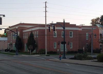
Photographed by Joel Seewald, October 12, 2019
3. Marysville Ohio Marker
The marker is at the street corner near a tree. Marysville City Hall is in the background.
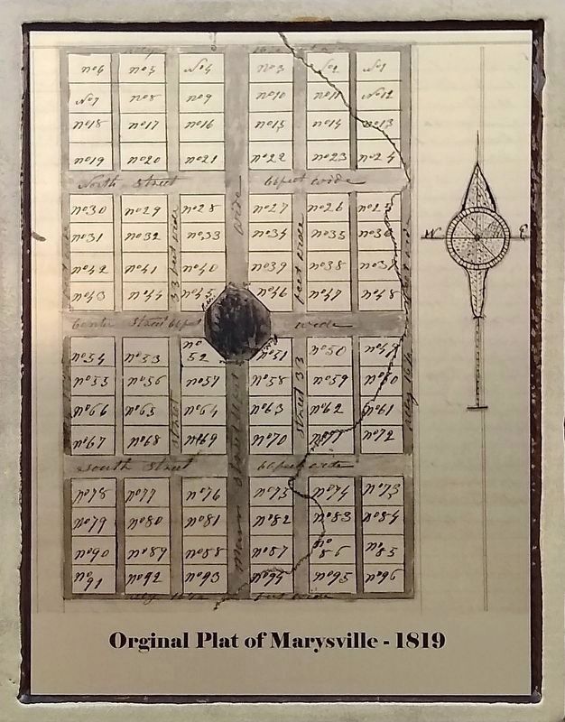
Photographed by Joel Seewald, October 12, 2019
4. Marker Detail
Original Plat of Marysville - 1819
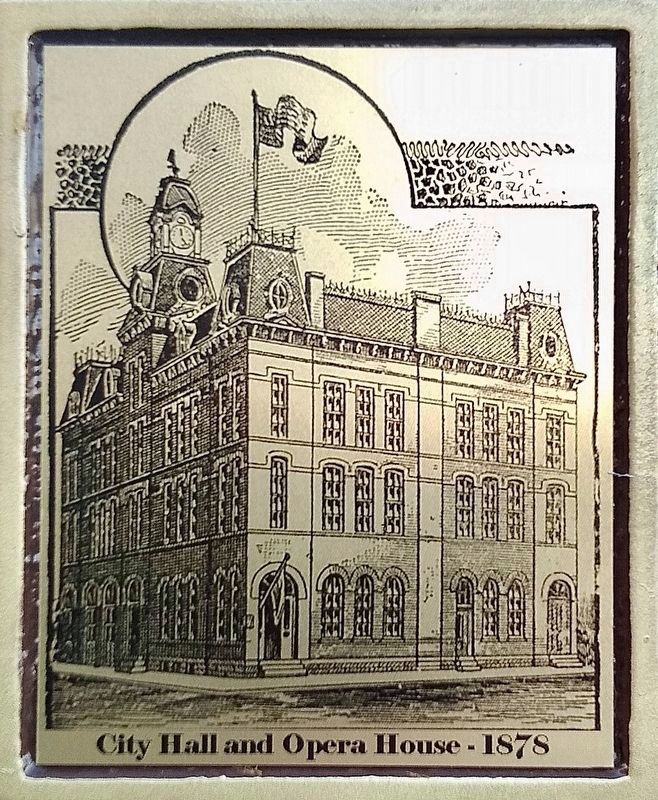
Photographed by Joel Seewald, October 12, 2019
5. Marker Detail
City Hall and Opera House - 1878
Credits. This page was last revised on July 20, 2026. It was originally submitted on October 16, 2019, by Joel Seewald of Madison Heights, Michigan. This page has been viewed 1,655 times since then and 221 times this year. Last updated on July 5, 2026, by Carl Gordon Moore Jr. of North East, Maryland. Photos: 1, 2, 3. submitted on October 16, 2019, by Joel Seewald of Madison Heights, Michigan. 4, 5. submitted on June 28, 2026. • Devry Becker Jones was the editor who published this page.
