
Huisduinen in Den Helder, North Holland, Netherlands — Northwestern Europe
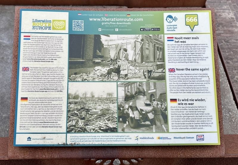
Nooit meer zoals het was
⎯⎯⎯
Never the same again!
⎯⎯⎯
Es wird nie wieder wie es war
| — | Liberation Route Europe | — |
Photographed by Andrew Ruppenstein, June 2, 2026
1. Nooit meer zoals het was / Never the same again! / Es wird nie wieder wie es war Marker

Als op 8 mei 1945 de Canadese bevrijders arriveren in Den Helder dan telt de stad nog maar 7000 inwoners, een kwart van voor de oorlog. De wijk Oude Helder is compleet weggevaagd, de stad is een schim van wat ze ooit was en de duinen liggen bezaaid met bunkers en mijnenvelden. Geen enkele plek in Nederland is tijdens de Tweede Wereldoorlog zo vaak gebombardeerd als Den Helder. Maar de Helderse bevolking is veerkrachtig en keert terug...
De kustlijn van het Waddengebied was onderdeel van de Atlantikwall, de Duitse verdedigingslinie langs de West-Europese kust. De algehele capitulatie van het Duitse leger was op 5 mei 1945 een feit, maar het Waddengebied was daarmee nog niet bevrijd. Van 5 april tot 20 mei woedde er op Texel een hevige strijd tussen de Georgische opstandelingen en Duitse bezetting. Pas op 11 juni 1945 vertrokken de laatste Duitse soldaten van Schiermonnikoog en was heel Nederland bevrijd. Tijdens de Liberation Route hoort u hun belevenissen. De geschiedenis van deze plek kunt u gratis downloaden vanaf www.liberationroute.com, scan de QR-code of download de Liberation Route Europe app.
When the Canadian liberators arrive in Den Helder on 8 May 1945, the city has only 7000 inhabitants, a quarter of the population before the war. The Ouwe Helder district has been completely wiped out, the city is a shadow of what it once was, and the dunes are dotted with bunkers and minefields. No other place in the Netherlands was bombed as often as Den Helder during the Second World War. The people from Den Helder are resilient and return...
The Wadden Sea coastline was part of the Atlantic Wall, the German line of defense along the West European coast. The general capitulation of the German army was a fact on May 5, 1945, but the Wadden Sea area was not yet liberated. From April 5th to May 20th, a fierce battle raged on Texel between Georgian insurgents and the German occupation. Only on June 11, 1945 did the last German soldiers leave Schiermonnikoog and then the whole of the Netherlands was liberated. During the Liberation Route, you will hear their experiences. The history of this location can be downloaded for free from www.liberationroute.com or download the Liberation Route Europe app and scan the QR code.
Als am 8. Mai 1945 die kanadischen Befreier in Den Helder eintreffen, hat die Stadt nur noch 7.000 Einwohner - ein Viertel der Vorkriegsbevölkerung. Das Stadtviertel Oude Helder wurde dem Erdboden gleichgemacht, die Stadt ist nur noch ein Schatten ihrer selbst und die Dünen sind übersät mit Bunkern und Minenfeldern. Kein anderer Ort in den Niederlanden wurde im Zweiten Weltkrieg so oft bombardiert wie Den Helder. Aber die Bevölkerung ist voller Lebenswillen und kehrt zurück...
Die Küste des Wattenmeerraums war Teil des Atlantikwalls, der deutschen Verteidigungslinie entlang der westeuropäischen Küste. Die allgemeine Kapitulation der deutschen Armee war eine Tatsache am 5. Mai 1945, aber das Wattenmeergebiet wurde noch nicht befreit. Vom 5. April bis 20. Mai tobte ein heftiger Kampf zwischen den georgischen Rebellen und der deutschen Besatzung auf Texel. Erst am 11. Juni 1945 verließen die letzten deutschen Soldaten Schiermonnikoog und dann wurden die gesamten Niederlande befreit. Auf der Liberation Route können Sie sich ihre Erlebnisse anhören. Die Geschichte dieses Ortes steht auf der Website www.liberationroute.com kostenlos zum Download bereit. Alternativ können Sie den QR-Code scannen oder sich die Liberation Route Europe App herunterladen.
Erected by Stichting
this page online
Topics. This historical marker is listed in this topic list: War, World II. A significant historical date for this entry is May 8, 1945.
Location. 52° 57.146′ N, 4° 43.571′ E. Marker is in Huisduinen, Noord-Holland (North Holland), in Den Helder. It is on R.W. van de Wintstraat. The marker is located in front of the Atlantikwall Centrum. Touch for map. Marker is at or near this postal address: R.W van de Wintstraat 41, Huisduinen, Noord-Holland 1789, Netherlands. Touch for directions.

Regionally, it is in Europe, the European Union, Atlantic Europe, the Benelux Low Countries, the Schengen Area, Western Europe, and the Western World. Historically, it finds itself in what was once the Roman Empire and specifically also the Holy Roman Empire.
Other nearby markers. At least 8 other markers are within walking distance of this marker: Fort Kijkduin (here, next to this marker); Monument ‘De Walvis’ / Huisduinen Whaling Memorial (about 90 meters away, measured in a direct line); Slag bij Kijkduin (21 augustus 1673) / Battle of Texel (August 21, 1673) (about 120 meters away); Vuurtoren de Lange Jaap / Lange Jaap Lighthouse
Photographed by Andrew Ruppenstein, June 2, 2026
2. Never the same again! marker - wide view
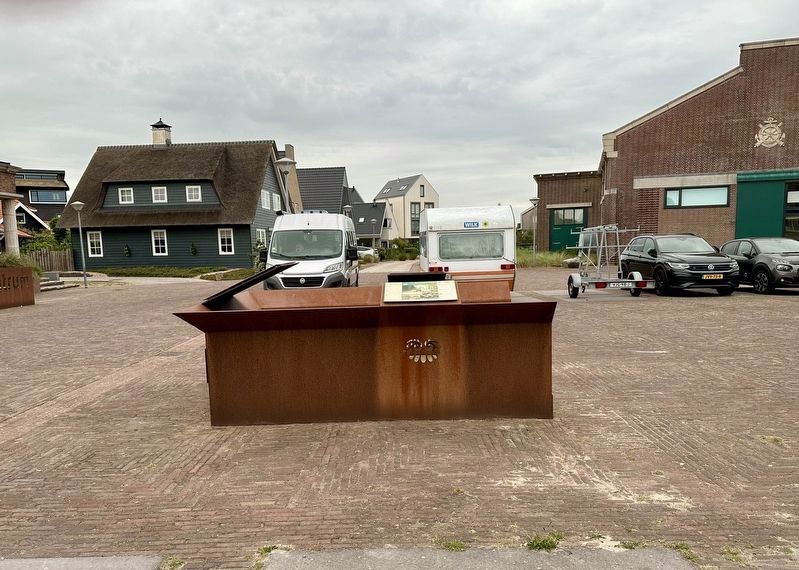
The marker is visible here mounted to an iron kiosk, along with markers for the Atlantic Wall and Fort Kijkduin.
Also see . . . Nooit meer zoals het was (Liberation Route Europe, in Dutch, English and German). The QR code on the marker leads to this Dutch-language page, with buttons also leading to German and English versions. Excerpt from the English verdion:
…The Germans feared an invasion from the sea, and in 1942 they decided to create the Atlantic Wall, a coastal defence line that ran from Norway to Spain. Parts of the city of Den Helder were demolished to make the construction of the wall possible.(Submitted on July 5, 2026.)
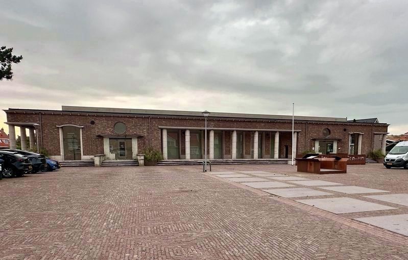
Den Helder became the base of operations for the Kriegsmarine and was under constant fire during the war. The bombs dropped by the Allies, intended for the military airfield and the port, were not always accurate and endedup spread throughout Den Helder. The long term damage was immense. No other place in the Netherlands was bombed as often during the Second World War.Photographed by Andrew Ruppenstein, June 2, 20263. Never the same again! markerThe marker is located in front of the Atlantikwall Centrum, a former German naval administration building from the Second World War that has been repurposed into a museum about the Atlantic Wall.
In 1943, the Atlantic Wall was strengthened. Mandatory civil evacuations followed, and a large wave of refugees got underway.
The residents sought refuge in nearby places such as Anna Paulowna, Julianadorp and Breezand. The war changed in June 1944; D-Day was the turning point for the Western Allied front, but the liberation of the Netherlands was difficult. The Dutch famine followed in the Northern Netherlands, and it wasn't until 8 May 1945 that the Canadians liberated Den Helder.
After their surrender on ships, the thousands of German soldiers returned to Germany. After the liberation, the coastline was still riddled with bunkers, mines, ammunition and barbed wire. The city had to be rebuilt from the ground up. A huge operation because Den Helder was completely uninhabitable, the city was isolated and suffered a serious food shortage. Still, the people of Den Helder managed to build a new city in a relatively short time. The vibrancy of the pre-war port city, however, remained a thing of the past.
Credits. This page was last revised on July 5, 2026. It was originally submitted on July 5, 2026, by Andrew Ruppenstein of Lamorinda, California. This page has been viewed 7 times since then. Photos: 1, 2, 3. submitted on July 5, 2026, by Andrew Ruppenstein of Lamorinda, California.
