Maryborough in Portlaoise in County Laois, Leinster, Ireland — Mid-East (and Dublin)
Main Street
⎯⎯⎯
Príomhshráid

Photographed by Ian Lefkowitz, May 17, 2026
1. Main Street / Príomhshráid Marker
[Gaeilge:]
Baile Múrtha
D’fhás Port Laoise thart ar an Seandún a thóg na lonnaitheoirí Sasanacha in 1547–48. Thug na ballaí cosaint do na lonnaitheoirí agus théidís isteach sa bhaile trí na háirsí agus na lánaí ar an Príomhshráid. Bhí teach cúirte agus príosún ag coirnéal Sráid na hEaglaise agus an Phríomhshráid.
[English:]
A Walled Town
Portlaoise grew around the Old Fort built by English settlers in 1547–48. A wall protected the settlers, and they entered the town via the archways and lanes coming off Main Street. On the corner of Church Street and Main Street stood a courthouse and prison.
Topics. This historical marker is listed in this topic list: Forts and Castles. A significant historical year for this entry is 1548.
Location. 53° 2.035′ N, 7° 18.049′ W. Marker is in Portlaoise, Leinster, in County Laois. It is in Maryborough. It is at the intersection of Main Street and Hynd's Square, on the left when traveling east on Main Street. Touch for map. Marker is at or near this postal address: 59 Main Street, Portlaoise, Leinster, Ireland. Touch for directions.

Regionally, it is on the Atlantic Ocean, in the North Atlantic Region, in Europe, on the Island of Ireland, on the Celtic Fringe, in the European Union, in Atlantic Europe, on one of the British Isles, in the Western World, and in the Anglosphere.
Other nearby markers. At least 8 other markers are within walking distance of this marker: Portlaoise Courthouse (within shouting distance of this marker); Old County Gaol (about 90 meters away, measured in a direct line); Old St Peter’s Church (about 150 meters away); Portlaoise Vocational School (about 150 meters away); Dún Phort Laoise / The Fort of Portlaoise (about 150 meters away); St Peter's Church (about 180 meters away); James Fintan Lalor (about 180 meters away); Portlaoise Heritage Trail / Slí Oidhreachta Port Laoise
this page online
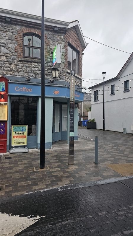
Photographed by Ian Lefkowitz, May 17, 2026
2. Main Street / Príomhshráid Marker
This wayfinding marker contains historic information and a map to the remaining markers.
Credits. This page was last revised on July 5, 2026. It was originally submitted on July 5, 2026, by Ian Lefkowitz of New York, New York. This page has been viewed 11 times since then. Photos: 1, 2. submitted on July 5, 2026, by Ian Lefkowitz of New York, New York. • Andrew Ruppenstein was the editor who published this page.
