Harmony in Fillmore County, Minnesota — The American Midwest (Upper Plains)
Let's Have "Harmony"
The Biggest Little Town in Southern Minnesota
Photographed by McGhiever, October 5, 2025
1. Let's Have "Harmony" Marker
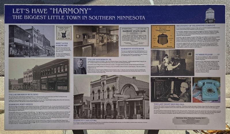
Bert Yates Hardware
Bert Yates had a hardware store located on north Main from 1938-1953.
The sign on the building just to the south indicates the Vadheim-Landry Drug Store.
Tallak Brokken Building
The south side of the Tallak Brokken building held the T.O. Stenvick Furniture and Casket Store, the White Tin Shop from 1897 through 1916, followed by the People's State Bank. Upstairs: Dr. Norman E. Anderson.
In 1882 The Tosten Johnson Café & Grocery was located in the north side of the Tallak Brokken building, followed by other businesses, and "Palace of Sweets" Café, then the Leonard Hanson Drug Store 1946-1969.
Harmony Post Office
The first post office at Greenfield was called Peterson but it has been called Harmony since 1872. In 1907 the postmaster rejoiced because Harmony post office was raised from 4th to 3rd class so that hereafter he would receive a regular salary instead of depending on stamp sales. Over the years the post office has been in various locations throughout Harmony; however since 1922 they have been located in the brick building at 50 Main Street N.
The post office underwent a remodeling
this page online
Originally the post office was a 3rd class office but it went to 2nd class with the heavy mailing due to the opening of the Niagara Cave. During the war years it was a very busy post office; however, the town was almost like a ghost town because so many of the men and boys were gone to the war. (Courtesy of Helen Lake)
Harmony State Bank
The bank was originally started by Tollef Sanderson, Sr., as a
Photographed by McGhiever, October 5, 2025
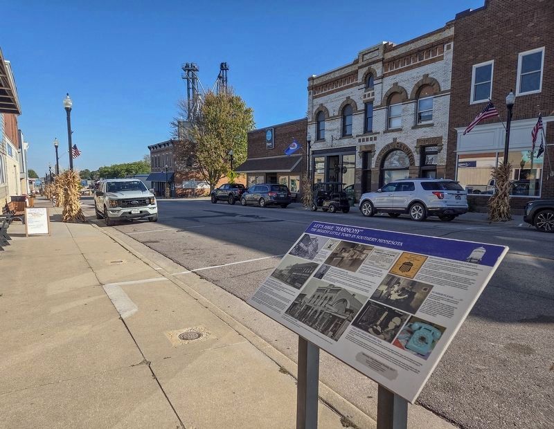
2. Let's Have "Harmony" Marker on the west side of Main Avenue
The Harmony State Bank was organized in 1904. Pictured are Tollef Sanderson, Jr., and Horace Olson.
Tollef Sanderson, Sr.
Tollef Sanderson was born on October 7, 1852, near Waterford, Racine County, Wisconsin. In 1868 he attended Beloit College for one year. In 1869 the family moved to Winnishiek County, Iowa, to a farm on the Minnesota State line.
He attended Luther College in Decorah and became a teacher. He taught school in Decorah, and later farmed south of Harmony.
Tollef married Ann Sophia Jacobsen on Februar4y [sic] 15, 1877, at Greenfield Lutheran Church in south Harmony. They had 4 children, 3 daughters and 1 son.
In 1888 Tollef was elected Treasurer of Fillmore County and again in 1890. In 1893 they moved to Harmony where he established the Bank of Harmony, and they built a large Victorian home. In 1904 the bank was incorporated as the Harmony State Bank, of which he remained President until his death in 1927.
Harmony Cash Store
H.E. Hanson was the proprietor of the Harmony Cash Store. He sold all lines of clothing for ladies and men, as well as children, and also custom made shoes. His store could readily be identified since the top had the distinct rounded front.
Beginning of the Telephone Company
K.D. Olson started a telephone company in 1896, and he owned the equipment and lines in town, and the rural area had several companies owned by the farmers.
It was on June 1, 1945 that twenty-six local citizens bought the Harmony Telephone Exchange Co., of which K.D. Olson was then president, and called it the Harmony Telephone Company. This company served the corporate limits of Harmony, since the farmers owned their own telephones, lines and equipment.
On January 1, 1950 the company was sold to Wally Piehn, and within two years about 150 modern phones, which did not need to be cranked, were installed. In 1953 the company wanted to progress to dial, but financial arrangements and agreements with the farmers to change from their privately owned set-up to dial had to be made. In October 1954 dial operations became a reality.
Until 1965 the original dial office was all that was needed to serve the area. In 1972, however, Harmony was eligible for direct dial, but all rural lines had to be put underground for storm-proofing. Again in 1974 there were not enough lines, and another expansion with about 15,000 wiring additions needed to be added at a cost of $69,000.
Number Please.........???
The Harmony telephone Co. office was located in the back room above what was then known as the Vadheim Drug Store.
Pictured are Mrs. Stella Mengis, standing at the left, Mrs. Lena Watkins, center, known as Harmony's first telephone operator, and Mrs Hilda (Boxrud) Ellis, who began work as a switchboard operator in 1920, and resigned after some 27 or 28 years of faithful service. It is believed that Stella began as an operator in 1911, or thereabouts, and was still on duty some 40 years later before she resigned.
(Courtesy of Harmony News)
The Last Night Before Dial
Pictured is Mrs. Mabel Yeoman at the telephone switchboard. This photo was taken that night in October of 1954 when the change-over was being made from the old type of telephone service to the modern dial system, and her last evening as night operator after 20 years of service, from 1934 to October 1954.
The customer did not need to crank the old phone on the wall to get central. People hardly ever gave the operator the number they wished to call, only the name of the person, and occasionally, if the operator happened to know the party being called was not at home, she would tell where they could be reached. In many instances, the telephone operator acted as a secretary to local businesses, doctors, etc. (Courtesy of Harmony News)
Erected by the Harmony Area Historical Society.
Topics. This historical marker is listed in these topic lists: Communications • Industry & Commerce • Settlements & Settlers. A significant historical year for this entry is 1896.
Location. 43° 33.295′ N, 92° 0.606′ W. Marker is in Harmony, Minnesota, in Fillmore County. It is on Main Avenue N. (Minnesota Route 139) south of 1st Street NW, on the right when traveling south. Touch for map. Marker is at or near this postal address: 45 Main Avenue N, Harmony MN 55939, United States of America. Touch for directions.

Regionally, this marker is in Southeast Minnesota and in Greater Rochester. It is also in the American Midwest, in the Corn Belt, and in the Driftless Area — Bluff Country. Globally, it is in North America, the Western Hemisphere, the Western World, and the Anglosphere. Historically, it finds itself in what was once Rupert’s Land, the territory of the Mississippian Culture, and the Louisiana Purchase.
Other nearby markers. At least 8 other markers are within walking distance of this marker: A different marker also named Let's Have "Harmony" (within shouting distance of this marker); a different marker also named Let's Have "Harmony" (within shouting distance of this marker); a different marker also named Let's Have "Harmony" (within shouting distance of this marker); a different marker also named Let's Have "Harmony" (within shouting distance of this marker); a different marker also named Let's Have "Harmony" (within shouting distance of this marker); a different marker also named Let's Have "Harmony" (within shouting distance of this marker); a different marker also named Let's Have "Harmony" (about 300 feet away, measured in a direct line); Historic McMichael Grain Elevator Preservation Project (about 500 feet away). Touch for a list and map of all markers in Harmony.
Credits. This page was last revised on August 5, 2026. It was originally submitted on July 5, 2026, by McGhiever of Minneapolis, Minnesota. This page has been viewed 11 times since then. Photos: 1, 2. submitted on July 5, 2026, by McGhiever of Minneapolis, Minnesota.
