Freeville in Tompkins County, New York — The American Northeast (Mid-Atlantic)
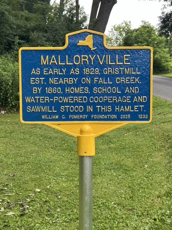
Malloryville
Photographed by Susan A. Dalaba, July 6, 2026
1. Malloryville Marker
est. nearby on Fall Creek.
By 1860, homes, school and
water-powered cooperage and
sawmill stood in this hamlet.
Erected 2025 by William G. Pomeroy Foundation. (Marker Number 1233.)
Topics and series. This historical marker is listed in this topic list: Industry & Commerce. In addition, it is included in the William G. Pomeroy Foundation series list. A significant historical year for this entry is 1829.
Location. 42° 32.044′ N, 76° 18.498′ W. Marker is in Freeville, New York, in Tompkins County. It is on West Malloryville Road, on the right when traveling west. Touch for map. Marker is at or near this postal address: 8 W Malloryville Rd, Freeville NY 13068, United States of America. Touch for directions.

Regionally, this marker is in Upstate New York and in the Southern Tier. It is also in the American Northeast and in the Mid-Atlantic. Globally, it is in North America, the Western Hemisphere, the Western World, and the Anglosphere. Historically, it finds itself in what was once the Haudenosaunee (Iroquois) Confederacy, New Netherland, and one of the original Thirteen Colonies.
this page online
Other nearby markers. At least 8 other markers are within 3 miles of this marker, measured as the crow flies: Veterans Memorial (approx. 1.3 miles away); Elm Tree Inn (approx. 1½ miles away); Old Baptist Church - 1828 (approx. 1.7 miles away); Site of Episcopal Zion Cemetery (approx. 1.7 miles away); Patriot Burials (approx. 1.7 miles away); Freeville Junction (approx. 2.4 miles away); “Daddy” (approx. 2.4 miles away); Indian Village (approx. 3 miles away). Touch for a list and map of all markers in Freeville.
Also see . . . Malloryville (William G. Pomeroy Foundation). (Submitted on July 7, 2026.)
Photographed by Susan A. Dalaba, July 5, 2026
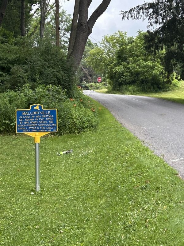
2. Malloryville Marker Looking East

Photographed by Susan A. Dalaba, July 5, 2026
3. Malloryville Marker
Credits. This page was last revised on July 7, 2026. It was originally submitted on July 6, 2026, by Susan A. Dalaba of Cortland, New York. This page has been viewed 16 times since then. Photos: 1, 2, 3. submitted on July 6, 2026, by Susan A. Dalaba of Cortland, New York. • Andrew Ruppenstein was the editor who published this page.
