
Union in Convent in St. James Parish, Louisiana — The American South (West South Central)
Pilgrim Full Gospel Baptist Church
Photographed by Cajun Scrambler, July 5, 2026
1. pilgrim Full Gospel Baptist Church Marker
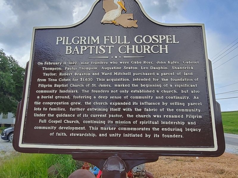
On February 11, 1892, nine founders who were Gabe Ross; John Kyles; Gabriel Thompson; Paulus Thompson; Augustine Seaton; Leo Dauphin; Shandrick Taylor: Robert Braxton and Ward Mitchell purchased a parcel of land from Tena Cohen for $1,630. This acquisition, intended for the foundation of Pilgrim Baptist Church of St. James, marked the beginning of a significant community landmark. The founders not only established a church, but also a burial ground, fostering a deep sense of community and continuity. As the congregation grew, the church expanded its influence by selling parcel lots to families, further entwining itself with the fabric of the community. Under the guidance of its current pastor, the church was renamed Pilgrim Full Gospel Church, continuing its mission of spiritual leadership and community development. This marker commemorates the enduring legacy of faith, stewardship, and unity initiated by its founders.
Erected 2026.
Topics. This historical marker is listed in this topic list: Religion & Religious Structures. A significant historical date for this entry is February 11, 1892.
Location. 30° 5.301′ N, 90° 54.334′ W.
this page online

Regionally, this marker is in the River Parishes and in Greater New Orleans. It is also in the American South, specifically in the Deep South, on the Gulf Coast, and in the Great River Road Region. Globally, it is in North America, a Gulf of Mexico state, the Western Hemisphere, the Western World, and the Anglosphere. Historically, it finds itself in what was once New Spain, the territory of the Mississippian Culture, the Louisiana Purchase, one of the Confederate States of America, and the Antebellum South.
Other nearby markers. At least 8 other markers are within 5 miles of this marker, measured as the crow flies: St. Mary's Chapel (about 400 feet away, measured in a direct line); Philippian Baptist Church (about 500 feet away); Tezcuco Plantation (approx. 1.9 miles away); Bocage Plantation (approx. 3.8 miles away); Houmas House
Photographed by Cajun Scrambler, July 5, 2026
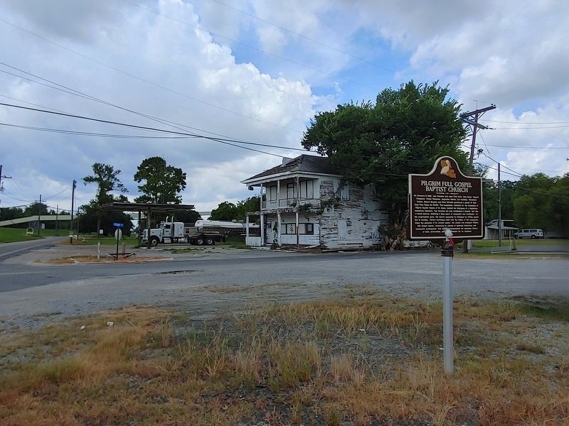
2. Pilgrim Full Gospel Baptist Church Marker
Another marker is no longer nearby. L'Hermitage (was approx. 3.7 miles away but has been confirmed missing).
More about this marker. Although not on marker, it was placed, in part, by Inclusive Louisiana organization, and local donors.
Credits. This page was last revised on July 9, 2026. It was originally submitted on July 6, 2026, by Cajun Scrambler of Assumption, Louisiana. This page has been viewed 15 times since then. Photos: 1, 2. submitted on July 6, 2026, by Cajun Scrambler of Assumption, Louisiana.
