Guildford in Surrey, England, United Kingdom — Northwestern Europe (the British Isles)
Quarry Street/Rosemary Alley
Photographed by Ray Gurganus, April 13, 2026
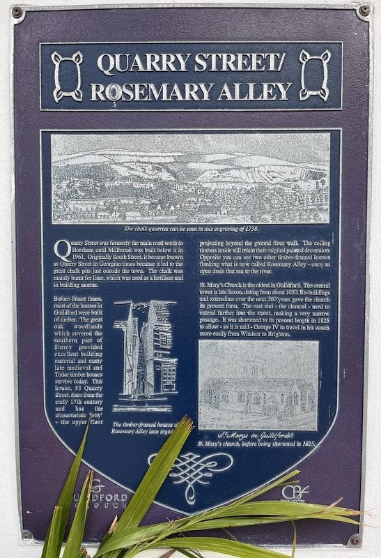
1. Quarry Street / Rosemary Alley Marker
Before Stuart times, most of the houses in Guildford were built of timber. The great oak woodlands which covered the southern part of Surrey provided excellent building material and many Late medieval and Tudor timber houses survive today. This house, 53 Quarry Street, dates from the early 17th century and has the characteristic 'jetty' - the upper floor projecting beyond the ground floor wall. The ceiling timbers inside still retain their original painted decoration. Opposite you can see two other timber-framed houses flanking what is now called Rosemary Alley - once an open drain that ran to the river.
St. Mary's Church is the oldest in Guildford. The central tower is late Saxon, dating from about 1050. Re-buildings and extensions over the next 200 years gave the church its present form. The east end the chancel - used to extend further into the street, making a very narrow passage. It was shortened to its present length in 1825 to allow - so it is said - George IV to travel in his coach more easily from Windsor to Brighton.
Erected by Guildford Borough.
Topics. This historical marker is listed in this topic list: Architecture.
Location. 51° 14.054′ N, 0° 34.434′ W. Marker is in Guildford, England, in Surrey. It is at the intersection of Quarry Street and Castle Street, on the left when traveling south on Quarry Street. The marker is mounted to the building at the corner of Quarry Street and Castle Street, directly opposite
this page online

Regionally, this marker is in the Greater South East. Globally, it is on the Atlantic Ocean, in the North Atlantic Region, in Europe, in Atlantic Europe, on one of the British Isles, in the Western World, and in the Anglosphere. Historically, it finds itself in what was once the Roman Empire.
Other nearby markers. At least 8 other markers are within walking distance of this marker: St. Mary's Church (about 90 meters away, measured in a direct line); The Castle Keep (about 90 meters away); The Star Inn History (about 120 meters away); Medieval Synagogue (about 120 meters away); The Stranglers (about 120 meters away); The Bowling Green (about 150 meters away); Henry Peak (1831-1914) (about 150 meters away); The Town Bridge (about 180 meters away). Touch for a list and map of all markers in Guildford.
Credits. This page was last revised on July 7, 2026. It was originally submitted on July 6, 2026, by Ray Gurganus of Washington, District of Columbia. This page has been viewed 8 times since then. Photo 1. submitted on July 6, 2026, by Ray Gurganus of Washington, District of Columbia. • Andrew Ruppenstein was the editor who published this page.
