
Ipswich in Suffolk, England, United Kingdom — Northwestern Europe (the British Isles)
Ipswich Blackfriars

Photographed by Ray Gurganus, April 19, 2026
1. Ipswich Blackfriars Marker
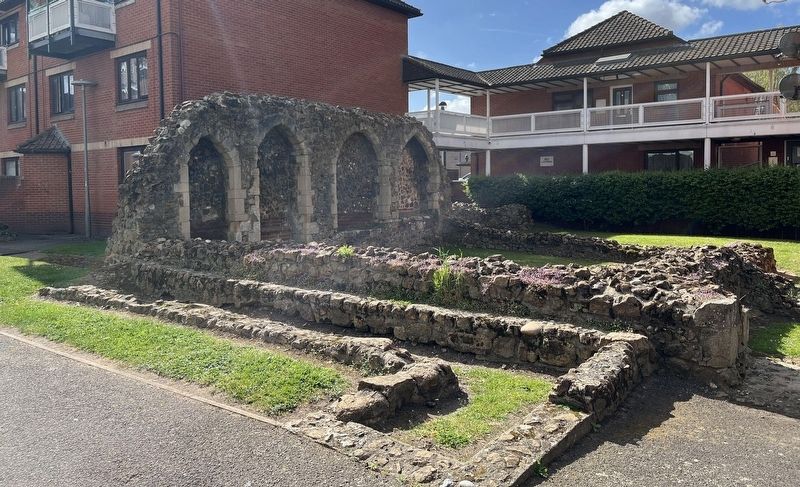
The Blackfriars Church was the first of the Friary buildings to be constructed in the late [illegible] century, built predominantly in septaria blocks (local mudstone) with limestone mouldings and quoins. The church, which was dedicated to St Mary, was longer than any of the surviving medieval churches in Ipswich, with a total length of 177ft (54m), the Choir being 30ft (9m) wide and the Nave 56ft (17m) wide.
Chapter House
The Chapter House, a building second only in importance to the Church itself, was when the business of the Friars, both sacred and secular, was conducted. It was also the burial place of seven Priors, who had, in succession, been the head of the Friary.
Sacristy
The Sacristy was where the sacred vessels, vestments, and valuables connected with the religious services were kept.
Choir
The Choir was the Friars' part of the Church:
this page online
Nave
The Nave was the public part of the Church, separated from the Choir by the Walking Place. Friary Churches emphasized preaching and so designed their Naves as halls with wide aisles and broad arcades. Over two hundred and fifty people requested in their wills to be buried in the Nave of this Church: "Robert Went, Dec. 21st. 1510, to be buried in the Blackfrlars' church here, before St Anne's altar; 6s 8d to the Blackfriars for his burial place." "Andrew Cursun, in 1511 to be buried in the blackfriars' church before the Image of St. Barbara."
The evangelistic Friars enhanced the status of one of the day services - Compline - as this took place at a time when the people of the town had finished work and were free to attend Church. The Screens separating the Choir and Nave were opened and the Friars went in procession into the Nave to join the assembled people for a Communal Blessing.
Erected by English Heritage.
Topics. This historical marker is listed in this topic list: Religion & Religious Structures. A significant historical year for this entry is 1216.
Location. 52° 3.303′ N,
Photographed by Ray Gurganus, April 19, 2026
2. Blackfriars Ruins

Regionally, this marker is in England’s East Anglia. Globally, it is on the Atlantic Ocean, in the North Atlantic Region, in Europe, in Atlantic Europe, on one of the British Isles, in the Western World, and in the Anglosphere. Historically, it finds itself in what was once the Roman Empire.
Other nearby markers. At least 8 other markers are within 13 kilometers of this marker, measured as the crow flies: Ipswich Almshouses (within shouting distance of this marker); Mary Whitmore, MBE (approx. half a kilometer away); Gipeswic (approx. 1.1 kilometers away); Ipswich (approx. 1.1 kilometers away); Dr. Kurt Erich Glauber (approx. 1.5 kilometers away); Woodbridge (approx. 11.5 kilometers away); Isaac Johnson (approx. 11.5 kilometers away); Thomas Seckford (approx. 11.5 kilometers away). Touch for a list and map of all markers in Ipswich.
Also see . . . Ipswich Blackfriars (Wikipedia). (Submitted on July 7, 2026.)
Credits. This page was last revised on July 7, 2026. It was originally submitted on July 7, 2026, by Ray Gurganus of Washington, District of Columbia. This page has been viewed 6 times since then. Photos: 1, 2. submitted on July 7, 2026, by Ray Gurganus of Washington, District of Columbia. • Andrew Ruppenstein was the editor who published this page.
