Phillipsburg in Warren County, New Jersey — The American Northeast (Mid-Atlantic)
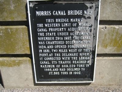
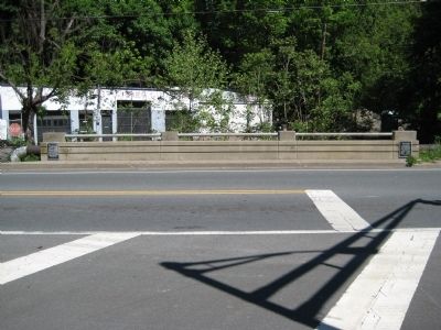
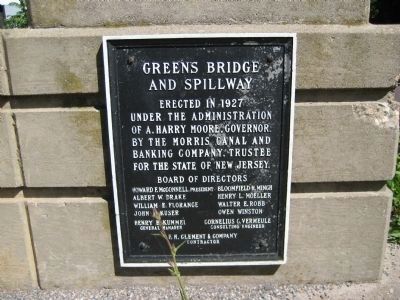
Morris Canal Bridge No. 2
Topics and series. This historical marker is listed in these topic lists: Bridges & Viaducts • Waterways & Vessels. In addition, it is included in the Lehigh Canal, and the Morris Canal series lists. A significant historical date for this entry is November 29, 1824.
Location. 40° 40.651′ N, 75° 10.164′ W. Marker is in Phillipsburg, New Jersey, in Warren County. Marker is at the intersection of S. Main Street and Carpentersville Road, on the right when traveling west on S. Main Street. Touch for map. Marker is in this post office area: Phillipsburg NJ 08865, United States of America. Touch for directions.
Other nearby markers. At least 8 other markers are within walking distance of this marker. Morris Canal - Lock 10 West (within shouting distance of this marker); Morris Canal Greenway (approx. 0.2 miles away); James Campbell (approx. ¼ mile away); Early Industry (approx. 0.4 miles away); Korean War Memorial (approx. 0.9 miles away); Veterans Memorial (approx. 0.9 miles away); World War II Memorial (approx. 0.9 miles away); World War I Memorial (approx. 0.9 miles away). Touch for a list and map of all markers in Phillipsburg.
Credits. This page was last revised on June 16, 2016. It was originally submitted on May 9, 2010, by Alan Edelson of Union Twsp., New Jersey. This page has been viewed 974 times since then and 10 times this year. Photos: 1, 2, 3. submitted on May 9, 2010, by Alan Edelson of Union Twsp., New Jersey. • Kevin W. was the editor who published this page.


