Near Clintwood in Dickenson County, Virginia — The American South (Mid-Atlantic)
The Crooked Road
Virginia's Heritage Music Trail
⎯⎯⎯
Dickenson County
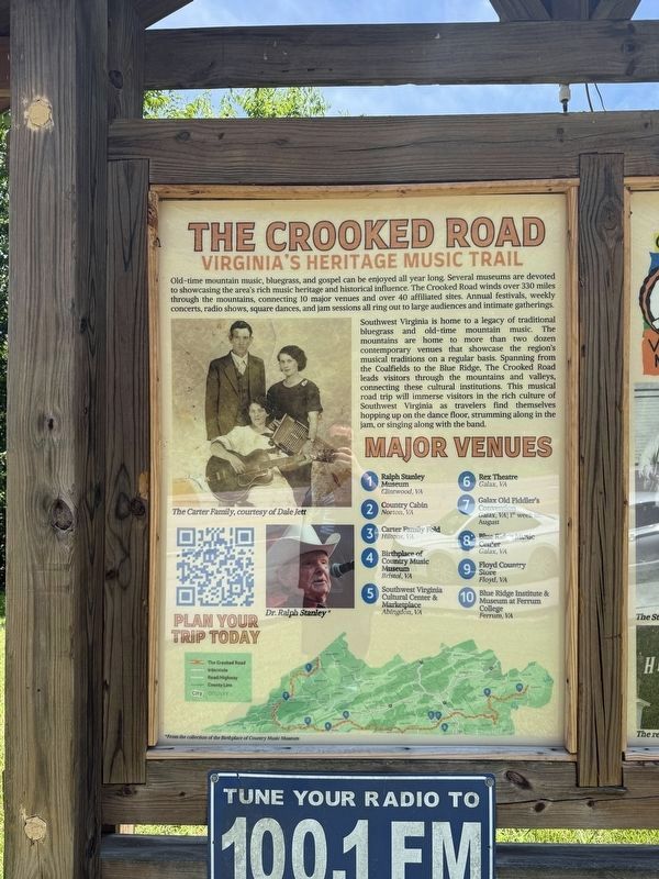
Virginia's Heritage Music Trail
Southwest Virginia is home to a legacy of traditional bluegrass and old-time mountain music. The mountains are home to more than two dozen contemporary venues that showcase the region's musical traditions on a regular basis. Spanning from the Coalfields to the Blue Ridge, The Crooked Road leads visitors through the mountains and valleys, connecting these cultural institutions. This musical road trip will immerse visitors in the rich culture of Southwest Virginia as travelers find themselves hopping up on the dance floor, strumming along in the jam, or singing along with the band.
Major Venues
❶ Ralph Stanley Museum Clintwood, VA
❷Country Cabin Norton, VA
Click or scan to see
this page online
❸ Carter Family Fold Hiltons, VA
❹ Birthplace of Country Music Museum Bristol, VA
❺ Southwest Virginia Cultural Center & Marketplace Abingdon, VA
❻ Rex Theatre Galax, VA
❼ Galax Old Fiddler's Convention Galax, VA | 1st week in August
❽ Blue Ridge Music Center Galax, VA
❾ Floyd Country Store Floyd, VA
❿ Blue Ridge Institute & Museum at Ferrum College Ferrum, VA
Many honors were presented to Ralph Stanley, including a National Heritage Fellowship and the America's Medal for the Arts. This honor was presented to
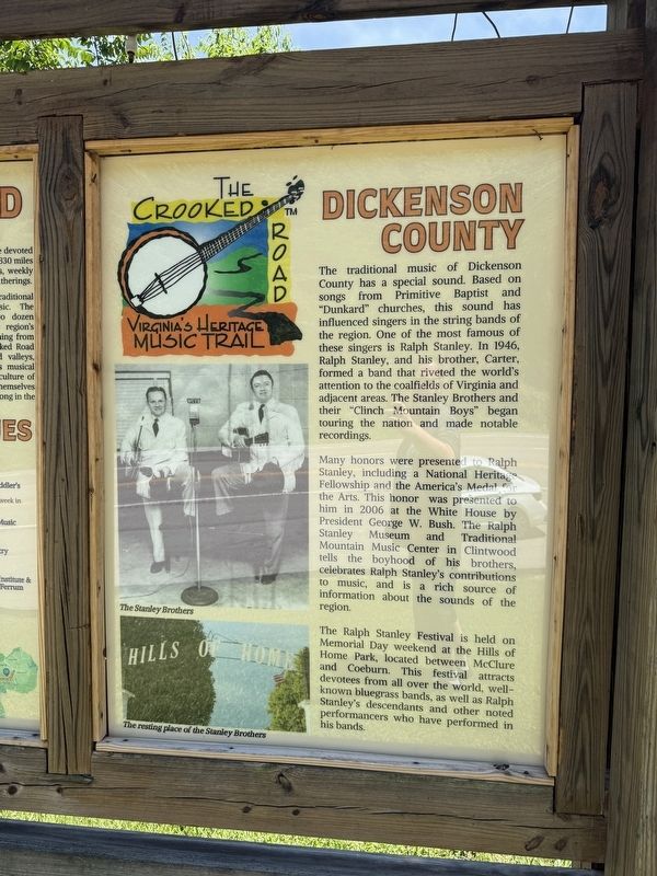
The Ralph Stanley Festival is held on Memorial Day weekend at the Hills of Home Park, located between McClure and Coeburn. This festival attracts devotees from all over the world, well-known bluegrass bands, as well as Ralph Stanley's descendants and other noted performers who have performed in his bands.
Erected by The Crooked Road.
Topics and series. This historical marker is listed in these topic lists: Arts, Letters, Music • Entertainment • Religion & Religious Structures. In addition, it is included in the Former U.S. Presidents: #43 George W. Bush, and the The Crooked Road: Virginia’s Heritage Music Trail series lists. A significant historical year for this entry is 1946.
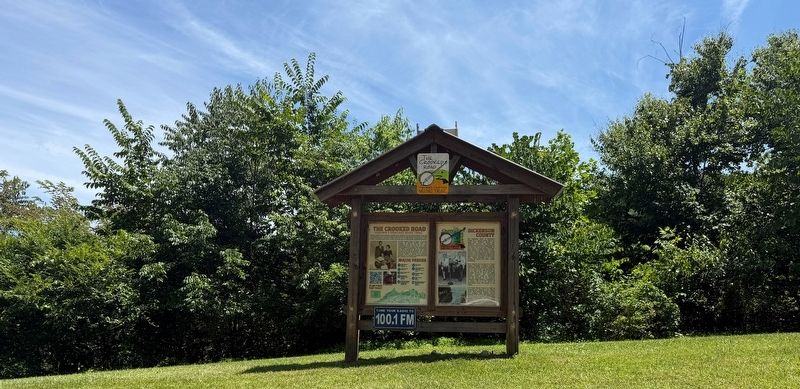
Location. 37° 7.881′ N, 82° 32.458′ W. Marker is near Clintwood, Virginia, in Dickenson County. It is on Dickenson Highway (Virginia Route 83) east of Red Onion
Photographed by Devry Becker Jones (CC0), July 3, 2026
3. The Crooked Road / Dickenson County Marker

Regionally, this marker is in Southwest Virginia. It is also in the American South, specifically in the Upper South, in Appalachia, and specifically in Southern Appalachia. Globally, it is in North America, the Western Hemisphere, the Western World, and the Anglosphere. Historically, it finds itself in what was once the original Cherokee Nation, the territory of the Mississippian Culture, one of the original Thirteen Colonies, one of the Confederate States of America, and the Antebellum South.
Other nearby markers. At least 8 other markers are within 4 miles of this marker, measured as the crow flies: Daniel Webster Dotson (about 800 feet away, measured in a direct line); Wise County / Dickenson County (approx. 0.3 miles away); Sunnydale Farm (approx. 1.8 miles away); Pound, Virginia (approx. 3.3 miles away); Pound War Memorial (approx. 3.4 miles away); These Men Gave the Supreme Sacrifice for Our Freedom (approx. 3½ miles away); Dotson-Mullins Field (approx. 3½ miles away); Dollie Buchanan of Shockey Hollow Honors "Friendship 7" Space Flight (approx. 3½ miles away).
Another marker is no longer nearby. The Crooked Road / Dickenson County (has been replaced with this marker).
Credits. This page was last revised on July 8, 2026. It was originally submitted on July 8, 2026, by Devry Becker Jones of Washington, District of Columbia. This page has been viewed 13 times since then. Photos: 1, 2, 3. submitted on July 8, 2026, by Devry Becker Jones of Washington, District of Columbia.
