Bluefield in Mercer County, West Virginia — The American South (Appalachia)
Railroads: Prelude Prelude to Prosperity
National Coal Heritage Area
| — | Coal Heritage Trail | — |
Photographed by Devry Becker Jones (CC0), July 3, 2026
1. Railroads: Prelude Prelude to Prosperity Marker
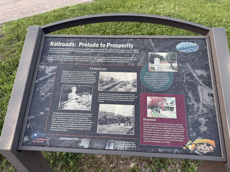
It is difficult to imagine any place in the country that changed as quickly and dramatically as Bluefield, West Virginia, in the late 1880s. Before the Norfolk & Western (N&W) Railway arrived, the area in and around Bluefield consisted of sprawling farmlands known commonly as the John Higginbotham Farm.
For a century, most of the land had been owned by a handful of families. Many were descended from the first Scots-Irish settlers in the area—the Davidson and Bailey families. Everything changed in 1887, when N&W officials selected Bluefield as the home for its division headquarters. The "blue fields of chicory" were hastily transformed into a city built upon a foundation of railroads and coal.
A Twist of Fate
Bluefield's fate could have been quite different. The N&W originally had planned to route its line through nearby Bluefield, Virginia—the first mine in the region had been opened in 1883 at Pocahontas, Virginia. The turning point was actually a subtle slope—a naturally occurring gradual incline known as the Gravity Hump, located along the N&W line near North Mercer in Bluefield, West Virginia.
The N&W turned
this page online
The N&W revised its original plans and ran the line through what would become downtown Bluefield, and the hump became the highest point anywehere on the N&W mainline—allowing engineers to take advantage of a switching system based on gravity.
Bramwell
The N&W also sparked the growth of another nearby town. Bramwell, founded in 1888 along the N&W line, reportedly was the wealthiest town per capita in the nation by the early 20th century. Passenger trains stopped 14 times each day in the quaint Victorian town, which was home to some of West Virginia's leading coal magnates. Although the Great Depression wiped out much of Bramwell's
[Sidebar:]
Bluefield's rapid growth generated a wave of building construction and produced several distinct communities. Today, Bluefield has five districts listed in the National Register of Historic Places: Downtown Bluefield, Country Club Hill, Jefferson Street, South Bluefield, and Upper Oakhurst.
Erected by America's Byways.
Topics and series. This historical marker is listed in these topic lists: Industry & Commerce • Natural Resources • Railroads & Streetcars • Settlements & Settlers. In addition, it is included in the Coal Heritage Trail series list. A significant historical year for this entry is 1887.
Location. 37° 16.211′ N, 81° 13.258′ W. Marker is in Bluefield, West Virginia, in Mercer County. It is on Princeton Avenue (U.S. 19) west of Tony Wagner Avenue, on the right when traveling east. Touch for map. Marker is at or near this postal address: 630 Princeton Ave, Bluefield WV 24701, United States of America. Touch for directions.

Regionally, this marker is in the Southern Coalfields. It is also in the American South, specifically in the Upper South, in Appalachia, and specifically in Southern Appalachia. Globally, it is in North America, the Western Hemisphere, the Western World, and the Anglosphere. Historically, it finds itself in what was once the territory of the Mississippian Culture.
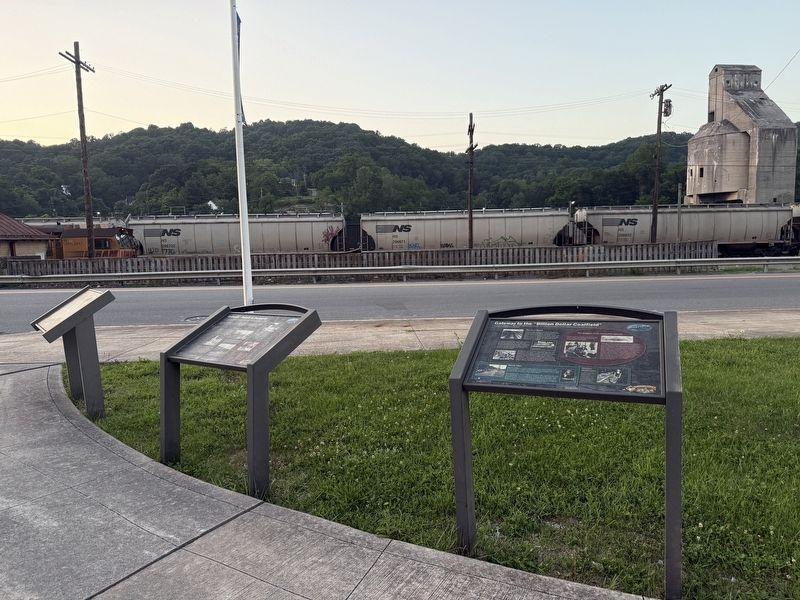
Other nearby markers. At least 8 other markers are within walking distance of this marker: Gateway to the "Billion Dollar Coalfield" (here, next to this marker); Bluefield Rail Yards (here, next to this marker); Coal Heritage Trail (within shouting distance of this marker); Where the Chicory Blooms (within shouting distance of this marker); West Virginia's Most Diverse City (within shouting distance of this marker); Legends and Landmarks (within shouting distance of this marker); Law and Commerce Building (about 600 feet away, measured in a direct line); The West Virginian Hotel (about 700 feet away). Touch for a list and map of all markers in Bluefield.
Credits. This page was last revised on July 9, 2026. It was originally submitted on July 9, 2026, by Devry Becker Jones of Washington, District of Columbia. This page has been viewed 9 times since then. Photos: 1, 2. submitted on July 9, 2026, by Devry Becker Jones of Washington, District of Columbia.
