Kinston in Lenoir County, North Carolina — The American South (South Atlantic)
Battle of Kinston
Confederates Retreat Across Jones Bridge
— Foster's Raid —
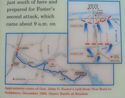
(Preface): Late in 1862, Union Gen. John G. Foster's garrison was well entrenched in New Bern and made several incursions into the countryside. On December 11, Foster led a raid from New Bern to burn the Wilmington and Weldon Railroad Bridge over the Neuse River at Goldsboro and to demonstrate in support of Gen. Ambrose E. Burnside's attack at Fredericksburg, Virginia. Foster's force consisted of 10,000 infantry, 650 cavalry, and 40 cannons.
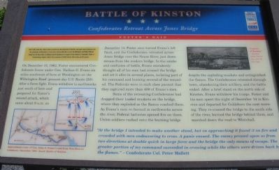
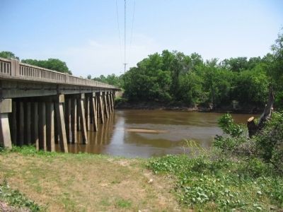
On December 12, 1862, Foster encountered Confederate forces under Gen. Nathan G. Evans six miles southwest of here at Woodington on the Wilmington Road (present-day U.S. Route 258). After a fierce fight, Evans withdrew to earthworks just south of here and prepared for Foster's second attack, which came about 9 a.m. on December 14. Foster soon turned Evans's left flank, and the Confederates retreated across Jones Bridge over the Neuse River, just downstream from the modern bridge. In the smoke and confusion of battle, Evans mistakenly thought all of his men had crossed the bridge and set it afire in several places, isolating part of his command and burning several of the wounded. The Federals were in such close pursuit that they captured more than 400 of Evans's men.
Some of the retreating Confederates had dropped their loaded muskets on the bridge, where they exploded as the flames reached them. As Evans's men re-formed in earthworks across the river, Federal batteries opened fire on them. Union soldiers rushed onto the burning bridge despite the exploding muskets and extinguished the flames. The Confederates retreated through town, abandoning their artillery, and the battle ended. After a brief stand on the north side of Kinston, Evans withdrew his troops. Foster and his men spent the night of December 14 in Kinston and departed for Goldsboro the next morning. They re-crossed the bridge to the south side of the river, burned the bridge behind them, and marched down the road to Whitehall.
"At the bridge I intended to make another stand, but on approaching it found it on fire and crowded with men endeavoring to cross. A panic ensued. The enemy pressed upon us from two directions at double quick in large force and the bridge the only means of escape. The greater portion of my command succeeded in crossing while the others were driven back by the flames." - Confederate Col. Peter Mallett
Erected by North Carolina Civil War Trails.
Topics and series. This historical marker is listed in this topic list: War, US Civil. In addition, it is included in the North Carolina Civil War Trails series list. A significant historical month for this entry is December 1824.
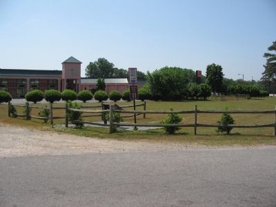
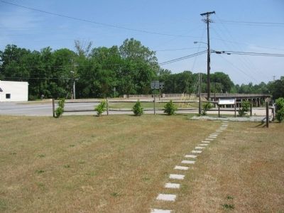
Location. 35° 14.719′ N, 77° 35.012′ W. Marker is in Kinston, North Carolina, in Lenoir County. Marker is at the intersection of South Queen Street (U.S. 258) and East New Bern Road (U.S. 70), on the right when traveling north on South Queen Street. Located just south of the bridge over the Neuse River. The wayside stop is number 11 of the Battle of Kinston driving tour. Touch for map. Marker is in this post office area: Kinston NC 28504, United States of America. Touch for directions.
Other nearby markers. At least 8 other markers are within walking distance of this marker. Foster's Raid (about 300 feet away, measured in a direct line); Richard Caswell Gatlin (about 500 feet away); North Carolina (about 500 feet away); First Battle of Kinston (approx. 0.3 miles away); Kinston Battlefield Park (approx. 0.3 miles away); The Night of December 13, 1862 (approx. 0.3 miles away); Fighting at Harriet's Chapel (approx. 0.3 miles away); The Site of Harriet's Chapel (approx. 0.3 miles away). Touch for a list and map of all markers in Kinston.
More about this marker. On the lower left is a map showing the Approximate route of Gen. John G. Foster's raid from New Bern to Goldsboro, December 1862. Another map indicates the tactical positions held during the Battle of Kinston as discussed in the marker's text. In the upper right is a drawing titled Capture of Kinston. courtesy of the University of North Carolina.
Also see . . . Explore Civil War Battlefields in Kinkson and Goldborough. Visit North Carolina website entry (Submitted on May 19, 2023, by Larry Gertner of New York, New York.)
Credits. This page was last revised on May 19, 2023. It was originally submitted on May 9, 2010, by Craig Swain of Leesburg, Virginia. This page has been viewed 1,408 times since then and 17 times this year. Photos: 1, 2, 3, 4, 5. submitted on May 9, 2010, by Craig Swain of Leesburg, Virginia.
