French Quarter in Charleston in Charleston County, South Carolina — The American South (South Atlantic)
Charleston Harbor
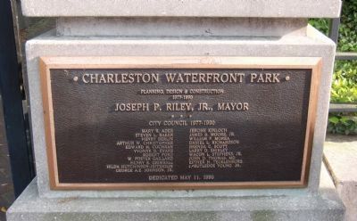
— Charleston Waterfront Park —
Inscription.
[Panel 1:]
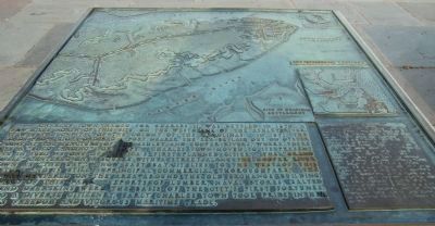
Seventeenth Century
Charles Town, named for Charles II, was settled in 1670, a few miles north of this site, on the west bank of the Ashley River It was the capital of the Colony of the Carolinas. In 1671, the Lords Proprietors ordered a fort nearer the sea be laid out on Oyster Point at the juncture of the Ashley and Cooper Rivers, where there was a “bold landing” for ships. Charles Town moved to its present site in 1680 as one of America’s first planned cities. The “Grand Modell” centered on a square with a street along the Cooper River known as “The Bay”. Now East Bay, it lies to the west of this location and is still a principal commercial thoroughfare. The city was centered on the area around the Old Exchange building westward of this park. Exports of lumber, naval stores, salted meats and deer skins were the basis of the city’s first fortunes. Home to a diverse citizenry, early Charles Town took pride in her religious freedom and vigorous maritime trade.
[Panel 2:]
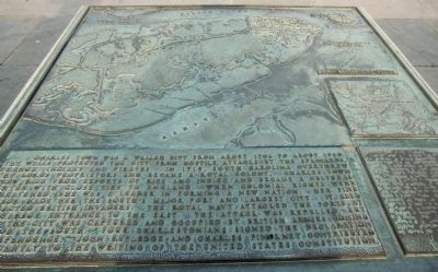
Eighteenth Century
Charles Town was a walled city from about 1704 to about 1720. The walls protected the city from hostile attacks by the Spaniards, French, Indians and pirates. In 1719, South Carolina overthrew the Lords Proprietors and became a Royal Colony. Charles Town grew rich from exports of rice and indigo and became a cultural center with close ties to England. When colonial rights were threatened, she was a leader in forming a new nation. Her fine harbor made her the South’s major port and largest city. It also attracted British invaders. The Royal Navy attacked the forts at the harbor entrance to the east. The attack was repelled, but the city was captured and occupied by British armies coming from the south. Four Charlestonians signed the Declaration of Independence: John Rutledge and Charles Pinckney contributed importantly to the writing of the United States Constitution.
[Panel 3:]
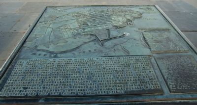
Nineteenth Century
Charleston, so spelled after 1745, was quick to recover from the Revolution and military occupation. Rice, Sea Island cotton and trade provided the highest per capita wealth of any American city in 1860. Grand houses, public buildings, and plantations were built. Her advocacy of states’ rights, nullification and secession gave her national importance. The Civil War began in 1861 with the firing on Fort Sumter, three miles southeastward of this point. During four years of struggle, the waterfront was the scene of naval activities involving armored warships, torpedo boats, a submarine and blockade runners. This
area was under heavy
shellfire from the Barrier Islands. Besieged, bombarded, and
impoverished by the War, Charleston lost her economic and political
stature. Banks, railroads, phosphate mining and agricultural
exports revived trade by the 1880s. A major earthquake in 1886
devastated the city but failed to kill her spirit.
[Panel 4:]
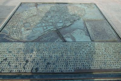
Twentieth Century
In the early part of the 20th century, Charleston continued her slow recovery from war, military occupation and social upheaval. In 1900, a naval base was established on the Cooper River, four miles upstream. In 1902, the West Indian Exposition, on the site of Hampton Park on the north side of town drew international attention, and the Cooper River Bridge opened in 1929. Growth of the military presence in both World Wars buttressed the economy. The nations’ preservation movement began in Charleston where the first historic district zoning ordinance was adopted in 1931. The rebuilding of the port wall, begun after 1945, restored the harbor to its former maritime importance. On this spot, stood Mallory Line’s ship terminals, once the city’s busiest, were destroyed by a spectacular fire in 1955. Since the late 1970s, racial harmony, economic revitalization, a cultural renaissance, and attention to urban design have brought Charlestonians a new measure of prosperity and
pride in their city. A fierce hurricane, steering straight for this
park, as yet incomplete, fell upon the city and harbor in September 1989.
It created new challenges, but as the 20th century drew to a close, Charleston was
looking to the future with her usual confidence and vision.
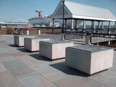
[Each bronze panel includes a map of the city and harbor for the corresponding century plus a Braille version of the narrative text.]
Erected 1990 by City of Charleston, South Carolina.
Topics. This historical marker is listed in these topic lists: Government & Politics • Notable Places. A significant historical month for this entry is September 1989.
Location. 32° 46.74′ N, 79° 55.505′ W. Marker is in Charleston, South Carolina, in Charleston County. It is in the French Quarter. Marker can be reached from Vendue Range Street east of Concord Street. Marker panels are in Waterfront Park, east of the end of Vendue Range Street, and 1.5 blocks east of E. Bay Street (U.S. 52). Touch for map. Marker is in this post office area: Charleston SC 29401, United States of America. Touch for directions.
Other nearby markers. At least 8 other markers are within walking distance of this marker. Robert Smalls (about 400 feet away, measured in a direct line); Elizabeth Timothy (about 500 feet away); Save Charleston Foundation (about 700 feet away); Farmers and Exchange Bank (about 800 feet away);
The Site of Craven Bastion (approx. 0.2 miles away); Slave Auctions (approx. 0.2 miles away); 8 Queen Street (approx. 0.2 miles away); Lee Cohen Harby (approx. 0.2 miles away). Touch for a list and map of all markers in Charleston.
Also see . . . Waterfront Park, Charleston. (Submitted on May 9, 2010, by Richard E. Miller of Oxon Hill, Maryland.)
Credits. This page was last revised on February 16, 2023. It was originally submitted on May 9, 2010, by Richard E. Miller of Oxon Hill, Maryland. This page has been viewed 1,964 times since then and 46 times this year. Photos: 1, 2, 3, 4, 5, 6. submitted on May 9, 2010, by Richard E. Miller of Oxon Hill, Maryland. 7. submitted on August 15, 2011, by Sandra Hughes Tidwell of Killen, Alabama, USA. 8, 9. submitted on October 6, 2011, by Mike Stroud of Bluffton, South Carolina. • Craig Swain was the editor who published this page.
