
Waynesboro, Virginia — The American South (Mid-Atlantic)
Settlement of Port Republic Road
Early Days
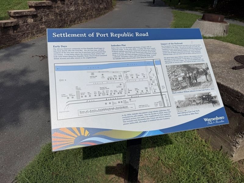
The African-American community on Port Republic Road began to take form shortly after the Civil War. For the first time, all black residents of the area were now free to purchase land and build their own homes. A map below shows the numerous black settlers that built early homes along Port Republic Road, Church Street (renamed Shiloh Avenue) and other streets in the neighborhood.
Imboden Plat
Before this area was developed with homes, it began with an industrial origin. In the early 1800s, a wealthy mill owner named Frederick Imboden purchased a large tract of land on the northern outskirts of town. Since the land covered both sides of the South River, it included the water privileges needed for Imboden to build a mill dam, and power a flour mill and blacksmith shop. A panel for Imboden Mill is found further north along the Greenway.
In the 1810s, Imboden also platted a large hillside subdivision that overlooked his mill complex. Over the decades to follow, many lots and block sections were sold to the neighborhood's first residents. This included early blacksmith John Crouse and African-American pioneer
this page online
Impact of the Railroad
The Chesapeake and Ohio Railroad was built on the north boundary of Waynesboro in the 1850s. The rail line brought new trade and commerce to town, including employment for the Port Republic Road community. Many black laborers worked in the nearby industrial section and rail depots along Railroad Avenue. Farm merchants, millwork shops, and coal yards were all within walking distance.
The photo below shows William Johnson, who worked at the Gaw Hay Grain & Feed Company. In this photo, he is loading large quantities of coal into a wagon. The coal was dumped from a rail siding built on concrete piers. The original rail piers remain today.
Erected by Waynesboro Parks & Recreation.
Topics. This historical marker is listed in these topic lists: African Americans • Industry & Commerce • Railroads & Streetcars • Settlements & Settlers.
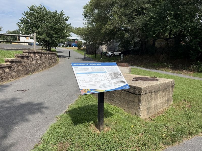
Location. 38° 4.257′ N, 78° 53.144′ W. Marker is in Waynesboro, Virginia. It is on Greenway Trail east of Abbe Place, on the left when traveling east. Touch for map.

Regionally, this marker is in Virginia’s Shenandoah Valley. It is also in the American South and specifically in the Upper South. Globally, it is in North America, the Western Hemisphere, the Western World, and the Anglosphere. Historically, it finds itself in what was once the territory of the Mississippian Culture, one of the original Thirteen Colonies, one of the Confederate States of America, and the Antebellum South.
Other nearby markers. At least 8 other markers are within walking distance of this marker: Waynesboro (approx. 0.2 miles away); River Crossings & Bridges (approx. 0.2 miles away); a different marker also named Waynesboro (approx. ¼ mile away); Ecology of the South River (approx. ¼ mile away); Port Republic Road Historic District (approx. 0.3 miles away); Fishburne Military School (approx. 0.3 miles away); William H. Harman Monument (approx. 0.3 miles away); Mercury and the South River (approx. 0.4 miles away). Touch for a list and map of all markers in Waynesboro.
Credits. This page was last revised on July 10, 2026. It was originally submitted on July 10, 2026, by Devry Becker Jones of Washington, District of Columbia. This page has been viewed 10 times since then. Photos: 1, 2. submitted on July 10, 2026, by Devry Becker Jones of Washington, District of Columbia.
