Roscoe in Sullivan County, New York — The American Northeast (Mid-Atlantic)
Borscht Belt - Roscoe
Borscht Belt Marker Project
| — | Jewish American Society for Historic Preservation | — |

Photographed by Marisa Scheinfeld
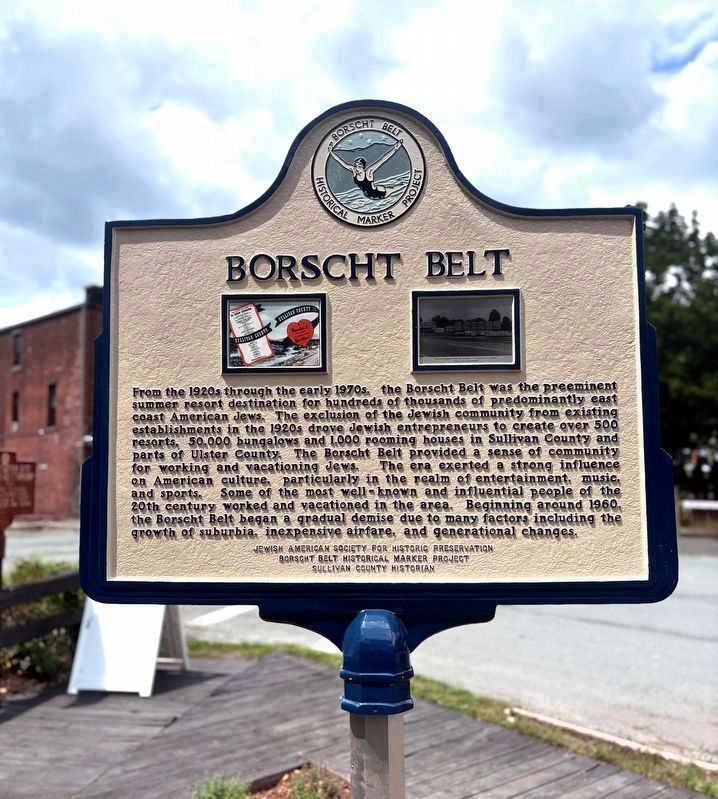
1. Borscht Belt - Roscoe Marker
Roscoe marks the northwestern edge of Sullivan County, where the Willowemoc and Beaverkill Rivers meet. A gateway between the Catskills’ fishing country and the resort corridor to the south, Roscoe became a hub for artists, nature lovers, and anglers with the arrival of the O&W Railroad in the late 19th century. By the 1940s, Roscoe promoted itself in the O&W Railway Vacation Guide, boasting picturesque views likened to the Alps.
During the Borscht Belt’s heyday, Roscoe was home to over a dozen hotels welcoming Jewish vacationers. Opened in 1900, the Campbell Inn was known as “A Little Switzerland in the Catskills,” featuring panoramic views and late Victorian architecture. Once Mountain Springs Hotel, Marian Gables Inn offered fresh air and lakeside recreation. Blending modern comforts with serene lakeside surroundings, Tennanah Lake House offered guests both relaxation and style. Its Century Room was a cutting-edge example of mid-century architecture.
Other local hotels included Alpine Country Club, Antrim Lodge, Chiloway, Hillside River View, Huff House, Lakewood Farm Inn, Pine Lawn, Rieping’s
this page online
( back )
Borscht Belt Historical Marker Project
Sullivan County Historian
Erected 2026 by Jewish American Society for Historic Preservation.
Topics and series. This historical

Photographed by Marisa Scheinfeld
2. Borscht Belt - Roscoe Marker
Location. 41° 55.899′ N, 74° 54.82′ W. Marker is in Roscoe, New York, in Sullivan County. It is at the intersection of Stewart Avenue and Railroad Avenue, on the right when traveling north on Stewart Avenue. Located across the street from the Roscoe O&W Railway Museum. Touch for map. Marker is at or near this postal address: 5 Railroad Avenue, Roscoe NY 12776, United States of America. Touch for directions.

Regionally, this marker is in Upstate New York and in the Hudson Valley. It is also in the American Northeast, in the Mid-Atlantic, in Appalachia, and specifically in Northern Appalachia. Globally, it is in North America, the Western Hemisphere, the Western World, and the Anglosphere. Historically, it finds itself in what was once New Netherland and also one of the original Thirteen Colonies.
Other nearby markers. At least 8 other markers are within
Photographed by Marisa Scheinfeld, July 12, 2026
3. Borscht Belt – Roscoe Marker
Also see . . .
1. History of the Borscht Belt - Catskills Borscht Belt Museum.
The Borscht Belt The region came to be called the Jewish Alps, Solomon County or more often, simply The Mountains. But another expression, the Borscht Belt, so-named for the hearty beet soup born in Eastern Europe, has had more staying power. What began as a patchwork of Jewish-owned farms whose proprietors took in summertime boarders to make ends meet grew into a sprawling constellation of all-inclusive resorts, hotels and more modest bungalow colonies and kuchalayns – establishments with shared kitchens. The larger, more successful establishments like Kutsher’s, The Concord and The Nevele had thousands of rooms, nightclubs, indoor pools and ski slopes.(Submitted on July 12, 2026, by Jerry Klinger of Boynton Beach, Florida.)
2. Borscht Belt (Wikipedia). (Submitted on July 13, 2026, by Michael Herrick of Southbury, Connecticut.)
Credits. This page was last revised on July 20, 2026. It was originally submitted on July 12, 2026, by Jerry Klinger of Boynton Beach, Florida. This page has been viewed 29 times since then. Photos: 1. submitted on July 12, 2026, by Jerry Klinger of Boynton Beach, Florida. 2. submitted on July 13, 2026, by Jerry Klinger of Boynton Beach, Florida. 3. submitted on July 12, 2026, by Jerry Klinger of Boynton Beach, Florida. • Michael Herrick was the editor who published this page.
