Battle in Carbon County, Wyoming — The American West (Mountains)
The Sierra Madre Range
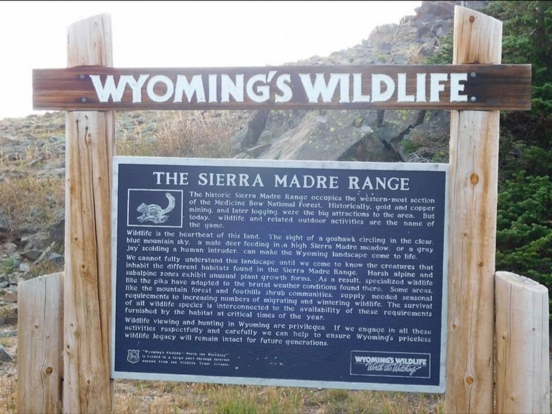
Photographed by Jimmy Emerson, September 5, 2025
1. The Sierra Madre Range Marker
The historic Sierra Madre Range occupies the western-most section of the Medicine Bow National Forest. Historically, gold and copper mining, and later logging, were the big attractions to the area. But today, wildlife and related outdoor activities are the name of the game.
Wildlife is the heartbeat of this land. The sight of a goshawk circling in the clear, blue mountain sky, a mule deer feeding in a high Sierra Madre meadow, or a gray Jay scolding a human intruder, can make the Wyoming landscape come to life.
We cannot fully understand this landscape until we come to know the creatures that inhabit the different habitats found in the Sierra Madre Range. Harsh alpine and subalpine zones exhibit unusual plant growth forms. As a result, specialized wildlife like the pika have adapted to the brutal weather conditions found there. Some areas, like the mountain forest and foothills shrub communities, supply needed seasonal requirements to increasing numbers of migrating and wintering wildlife. The survival of all wildlife species is interconnected to the availability of these requirements furnished by the habitat at
this page online
Wildlife viewing and hunting in Wyoming are privileges. If we engage in all these activities respectfully and carefully we can help to ensure Wyoming's priceless wildlife legacy will remain intact for future generations.
Topics. This historical marker is listed in this topic list: Natural Resources.
Location. 41° 9.365′ N, 106° 58.906′ W. Marker is in Battle, Wyoming, in Carbon County. It is on Wyoming Route 70, on the left when traveling east. Touch for map. Marker is at or near this postal address: 28 Waterton Vly, Encampment WY 82325, United States of America. Touch for directions.

Regionally, this marker is in Wyoming’s Westward Expansion Trails Region. It is also in the American Mountain West. Globally, it is in North America, the Rocky Mountains, the Western Hemisphere, the Western World, and the Anglosphere. Historically, it finds itself in what was once the Republic of Texas.
Other nearby markers. At least 2 other markers are within 11 miles of this marker, measured as the crow flies: Thomas A. Edison (approx. 1½ miles away); Encampment, Wyoming (approx. 10.8 miles away).
More about this marker. The marker is located at a rest area overlook on the north side of Wyoming 70.
Credits. This page was last revised on July 13, 2026. It was originally submitted on September 21, 2025, by Jimmy Emerson of Dalton, Georgia. This page has been viewed 100 times since then and 56 times this year. Last updated on July 13, 2026, by Jimmy Emerson of Dalton, Georgia. Photo 1. submitted on September 21, 2025, by Jimmy Emerson of Dalton, Georgia. • Devry Becker Jones was the editor who published this page.
