
Scotts Hill in Henderson County, Tennessee — The American South (East South Central)
116 Highway 114
| — | Businesses that have operated at this location | — |

Photographed by David Austin
1. 116 Highway 114 Marker
Businesses that have operated at this location Buck’s Lumber Warehouse, Hill Theathre, built in 1948 by Earl Buck and Gene Helms with Homemade blocks made on site. The Theathre operated until 1963. This was a very popular venue, people from all over came to see the latest movies. Many people still remember when it was the place to be. The Board of Trustees at its closing included: President, A.C. Tarlton; Vice-President, Earl Buck; Directors, Joe Boswell, Hyder White, Cecil Milam, E.D. Maness. The building is currently privately owned and not open to the public.
Erected 2026 by Tennessee America 250.
Topics. This historical marker is listed in these topic lists: Architecture • Entertainment • Industry & Commerce. A significant historical year for this entry is 1948.
Location. 35° 30.928′ N, 88° 14.739′ W. Marker is in Scotts Hill, Tennessee, in Henderson County. It is at the intersection of State Highway 114 (at milepost 0) and Tennessee Highway 201, on the right when traveling north on State Highway 114. Touch for map. Marker is at or near this postal address: 116 Highway 114 South, Scotts Hill TN 38374,
this page online

Regionally, this marker is in West Tennessee. It is also in the American South and specifically in the Upper South. Globally, it is in North America, the Western Hemisphere, the Western World, and the Anglosphere. Historically, it finds itself in what was once the territory of the Mississippian Culture, one of the Confederate States of America, and the Antebellum South.
Other nearby markers. At least 8 other markers are within walking distance of this marker: 110 Highway 114 South (a few steps from this marker); 106 Highway 114 South (a few steps from this marker); 61 Highway 114 South (about 300 feet away, measured in a direct line); 30 Church St (about 500 feet away); 20 Highway 114 South (about 500 feet away); Farmers State Bank and FirstBank: A Century of Community Banking (about 500 feet away); 40 Church Street (about 600 feet away); 15 Highway 114 South (about 600 feet away). Touch for a list and map of all markers in Scotts Hill.
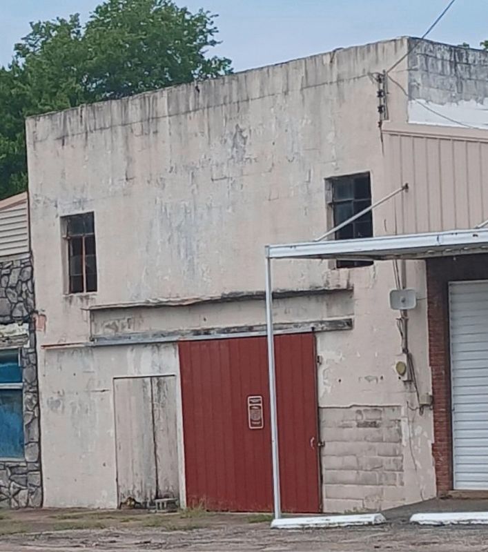
Photographed by David Austin
2. 116 Highway 114 Marker
Credits. This page was last revised on July 23, 2026. It was originally submitted on July 13, 2026, by David Austin of Scotts Hill, Tennessee. This page has been viewed 21 times since then. Photos: 1. submitted on July 13, 2026, by David Austin of Scotts Hill, Tennessee. 2. submitted on July 23, 2026, by David Austin of Scotts Hill, Tennessee. • James Hulse was the editor who published this page.
