Great Yarmouth in Norfolk, England, United Kingdom — Northwestern Europe (the British Isles)
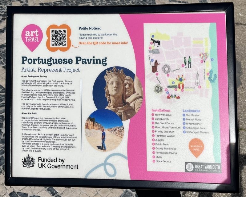
Portuguese Paving
Artist: Reprezent Project
| — | Art Trail | — |
Photographed by Ray Gurganus, April 26, 2026
1. Portuguese Paving Marker
About Portuguese Paving
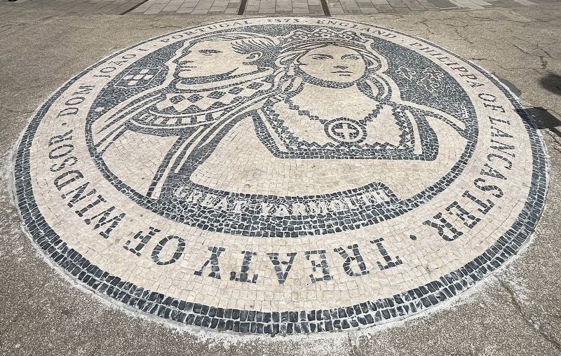
The pavement represents the Portuguese alliance with England (United Kingdom now). The Treaty of Windsor is the oldest alliance in the world.
The alliance started in 1373 but renowned in 1386 with the Wedding between Philippa of Lancaster (Princess of England) and King John I (first King of Portugal). Making Philippa the first Queen of Portugal. The artwork is in a circle-representing their wedding ring.
The paving is made from limestone and basalt that can only be found in the mountains of Portugal. It is named Calçada Portuguesa.
About the Artist
Reprezent Project is a community-led urban art organisation. With over 50 local art murals, celebrating diversity through artistic inclusion and initiative Projects empower people and communities To explore their creativity and use it as self-expression and social change.
Rui Ferreira aka RAF is a street artist from Portugal that painted the largest mural of Europe in Lisbon and created the artwork digitally. The stencil was cut out by hand to use on the installation.
Fernando Simoes is a stone and mosaic artist with over 40 years of experience:
this page online
Erected by Great Yarmouth Borough Council. (Marker Number 10.)
Topics. This historical marker is listed in this topic list: Arts, Letters, Music. A significant historical year for this entry is 1373.
Location. 52° 36.328′ N, 1° 43.743′ E. Marker is in Great Yarmouth, England, in Norfolk. It is at the intersection of Dene Side and Alexandra Road, on the right when traveling south on Dene Side. Touch for map. Marker is at or near this postal address: 54 Dene Side, Great Yarmouth, England NR30 2PG, United Kingdom. Touch for directions.

Regionally, this marker is in East Anglia. Globally, it is on the Atlantic Ocean, in the North Atlantic Region, in Europe, in Atlantic Europe, on one of the British Isles, in the Western World, and in the Anglosphere. Historically, it finds itself in what was once the Roman Empire.
Other nearby markers. At least 8 other markers are within 21 kilometers of this marker, measured as the crow flies: Yarn With Ernie (approx. 0.3 kilometers away); The Marseille of the North (approx. 0.8 kilometers
Photographed by Ray Gurganus, April 26, 2026
2. Calçada Portuguesa
Credits. This page was last revised on July 15, 2026. It was originally submitted on July 14, 2026, by Ray Gurganus of Washington, District of Columbia. This page has been viewed 14 times since then. Photos: 1, 2. submitted on July 14, 2026, by Ray Gurganus of Washington, District of Columbia. • Andrew Ruppenstein was the editor who published this page.
