Great Yarmouth in Norfolk, England, United Kingdom — Northwestern Europe (the British Isles)
The Marseille of the North
Photographed by Ray Gurganus, April 26, 2026
1. The Marseille of the North Marker
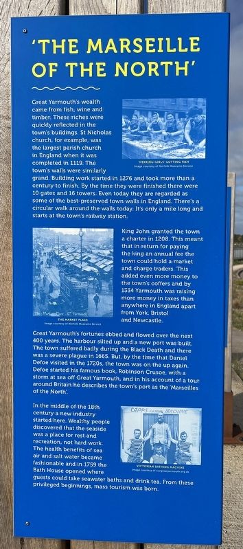
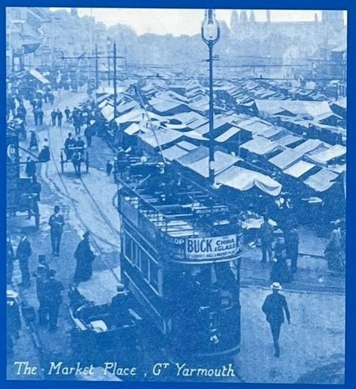
King John granted the town a charter in 1208. This meant that in return for paying the king an annual fee the town could hold a market and charge traders. This added even more money to the town's coffers and by 1334 Yarmouth was raising more money in taxes than anywhere in England apart from York, Bristol and Newcastle.
Great Yarmouth's fortunes ebbed and flowed over the next 400 years. The harbour silted up and a new port was built. The town suffered badly during the Black Death and there was a severe plague in 1665. But, by the time that Daniel Defoe visited in the 1720s, the town was on the up again. Defoe started his famous book, Robinson Crusoe, with a storm at sea off Great Yarmouth, and in his account of a tour around Britain he describes the town's port as the 'Marseilles of the North'.
In the middle of the 18th century a new industry started here. Wealthy people discovered that the seaside was a place for rest and recreation, not hard work. The health benefits of sea air and salt water became fashionable and in 1759 the Bath House opened where guests could take seawater baths and drink tea. From these privileged beginnings, mass tourism was born.
Erected by Greater Anglia.
Topics. This historical
this page online
Location. 52° 36.699′ N, 1° 43.301′ E. Marker is in Great Yarmouth, England, in Norfolk. It is on North Quay. The marker is just a few steps south of the Great Yarmouth Station car park. Touch for map. Marker is at or near this postal address: 90 N Quay, Great Yarmouth, England NR30 1JU, United Kingdom. Touch for directions.

Regionally, this marker is in East Anglia. Globally, it is on the Atlantic Ocean, in the North Atlantic Region, in Europe, in Atlantic Europe, on one of the British Isles, in the Western World, and in the Anglosphere. Historically, it finds itself in what was once the Roman Empire.
Other nearby markers. At least 8 other markers are within 21 kilometers of this marker, measured as the crow flies: Tourism, Fish & Family Fun (here, next to this marker); Yarn With Ernie (approx. 0.6 kilometers away); Portuguese Paving (approx. 0.8 kilometers away); Co-operative Society Shop (approx. 19.9 kilometers away); St. Peter's House (approx. 20.1 kilometers away); The Public Hall (approx. 20.2 kilometers away);
Picture from the marker
2. The Market Place
Photographed by John Valentine and Sons, circa 1908
3. St Nicholas Church (mentioned on marker)
Credits. This page was last revised on July 14, 2026. It was originally submitted on July 14, 2026, by Ray Gurganus of Washington, District of Columbia. This page has been viewed 11 times since then. Photos: 1, 2. submitted on July 14, 2026, by Ray Gurganus of Washington, District of Columbia. 3. submitted on July 14, 2026, by Andrew Ruppenstein of Lamorinda, California. • Andrew Ruppenstein was the editor who published this page.
Editor’s want-list for this marker. photo of the marker within its surroundings • Can you help?
