Missouri Valley in Harrison County, Iowa — The American Midwest (Upper Plains)
Missouri Valley Veterans' Memorial
Photographed by Thomas Onions, April 3, 2010
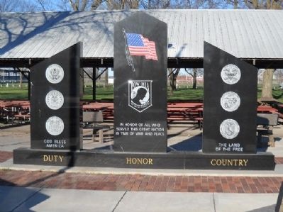
1. Missouri Valley Veterans' Memorial Marker
Left column
God Bless America
Seals of Armed Forces
Center column
In Honor of All Those Who Served This Great Nation in War and Peace Time
American Flag
MIA/POW Seal
Right column
The Land of the Free
Seals of Armed Forces
Base
Duty Honor Country
Erected 2005 by City of Missouri Valley.
Topics. This memorial is listed in this topic list: Military.
Location. 41° 33.374′ N, 95° 54.34′ W. Memorial is in Missouri Valley, Iowa, in Harrison County. It is on Huron Street 0.1 miles east of Shawmult Street, on the left when traveling west. This Veterans' Memorial is located in the middle of the City Park near the American Legion Pavilion. There is plenty of parking nearby. Touch for map. Memorial is in this post office area: Missouri Valley IA 51555, United States of America. Touch for directions.

Regionally, this memorial is in Western Iowa, in Loess Hills, and in Greater Omaha. It is also in the American Midwest, in the Lewis & Clark Corridor, and in the Corn Belt. Globally, it is in North America, the Western
this page online
Other nearby markers. At least 8 other markers are within 7 miles of this marker, measured as the crow flies: 3389 Miles from New York to San Francisco... Join the Ride! (approx. 3.6 miles away); Loess Hills of Western Iowa (approx. 3.6 miles away); Missouri Valley Freedom Rock Veterans Memorial (approx. 3.6 miles away); Terracing in the Loess Hills (approx. 3.6 miles away); Agriculture in the Loess Hills (approx. 3.6 miles away); Lewis and Clark Campsite Area (approx. 5½ miles away in Nebraska); Steamboat Bertrand Discovery Site (approx. 6.8 miles away in Nebraska); April 1, 1865: The Bertrand Goes Down (approx. 6.8 miles away in Nebraska). Touch for a list and map of all markers in Missouri Valley.
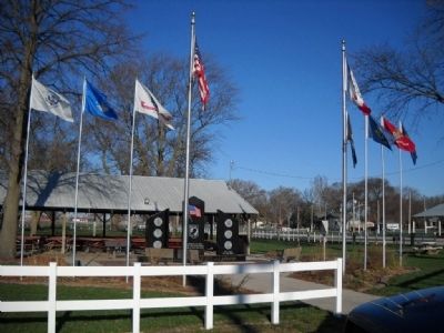
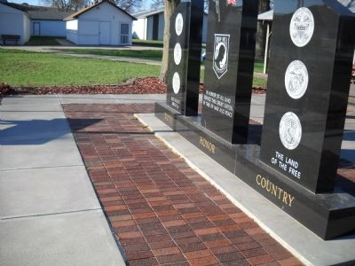
More about this memorial. The marker has the same design front and back. The Memorial has a lighted flagpole for the American flag and unlighted poles for the flags of the different branches of the Services. An engraved brickway surrounds the Memorial.
Also see . . . Missouri Valley Veterans Memorial / Harrison Co. Historical Village and Welcome Center.
Photographed by Thomas Onions, April 3, 2010
2. Missouri Valley Veterans' Memorial Marker
Area photo of the memorial.
Photographed by Thomas Onions, April 3, 2010
3. Missouri Valley Veterans' Memorial Marker
Photo of the Brickway.
Photographed by Thomas Onions, April 3, 2010
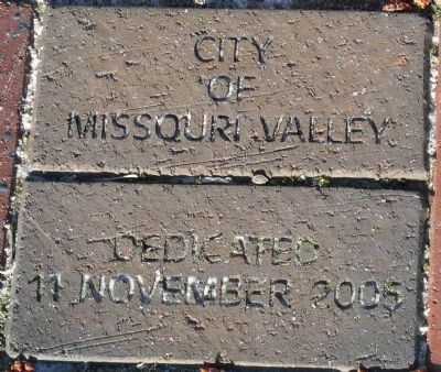
4. Missouri Valley Veterans' Memorial Marker
Dedication Bricks
Credits. This page was last revised on December 14, 2025. It was originally submitted on May 10, 2010, by Thomas Onions of Olathe, Kansas. This page has been viewed 1,847 times since then and 20 times this year. Photos: 1, 2, 3, 4. submitted on May 10, 2010, by Thomas Onions of Olathe, Kansas.
