
Manfred in Wells County, North Dakota — The American Midwest (Upper Plains)
Church and Neighborhood
An Authentic Settlers' Community Celebrating Rural America
Photographed by Cosmos Mariner, June 28, 2024
1. Church and Neighborhood Marker
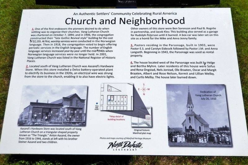
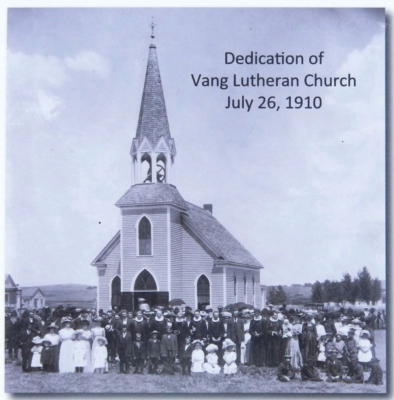
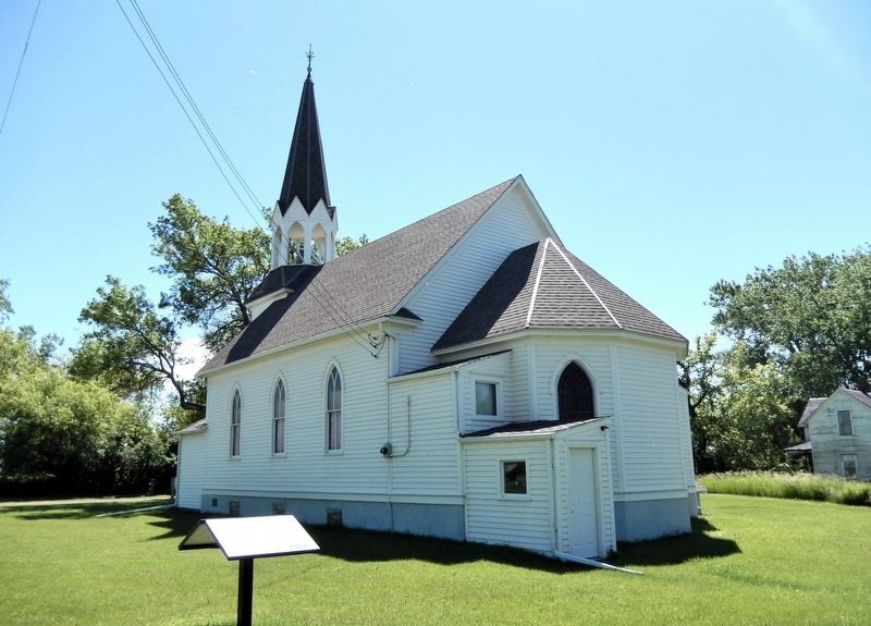
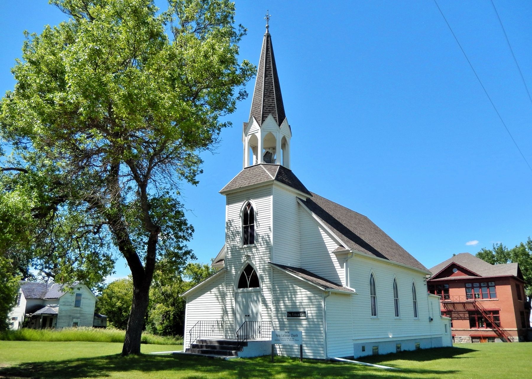
1. One of the first endeavors the pioneers desired to do when settling was to organize their churches. Vang Lutheran Church was chartered on October 7, 1894; and in 1906, the congregation constructed their “late Gothic Revival style” building for the cost of $2,155. At first, worship services were conducted in the Norwegian language. Then in 1918, the congregation voted to begin offering periodic services in the English language. The number of English language services increased year-by-year until the mid-1940s when Norwegian language services were no longer held. In 2001, Vang Lutheran Church was listed in the National Register of Historic Places.
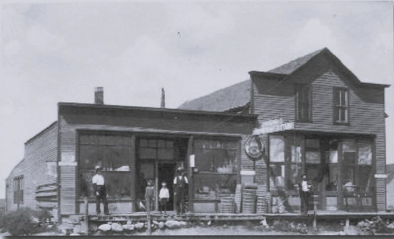
2. Located south of Vang Lutheran Church was Aasand's Hardware Store. When this store installed a Delco battery-operated plant to electrify its business in the 1920s, an electrical wire was strung from the store to the church, enabling it to also have electric lights.
Other owners of this store were Ben Sorenson and Paul B. Rognlie in partnership, and Jacob Klev. This building also served as a garage for Rudolph Peterson until it burned. A box car was later set on this site as
this page online
3. Pastors residing in the Parsonage, built in 1903, were Pastor E.S. and Carolyn Eidesvik followed by Pastor J.M. and Anna Langseth. Beginning in 1943, the Parsonage was used as rental property.
4. The house located west of the Parsonage was built by Helge and Bertha Myhre. Later residents of this house were Sofus and Rena Ongstad, Nels Jorstad, Ole Braaten, Oscar and Margit Braaten, Albert and Rose Nelson, Kermit and Lillian Melby, and Curtis Melby. The house later burned down.
Topics. This historical marker is listed in these topic lists: Architecture • Industry & Commerce • Religion & Religious Structures • Settlements & Settlers. A significant historical date for this entry is October 7, 1894.
Location. 47° 41.722′ N, 99° 45.048′ W. Marker is in Manfred, North Dakota, in Wells County. It is on 1st Avenue West just north of Le Grand Street, on the left when traveling north. Touch for map. Marker is in this post office area: Manfred ND 58465, United States of America. Touch for directions.

Regionally, this marker is in North Dakota’s Drift Prairie. It is also in the American Lewis

Courtesy Manfred Heritage Museum
2. Marker detail: Map of building locations
Other nearby markers. At least 8 other markers are within walking distance of this marker: School and Neighborhood (here, next to this marker); Vang Lutheran Church (within shouting distance of this marker); East Side of Main Avenue (about 400 feet away, measured in a direct line); Central Office and Neighborhood (about 400 feet away); The Elevators of Manfred (about 500 feet away); North Side of Elevator Street (about 500 feet away); Soo Line Railroad at Manfred (about 600 feet away); West Side of Main Avenue (about 600 feet away). Touch for a list and map of all markers in Manfred.
Regarding Church and Neighborhood. Vang Lutheran Church is listed on the National Register of Historic Places: № 01000674.
Related markers. Click here for a list of markers that are related to this marker. Vang Lutheran Church
Courtesy Manfred Heritage Museum
3. Marker detail: Aasand's Hardware Store
Aasand's Hardware Store was located south of Vang Lutheran Church on a triangular-shaped property known as “The Triangle.” Anton Aasand, the owner from 1916 to 1944, stands at left with his brother Steiner Aasand and two children.
Courtesy Manfred Heritage Museum
4. Marker detail: Dedication of Vang Lutheran Church
July 26, 1910
July 26, 1910
Photographed by Cosmos Mariner, June 28, 2024
5. Church and Neighborhood Marker
Looking southwest from 1st Avenue West. The northeast corner of Vang Lutheran Church is in the background.
Photographed by Cosmos Mariner, June 28, 2024
6. Vang Lutheran Church (southeast elevation)
Credits. This page was last revised on July 19, 2026. It was originally submitted on July 15, 2026, by Cosmos Mariner of Cape Canaveral, Florida. This page has been viewed 13 times since then. Photos: 1, 2, 3, 4, 5, 6. submitted on July 19, 2026, by Cosmos Mariner of Cape Canaveral, Florida.
