Horning in Shelburne in Dufferin County, Ontario — Central Canada (North America)
Shelburne Railway Station

Photographed by Tim Boyd, July 12, 2026
1. Shelburne Railway Station Marker
Passenger service continued until 1970. The era of rail travel came to an end when the last train left Shelburne in Dec. 1995.
This scene depicts the Shelburne train station circa 1914.
Topics. This historical marker is listed in this topic list: Railroads & Streetcars. A significant historical year for this entry is 1873.
Location. 44° 4.695′ N, 80° 12.218′ W. Marker is in Shelburne, Ontario, in Dufferin County. It is in Horning. It is at the intersection of Victoria Street and Main Street East, on the right when traveling south on Victoria Street. Touch for map. Marker is at or near this postal address: 203 Main Street E, Shelburne ON L0N 1S3, Canada. Touch for directions.

Regionally, this marker is in the York, Durham and Headwaters Area, and in Southwestern Ontario. It is also in Central Canada. Globally, it is in North America, the Western Hemisphere, the Western World, and the Anglosphere. Historically, it finds itself in what was once a British colony, the Viceroyalty of New France,
this page online
Other nearby markers. At least 8 other markers are within 16 kilometers of this marker, measured as the crow flies: The Founding of Shelburne (a few steps from this marker); Red Front Store Lane (within shouting distance of this marker); Horning’s Mills (approx. 8.4 kilometers away); Relessey (Maguire’s Corners) (approx. 14.5 kilometers away); Relessey (approx. 14.5 kilometers away); The Hand Family of Stanton (approx. 14.8 kilometers away); Building Dufferin (approx. 14.8 kilometers away); Windmill (approx. 14.8 kilometers away). Touch for a list and map of all markers in Shelburne.

Photographed by Tim Boyd, July 12, 2026
2. Shelburne Railway Station Marker
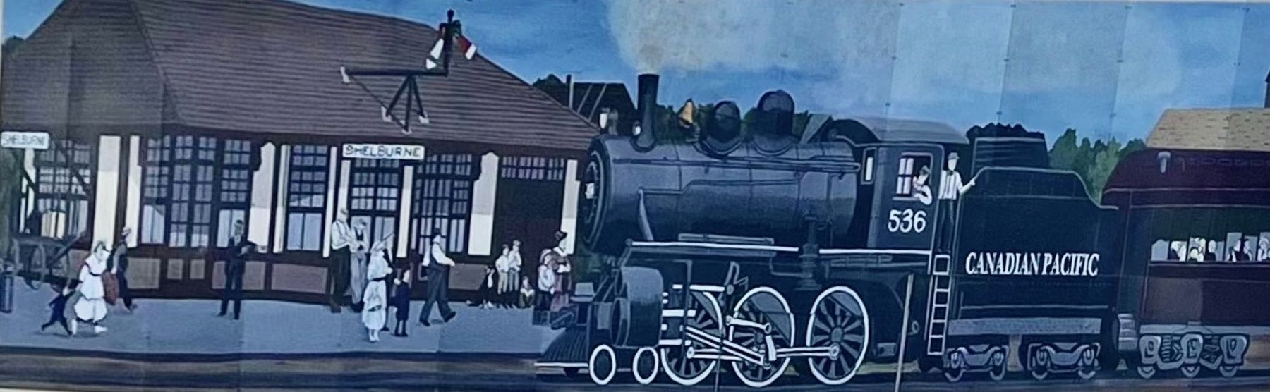
Photographed by Tim Boyd, July 12, 2026
3. Shelburne Railway Station mural
Credits. This page was last revised on July 16, 2026. It was originally submitted on July 15, 2026, by Tim Boyd of Hamilton, Ontario. This page has been viewed 19 times since then. Photos: 1, 2, 3. submitted on July 15, 2026, by Tim Boyd of Hamilton, Ontario. • Andrew Ruppenstein was the editor who published this page.
