
East Hants Municipality near Kennetcook in Hants, Nova Scotia — The Atlantic Provinces (North America)
Site of the East Hants Courthouse
Erected 1866 — Destroyed by Fire 1954

Photographed by David Graff, October 24, 2025
1. Site of the East Hants Courthouse Marker
1880 — 13th January — 1980
Topics. This historical marker is listed in these topic lists: Architecture • Disasters. A significant historical year for this entry is 1880.
Location. 45° 7.214′ N, 63° 42.393′ W. Marker is near Kennetcook, Nova Scotia, in Hants. It is in East Hants Municipality. It is on Courthouse Hill Road 0.3 kilometers east of Nova Scotia Route 354, on the left when traveling east. Touch for map. Marker is at or near this postal address: Courthouse Hill Road, Kennetcook NS B2S 3C9, Canada. Touch for directions.

Regionally, this marker is in the Maritimes and in Atlantic Canada. Globally, it is in the North Atlantic Region, North America, the Western Hemisphere, the Western World, and the Anglosphere. Historically, it finds itself in what was once a British colony and also the Viceroyalty of New France.
Other nearby markers. At least 2 other markers are within 16 kilometers of this marker, measured as the crow flies: Court House Hill (here, next to this marker); Alden Nowlan (approx. 16.2 kilometers away).
Regarding Site of the East Hants Courthouse. This is one of a pair of fenced-in markers collectively known as the Courthouse Hill Monument.
this page online

Photographed by David Graff, October 24, 2025
2. Site of the East Hants Courthouse Marker
The Courthouse Marker is seen behind the nearest marker.
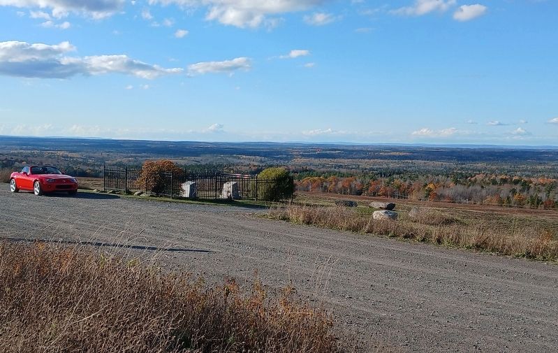
Photographed by David Graff, October 24, 2025
3. View of the markers and area from Courthouse Hill
Credits. This page was last revised on July 30, 2026. It was originally submitted on July 16, 2026, by David Graff of Halifax, Nova Scotia. This page has been viewed 11 times since then. Photos: 1, 2, 3. submitted on July 16, 2026, by David Graff of Halifax, Nova Scotia.
