Manfred in Wells County, North Dakota — The American Midwest (Upper Plains)
West Side of Main Avenue
An Authentic Settlers' Community Celebrating Rural America

Photographed by Cosmos Mariner, June 28, 2024
1. West Side of Main Avenue Marker
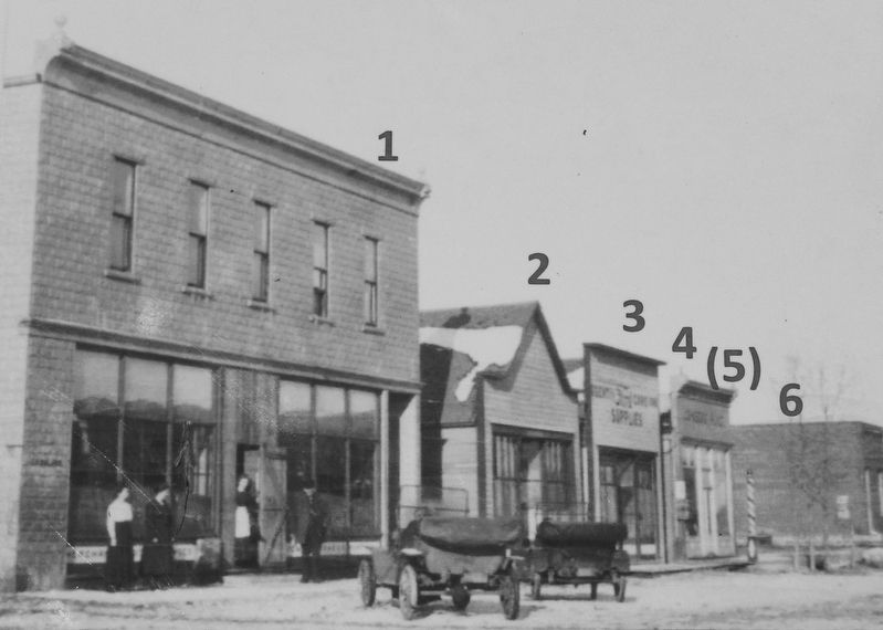
In 1908, quite a change took place on the west side of Main Avenue, when several buildings were added.
1. Early in 1908, C.C. Melby moved buildings #2 and #3 from facing south to facing east farther to the north. In the lots vacated by those buildings, the C.C. Melby Department Store was built. The store was on the ground level and contained groceries, dry goods, hardware, and furniture. The second level had offices, as well as apartments and a large hall for social events. One of the offices was occupied by Manfred's first doctor, Dr. P.A. Boyum, 1908-1912. The Manfred Cornet Band, organized in 1907, gave concerts in Melby's Hall and continued to perform until 1915. This store closed in 1930 and was dismantled in 1939.
2. In 1908, C.C. Melby purchased this building from John Nelson. After being remodeled in this new location on Main Avenue, the building was rented 1909-1914 to Otto Anderson as Anderson Drug Store; 1914-1920 to Manfred's second doctor, Dr. W. Roy Owen; and later it was a confectionery store.
3. In 1908, C.C. Melby purchased this building from Otto Sletten. He moved it from Elevator Street to this new location,
this page online
4. Nennie Johnson built Johnson's Place in 1908 to serve as a barber shop, pool hall, and lunch counter. He later changed his business into a store. In 1945, Nennie sold the business to Rudolph and Nora Peterson, who renamed it Peterson's Store. Other owners were Ervin and Evelina Boese 1952 to 1956, Edwin and Stella Sorenson 1956 until it closed in 1978.
(5). Not pictured is the later-constructed building that housed Hieb's Hardware Store in the late 1940s and Helland's Electric in the early 1950s.
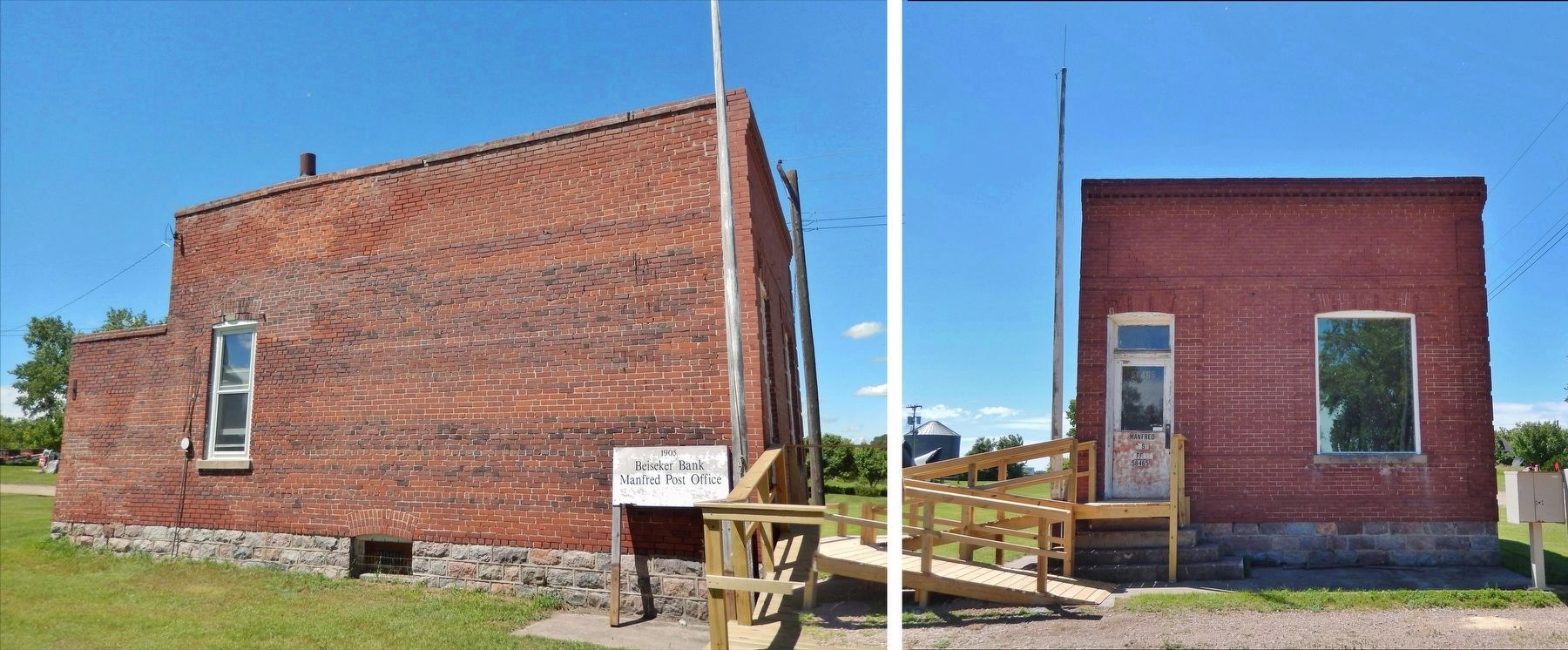
6. T.L. Beiseker built the First State Bank of Manfred in 1905. This building served as a bank until 1926; the office for Anderson Motor Company 1926-1931; the Manfred Post Office with Jerret Biever 1932-1937; Oris Biever's gas station and cream station 1940-1944; the Manfred Post Office with Oscar Ongstad, Marlys Koenig, and Edgar Flick 1944-1992. The Manfred Post Office closed in 1992.
Topics. This historical marker is listed in these topic lists: Architecture • Industry & Commerce • Settlements & Settlers. A significant historical year for this entry is 1908.
Location. 47° 41.659′ N,

Courtesy Manfred Heritage Museum
2. Marker detail: Map of building locations

Regionally, this marker is in the Drift Prairie. It is also in the American Lewis & Clark Corridor, on the prairies, and on the Northern Plains. Globally, it is in North America, the Western Hemisphere, the Western World, and the Anglosphere. Historically, it finds itself in what was once Rupert’s Land and also the Louisiana Purchase.
Other nearby markers. At least 8 other markers are within walking distance of this marker: Soo Line Railroad at Manfred (here, next to this marker); The Elevators of Manfred (within shouting distance of this marker); North Side of Elevator Street (within shouting distance of this marker); Central Office and Neighborhood (within shouting distance of this marker); East Side of Main Avenue (within shouting distance of this marker); Manfred Lake on the James River (about 300 feet away, measured in a direct
Courtesy Manfred Heritage Museum
3. Marker detail: West Side of Main Avenue in late 1908

Courtesy Manfred Heritage Museum
4. Marker detail: The Manfred Cornet Band, July 4, 1909
Photographed by Cosmos Mariner, June 28, 2024
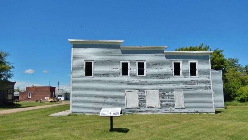
5. West Side of Main Avenue Marker
Looking north; Manfred Avenue (formerly Main Avenue) is on the left. Hotel Johnson (built 1906) is in the background.
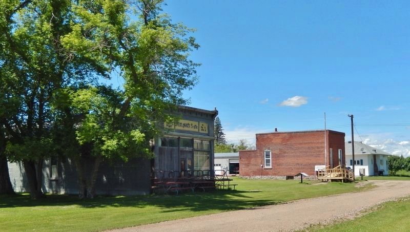
Photographed by Cosmos Mariner, June 28, 2024
6. West Side of Manfred Avenue / Main Avenue (2024)
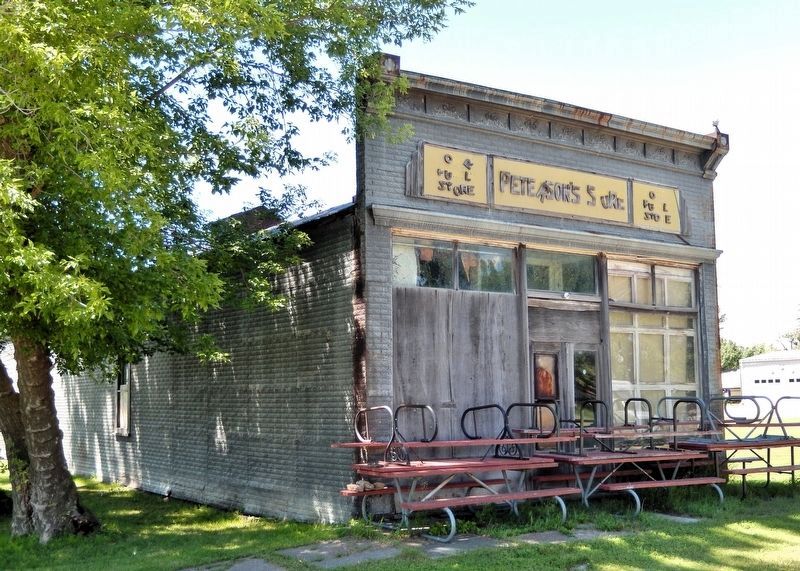
Photographed by Cosmos Mariner, June 28, 2024
7. Peterson's Store (built 1908)
Photographed by Cosmos Mariner, June 28, 2024
8. First State Bank (built 1905) & Post Office (1932-1937 & 1944-1992)
Credits. This page was last revised on July 19, 2026. It was originally submitted on July 16, 2026, by Cosmos Mariner of Cape Canaveral, Florida. This page has been viewed 15 times since then. Photos: 1, 2, 3. submitted on July 18, 2026, by Cosmos Mariner of Cape Canaveral, Florida. 4, 5, 6, 7, 8. submitted on July 19, 2026, by Cosmos Mariner of Cape Canaveral, Florida.
