Huisduinen in Den Helder, North Holland, Netherlands — Northwestern Europe
Fort Kijkduin
Photographed by Andrew Ruppenstein, June 2, 2026
1. Fort Kijkduin Marker

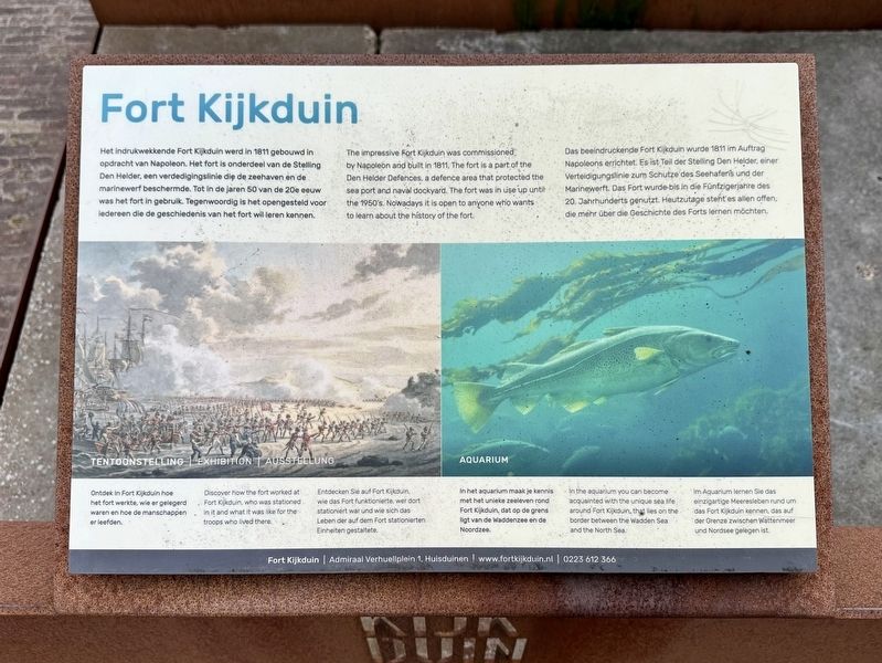
Het indrukwekkende Fort Kijkduin werd in 1811 gebouwd in opdracht van Napoleon. Het fort is onderdeel van de Stelling Den Helder, een verdedigingslinie die de zeehaven en de marinewerf beschermde. Tot in de jaren 50 van de 20e eeuw was het fort in gebruik. Tegenwoordig is het opengesteld voor ledereen die de geschiedenis van het fort wil leren kennen.
Ontdek in Fort Kijkduin hoe het fort werkte, wie er gelegerd waren en hoe de manschappen er leefden.
In het aquarium maak je kennis met het unieke zeeleven rond Fort Kijkduin, dat op de grens ligt van de Waddenzee en de Noordzee.
The impressive Fort Kijkduin was commissioned by Napoleon and built in 1811, The fort is a part of the Den Helder Defences, a defence area that protected the sea port and naval dockyard. The fort was in use up until the 1950's. Nowadays it is open to anyone who wants to learn about the history of the fort.
Discover how the fort worked at Fort Kijkduin, who was stationed in it and what it was like for the troops who lived there.
In the aquarium you can become acquainted with the unique sea life, around
this page online
Das beeindruckende Fort Kijkduin wurde 1811 im Auftrag Napoleons errichtet. Es ist Teil der Stelling Den Helder, einer Verteidigungslinie zum Schutze des Seehafens und der Marinewerft. Das Fort wurde bis in die Fünfzigerjahre des 20. Jahrhunderts genutzt. Heutzutage steht es allen offen. die mehr über die Geschichte des Forts lernen möchten.
Entdecken Sie auf Fort Kijkduin. wie das Fort funktionierte, wer dort stationiert war und wie sich das Leben der auf dem Fort stationierten Einheiten gestaltete.
Im Aquarium lernen Sie das einzigartige Meeresleben rund um das Fort Kijkduin kennen, das auf der Grenze zwischen Wattenmeer und Nordsee gelegen ist.
Topics. This historical marker is listed in this topic list: Forts and Castles. A significant historical year for this entry is 1811.
Location. 52° 57.144′ N, 4° 43.571′ E. Marker is in Huisduinen, Noord-Holland (North Holland), in Den Helder. It is on R.W. van de Wintstraat, on the right when traveling north. The marker is located in front of the Atlantikwall Centrum. Touch for map.
Photographed by Andrew Ruppenstein, June 2, 2026
2. Fort Kijkduin Marker - wide view
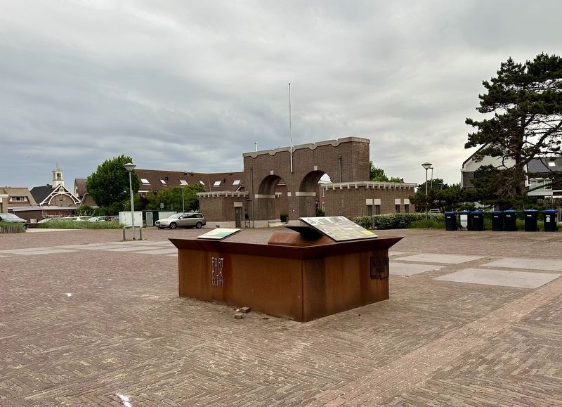
The Fort Kijkduin marker is one of three markers visible here, all set on stained steel kiosk, with the Fort Kijkduin marker visible on the left, next to the Atlantik Wall marker, with the Liberation Route Europe marker just behind them.

Regionally, it is in Europe, the European Union, Atlantic Europe, the Benelux Low Countries, the Schengen Area, Western Europe, and the Western World. Historically, it finds itself in what was once the Holy Roman Empire.
Other nearby markers. At least 8 other markers are within walking distance of this marker: De Atlantikwall / Der Atlantikwall / The Atlantikwall (here, next to this marker); Nooit meer zoals het was / Never the same again! / Es wird nie wieder wie es war (here, next to this marker); Monument ‘De Walvis’ / Huisduinen Whaling Memorial (about 90 meters away, measured in a direct line); Slag bij Kijkduin (21 augustus 1673) / Battle of Texel (August 21, 1673) (about 120 meters away); Vuurtoren de Lange Jaap / Lange Jaap Lighthouse (approx. 0.4 kilometers away); Monument Joodse Begraafplaats / Jewish Cemetery Memorial (approx. 0.7 kilometers away); Waddenzee-graftekens / Waddenzee Gravestones (approx. 0.8 kilometers away); Bijzonder oude graftekens / Exceptionally Old Grave Markers
Photographed by Wistula (via Wikimedia Commons under GNU 1.2 license), August 20, 2011
3. Fort Kijkduin entrance
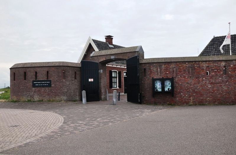
The fort itself is a bit more than 200 meters from the marker in a direct line, or more than twice that following the roads.
Also see . . . Fortifications of Den Helder (Wikipedia). Overview:
The Fortifications of Den Helder form a circle of fortresses and other works that defended Den Helder in the Netherlands from the end of the 18th century till the end of World War II. They are now getting repurposed for tourism.(Submitted on July 17, 2026.)
Credits. This page was last revised on July 17, 2026. It was originally submitted on July 17, 2026, by Andrew Ruppenstein of Lamorinda, California. This page has been viewed 17 times since then. Photos: 1, 2, 3. submitted on July 17, 2026, by Andrew Ruppenstein of Lamorinda, California.
