De Cocksdorp in Texel, North Holland, Netherlands — Northwestern Europe
“Rose O’Day”
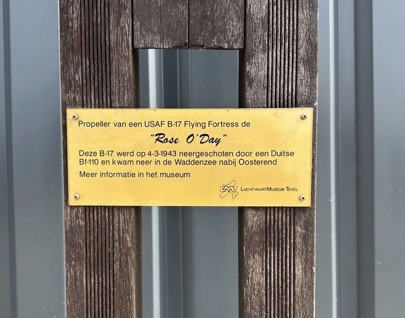
Photographed by Andrew Ruppenstein, June 1, 2026
1. “Rose O’Day” Marker

"Rose O'Day"
Deze B-17 werd op 4-3-1943 neergeschoten door een Duitse Bf-110 en kwam neer in de Waddenzee nabij Oosterend
Meer informatie in het museum
Propeller from a USAF B-17 Flying Fortress, the
"Rose O'Day"
This B-17 was shot down by a German Bf-110 on March 4, 1943, and crashed into the Wadden Sea near Oosterend.
More information in the museum.
Erected by Luchtvaart Museum Texel.
Topics. This historical marker is listed in these topic lists: Air & Space • War, World II. A significant historical date for this entry is March 4, 1943.
Location. 53° 7.083′ N, 4° 49.621′ E. Marker is in De Cocksdorp, Noord-Holland (North Holland), in Texel. It is on Postweg, on the right when traveling north. The propeller and marker are located in front of the Lucht- en Oorlogsmuseum Texel. Touch for map. Marker is at or near this postal address: Postweg 126, De Cocksdorp, Noord-Holland 1795 JS, Netherlands. Touch for directions.

Regionally, this marker is on the German Wadden Sea. Globally, it is in Europe, the European Union, Atlantic
this page online
Other nearby markers. At least 8 other markers are within 6 kilometers of this marker, measured as the crow flies: De Russenoorlog op Texel / The Russian War on Texel / Der Russenkrieg auf Texel (a few steps from this marker); De Atlantikwall / Der Atlantikwall / The Atlanticwall (within shouting distance of this marker); RK kerk / Roman Catholic Church (approx. 5 kilometers away); Molenbos (approx. 5 kilometers away); De Cocksdorp (approx. 5 kilometers away); Vuurtoren / Lighthouse (approx. 5 kilometers away); De Niuewe Aanleg (approx. 5 kilometers away); Zanddijk (approx. 5.1 kilometers away). Touch for a list and map of all markers in De Cocksdorp.
Related marker. Click here for another marker that is related to this marker.
Also see . . . 41-24512 Rose ODay (IWM American Archive). Excerpt:
Assigned 322BS/91BG [LG-N] Bangor 1-Sep-42; Bassingbourn 29-Sep-42; Missing in Action (MIA) 7+m Hamm 4-Mar-43. Aircraft sustained repeated attacks by fighters(Submitted on July 18, 2026.)and crashed into the North Sea just of the southern tip of Texel Island, Holland. The crew was ordered to bale out, but most landed in the sea and were lost. Co-pilot: 1LT Harold E. Kious rescued by ferryboat Dr Wagemaker, and then captured as a POW. Missing Air Crew Report 3721.Photographed by Andrew Ruppenstein, June 1, 20262. “Rose O’Day” Marker - wide view

Credits. This page was last revised on July 18, 2026. It was originally submitted on July 18, 2026, by Andrew Ruppenstein of Lamorinda, California. This page has been viewed 10 times since then. Photos: 1, 2. submitted on July 18, 2026, by Andrew Ruppenstein of Lamorinda, California.
