Relessey in Mono in Dufferin County, Ontario — Central Canada (North America)
Relessey
Photographed by Tim Boyd, July 12, 2026
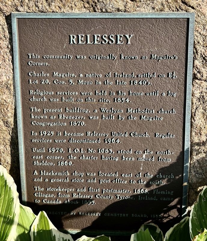
1. Relessey Marker
This community was originally known as Maguire’s Corners.
Charles Maguire, a native of Ireland, settled on E1/2, Lot 20, Con. 5. Mono in the late 1840s.
Religious services were held in his home until a log church was built on this site, 1854.
The present building, a Weslyan Methodist church known as Ebenezer, was built by the Maguire Congregation 1870.
In 1925 it became Relessey United Church. Regular services were discontinued 1964.
Until 1970, L.O.L. No 1083, stood on the northeast corner, the charter having been moved from Sheldon, 1860.
A blacksmith shop was located east of the church and a general store and post office to the south.
The storekeeper and first postmaster, 1868, Fleming Clingan, from Relessey County Tyrone, Ireland, came to Canada about 1855.
Topics. This historical marker is listed in these topic lists: Religion & Religious Structures • Settlements & Settlers. A significant historical year for this entry is 1854.
Location. 44° 2.894′ N, 80° 1.623′ W. Marker is in Mono, Ontario, in Dufferin County. It is in Relessey. It is at the intersection of Mono Centre Road (Dufferin Road
this page online

Regionally, this marker is in the York, Durham and Headwaters Area, and in Southwestern Ontario. It is also in Central Canada. Globally, it is in North America, the Western Hemisphere, the Western World, and the Anglosphere. Historically, it finds itself in what was once a British colony, the Viceroyalty of New France, the Haudenosaunee (Iroquois) Confederacy, and Rupert’s Land.
Other nearby markers. At least 8 other markers are within 14 kilometers of this marker, measured as the crow flies: Relessey (Maguire’s Corners) (within shouting distance of this marker); Windmill (approx. 7.6 kilometers away); The County of Dufferin (approx. 7.6 kilometers away); The Hand Family of Stanton (approx. 7.7 kilometers away); Building Dufferin (approx. 7.7 kilometers away); The Corbetton Church (approx. 7.8 kilometers away); Historic Corbetton Church Building (approx. 7.8 kilometers away); Red Front Store Lane (approx.

Photographed by Tim Boyd, July 12, 2026
2. Relessey Marker
Facing east on Mono Centre Road

3. Relessey in 1880
Source: McGill University (public domain)

Photographed by Tim Boyd, July 12, 2026
4. Relessey Church (Ebenezer) and Cemetery in 2026
Credits. This page was last revised on July 19, 2026. It was originally submitted on July 19, 2026, by Tim Boyd of Hamilton, Ontario. This page has been viewed 16 times since then. Photos: 1, 2, 3, 4. submitted on July 19, 2026, by Tim Boyd of Hamilton, Ontario. • Andrew Ruppenstein was the editor who published this page.
