
Golden in Jefferson County, Colorado — The American Mountains (Southwest)
Rock Flour Millstone
Photographed by Alan M. Perrie, December 8, 2018
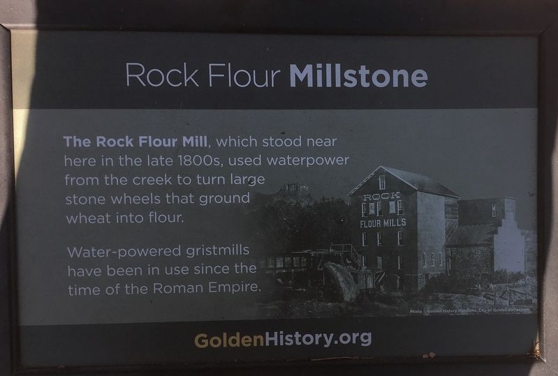
1. Rock Flour Millstone Marker
The Rock Flour Mill, which stood near here in the late 1800’s, used waterpower from the creek to turn large stone wheels that ground wheat into flour.
Water-powered gristmills have been in use since the time of the Roman Empire.
Erected by Golden History.org.
Topics. This historical marker is listed in this topic list: Notable Buildings.
Location. Marker is missing. It was located near 39° 45.361′ N, 105° 13.462′ W. Marker was in Golden, Colorado, in Jefferson County. It could be reached from 10th Street just east of Cheyenne Street, on the right when traveling east. The marker is found on the Clear Creek Trail 0.1 mile west of Washington Ave and in back of the Golden History Museum. Touch for map. Marker was at or near this postal address: 923 10th St, Golden CO 80401, United States of America. Touch for directions.

Regionally, this marker was in Colorado’s Front Range. It was also in the American Mountain West. Globally, it was in North America, the Rocky Mountains, the Western Hemisphere, the Western World, and the Anglosphere. Historically,
this page online
Other nearby markers. At least 8 other markers are within walking distance of this location: Son of Liberty (here, next to this marker); Castle Rock (within shouting distance of this marker); Colorado National Guard Armory (within shouting distance of this marker); Guggenheim Hall (within shouting distance of this marker); What's that "M"? (within shouting distance of this marker); Revolutionary War Patriots (about 400 feet away, measured in a direct line); First Resident/Agriculturalist (about 400 feet away); Floods on Clear Creek (about 500 feet away). Touch for a list and map of all markers in Golden.
Another marker is no longer nearby. Down by the Old Mill Stream (was within shouting distance of this marker but has been confirmed missing).
Also see . . .
1. Millstone (Wikipedia). (Submitted on December 15, 2018, by Alan M. Perrie of Unionville, Connecticut.)
2. Rock Flour Millstone. (Submitted on December 15, 2018, by Alan M. Perrie of Unionville, Connecticut.)
Photographed by Alan M. Perrie, December 8, 2018
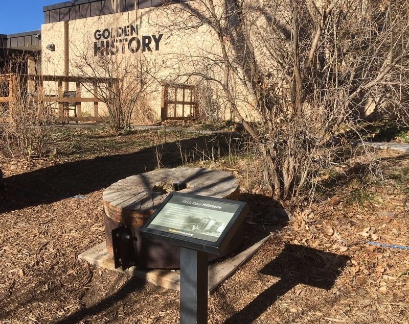
2. The millstone for the Rock Flour Mill.
Credits. This page was last revised on July 21, 2026. It was originally submitted on December 15, 2018, by Alan M. Perrie of Unionville, Connecticut. This page has been viewed 385 times since then and 33 times this year. Last updated on July 21, 2026, by Susan Van Den Bosch of Almond, Wisconsin. Photos: 1, 2. submitted on December 15, 2018, by Alan M. Perrie of Unionville, Connecticut. • Devry Becker Jones was the editor who published this page.
