Kalispell in Flathead County, Montana — The American West (Mountains)
REMOVED
SEE LOCATION SECTION
Courthouse Historic District
Photographed by Jimmy Emerson, July 12, 2009
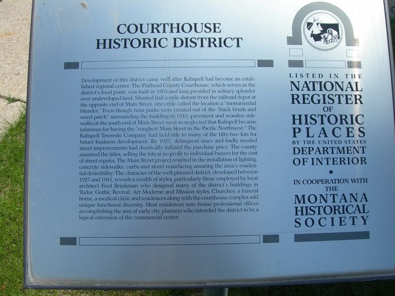
1. Courthouse Historic District Marker
Inscription.
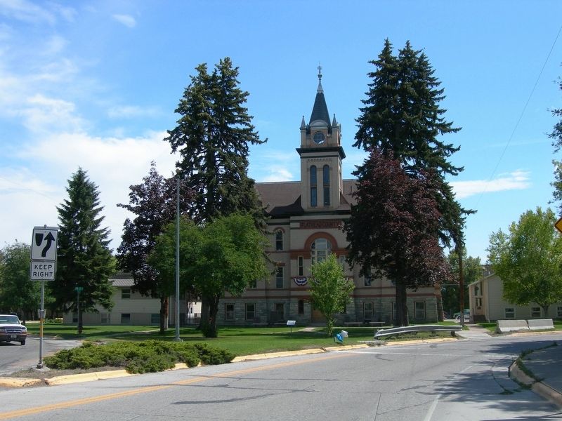
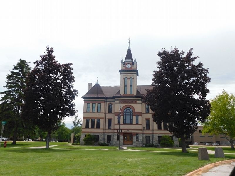
Development of this district came well after Kalispell had become an established regional center. The Flathead County Courthouse, which serves as the district's focal point, was built in 1903 and long presided in solitary splendor over undeveloped land. Situated half a mile distant from the railroad depot at the opposite end of Main Street, one critic called the location a "monumental blunder." Even though twin parks were created out of the "buck brush and weed patch" surrounding the building in 1910, pavement and wooden sidewalks at the south end of Main Street were so neglected that Kalispell became infamous for having the "roughest Main Street in the Pacific Northwest." The Kalispell Townsite Company had held title to many of the fifty-two lots for
future business development. By 1927, delinquent taxes and badly needed
street improvements had drastically inflated the purchase price. The county
assumed the titles, selling the lots at no profit to individual buyers for the cost of street repairs. The Main Street project resulted in the installation of lighting, concrete sidewalks, curbs and street resurfacing assuring
Click or scan to see this page online
the area's residential desirability. The character of the well-planned district, developed between 1927 and 1941, reveals a wealth of styles, particularly those employed by local architect Fred Brinkman who designed many of the district's buildings in Tudor, Gothic Revival, Art Moderne and Mission styles. Churches, a funeral
home, a medical clinic and residences along with the courthouse complex add
unique functional diversity. Most residences now house professional offices
accomplishing the aim of early city planners who intended the district to be a
logical extension of the commercial center.
Listed in the National Register of Historic Places by the United States Department of the Interior in Cooperation with the Montana Historical Society
Erected by Montana Historical Society.
Topics and series. This historical marker is listed in this topic list: Architecture. In addition, it is included in the Montana National Register Sign Program series list. A significant historical year for this entry is 1903.
Location. Marker has been permanently removed. It was located near 48° 11.45′ N, 114° 18.658′ W. Marker was in Kalispell,
Photographed by Jimmy Emerson, July 12, 2009
2. Courthouse Historic District Marker and courthouse
Montana, in Flathead County. It was on South Main Street. Touch for map. Marker was at or near this postal address: 800 S Main Street, Kalispell MT 59901, United States of America.
We have been informed that this marker is no longer there and will not be replaced. This page is an archival view of what was.
Regionally, this marker was in Western Montana and in Glacier Country. It was also in the American Mountain West and in the Lewis & Clark Corridor. Globally, it was in North America, the Rocky Mountains, the Western Hemisphere, the Western World, and the Anglosphere. Historically, it found itself in what was once Rupert’s Land and also the Louisiana Purchase.
3. Courthouse Historic District Marker used to be where the flag pole is now located
Kalispell.
Credits. This page was last revised on July 23, 2026. It was originally submitted on July 21, 2026, by Jimmy Emerson of Dalton, Georgia. This page has been viewed 8 times since then. Photos:1, 2, 3. submitted on July 21, 2026, by Jimmy Emerson of Dalton, Georgia. • Andrew Ruppenstein was the editor who published this page.