Near Newcastle in Weston County, Wyoming — The American West (Mountains)
Camp Jenney
Photographed by Keith L, September 21, 2006
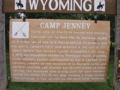
1. Camp Jenney Marker
Camp site of the first authorized military expedition into the Black Hills. On September 12, 1857 Lt. G. K. Warren of the U. S. Topographical Engineers and his party, camped here and erected a log corral. (17 years before the famous Custer Expedition.) On June 3, 1875, the expedition headed by Professor Walter P. Jenney under military escort commanded by Col. R. I. Dodge of Ft. Laramie, camped on the location of Lt. Warren's camp and corral. A stockade was erected and became known as Camp Jenney. The stockade was a stop over for gold seekers during the winter 75 – 76 and later became a stage station. The stockade is now located by the Anna Miller Museum.
Topics. This historical marker is listed in this topic list: Exploration. A significant historical month for this entry is June 1848.
Location. Marker has been permanently removed. It was located near 43° 48.96′ N, 104° 7.374′ W. Marker was near Newcastle, Wyoming, in Weston County. It was on U.S. 16 3 miles east of U.S. 85, on the right when traveling east. The marker stood at a pull-off. Touch for map. Marker was at or near this postal address: 5428 U.S Highway 16, Newcastle
this page online
We have been informed that this marker is no longer there and will not be replaced. This page is an archival view of what was.
Regionally, this marker was in the Powder River Basin. It was also in the American Mountain West, in the Black Hills, on the Great Plains, on the Northern Plains, and specifically on the High Plains. Globally, it was in North America, the Western Hemisphere, the Western World, and the Anglosphere. Historically, it found itself in what was once the Louisiana Purchase.

Other nearby markers. At least 8 other markers are within 5 miles of this location, measured as the crow flies: A different marker also named Camp Jenney (here, next to this marker); The Jenney Stockade (a few steps from this marker); Site of Field City (approx. ¼ mile away); Cheyenne – Deadwood Trail (approx. ¾ mile away); Accidental Oil Well (approx. one mile away); The Trains Power Newcastle (approx. 4.9 miles away); Cambria Powers the Trains (approx. 4.9 miles away); Hanging of Diamond L. Slim Clifton (approx. 4.9 miles away). Touch for a list and map of all markers in Newcastle.
Also see . . . The 1874 Custer Expedition to the Black Hills.
Photographed by Keith L, September 21, 2006
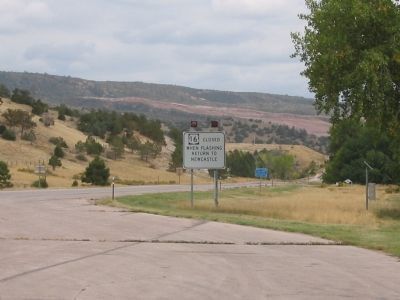
2. Eastbound View from Marker
Photographed by Jimmy Emerson, September 7, 2022
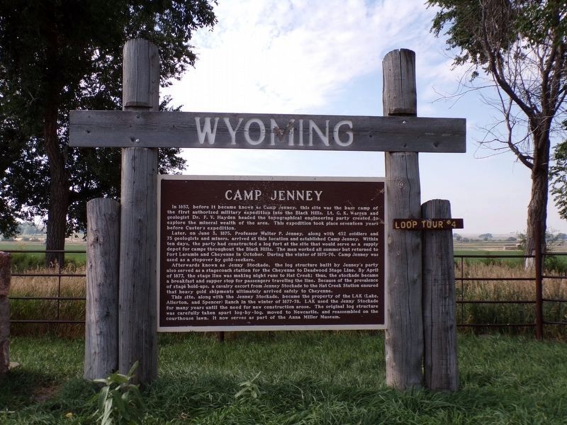
3. Camp Jenney Marker
It replaced the previous wooden marker.
Credits. This page was last revised on July 23, 2026. It was originally submitted on December 19, 2007, by Keith L of Wisconsin Rapids, Wisconsin. This page has been viewed 3,767 times since then and 200 times this year. Last updated on July 22, 2026, by Jimmy Emerson of Dalton, Georgia. Photos: 1, 2. submitted on December 19, 2007, by Keith L of Wisconsin Rapids, Wisconsin. 3. submitted on July 22, 2026, by Jimmy Emerson of Dalton, Georgia. • Devry Becker Jones was the editor who published this page.
